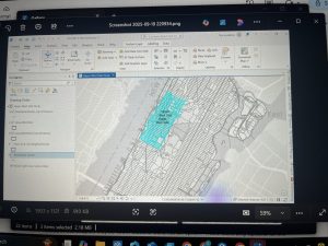
 Chapter 4: This chapter was very helpful in learning how to label, organize, and combine data.I did have a few struggles within this chapter. My main struggles were in 4-1 and 4-2. In 4-1, the chapter told me to paste some of the data into a different folder so that it was available in multiple places. However, I was only able to paste one of the data sets into the correct folder. The other data set didn’t give me the option to paste it. Additionally, at the end of 4-1, the instructions told me to delete the tracts file from the geodatabase. This permanently deleted the information on that file. However, in 4-2, I needed the information on the file. I think that this is a part of the chapter that I might have to go back and redo to figure out if I messed that part up. Something that I thought was interesting was the use of parentheses to order attributes when selecting them. Another thing that I thought was interesting was the ability to select for specific attributes. While this can become a little confusing if it isn’t selected perfectly, it can be super useful when trying to narrow down the data on the map. I had some more struggles in 4-5. In this section, I struggled selecting the field in the attribute table for the neighborhoods in Pittsburgh. The book told me to select fields X and Y, but neither of those fields was an option, and I was not able to create them as an option. I also had struggles with the table in 4-6. In this table, the book wanted me to insert rows to assign categories to the crime types. However, the table wouldn’t allow me to insert any rows into it.
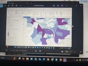
Chapter 5: While this chapter provided me with a lot of solid information, I ran into quite a few issues. In 5-1 to 5-3, it was super interesting learning about different coordinate systems and different easy-to-display maps. I never thought about how distorted a map may appear on a flat vs a rounded surface. The last part of 5-3 was where I began running into issues. The chapter didn’t provide any information on how to create your own map and add counties to it. I also ran into a few issues with displaying the libraries in 5-4; however, I was able to figure it out using a different method than the one the chapter explained in the book. In 5-5, I thought it was very interesting how many different websites held data that you could download and place onto a map in ArcGIS. In this section, I ran into quite a few problems. My first problem was that when using the Convert Table into Geodatabase tool, the BikeWorkData did not appear in my contents page. After about 30 minutes of trial and error, I eventually gave up and was not able to do any further work with the table since it would not appear. Additionally, in this section, the Light Grey Base didn’t have any valid data. I am wondering if this is connected with the table not appearing. I was also not able to figure out how to calculate the field tools. I entered the information that the book told me, but the tool said it wasn’t successful even after multiple attempts. Because of this, I wasn’t able to do any further work with this section. The last problem that I ran into was at the end of 5-6. When I searched transportation on the website linked in the chapter, bicycle count stations were not an option. There were only options for the bike paths.
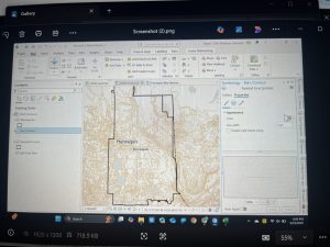
Chapter 6: This chapter was very helpful in explaining specific examples of the many ways that GIS can be used by fire stations. I luckily didn’t have many struggles in this chapter. One of my struggles was that since I wasn’t able to create one of the tables in the previous chapter, I never learned how to combine tables. In this chapter, I tried to combine the tables, but a lot of the data ended up disappearing, so I’m not sure I did it correctly. I went back to the chapter to try to go over how to combine tables, but I am still quite confused about it. Additionally, I have completely forgotten how to select features on an attribute table. It would be more helpful if the chapter reviewed how to do this; however, I will have to return to previous chapters and review it myself. Something that intrigued me was how you could examine overlapping points of data to determine which streets, neighborhoods, and people were inside each fire zone. One of the most important things that I learned from this week’s chapter is not to work on this course at night. Staring at a computer and trying to problem solve when you are tired never ends well and just leads to you going to sleep frustrated.