Chapter 4
- In Chapter I learned how to import data into my new works, as well as how to modify attributes within the attribute table.
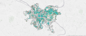
- In the map below I learned how to focus on a couple of data points within the data set. the green is specifically just robberies and burglaries out of all the crime within Pittsburgh.
- Additionally I learned how to create spatial joints which give the amount of instances within a certain area of the map.
Chapter 5
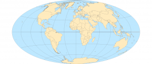
- In this chapter I learned how to un-skew the map and make the maps in the world shape.
- I learned about the process to change a maps coordinate system.
- Then I learned about TIGER files and census tracts.
Chapter 6
- In this chapter I learned how to dissolve features on my maps to either make maps simpler or more advanced, depending on what the idea of the map is and the target audience.
- I also learned how to merge water features and other features in general.
- Finally, I learned how to intersect features and what the tabulate intersection tool is.