Chapter 4:
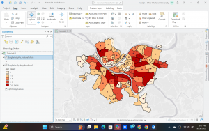
This chapter focuses on classifying with different types of methods, symbology, and labeling. The different types of classification affect the way the patterns show up on the maps. We also learned about ways to make the maps cleaner such as basemaps, techniques for labeling, and transparency. The goal was to turn the information into readable on the map.
Chapter5:
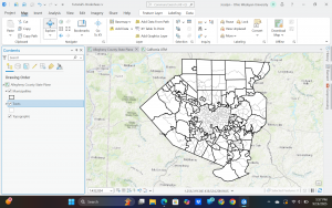
Locating data accurately through coordinate systems was a main point of this chapter. Address locators, geocoding, and adding x,y data tables to make features was introduced. Aligning layers properly was also an important topic.
Chapter 6:
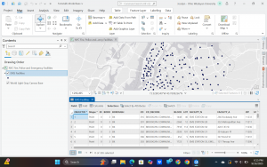
This chapter gave us ways to answer spatial analysis questions through buffers, overlays, and proximity tools. These were used to study spatial relationships between each other and the features. Differnt spatial and attributes were compared this helped me to understand how both data and geography can be used to filter information and answer questions.