Chapter 1
This was a good introduction for how to use GIS program. As this was my first time using a software like this, I found it very confusing at first. By time I got to the end of the chapter I was starting to understand how to work the program. The different layers and understanding how they all work was a key point I got from this chapter. The part I found the hardest was probably understanding the hard drive and how to transfer stuff in to start the tutorials.
Chapter 2
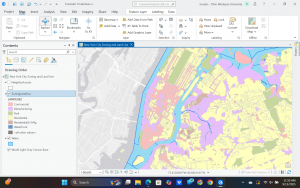
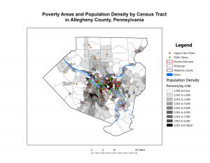
This chapter was cool due to how I learned how to kind of categorize things on the map based on what it is and make them different colors. I can make it so I can easily see the spatial differences in a map. This helped me to fully understand the importance of GIS and how it is truly used in the real world. I had a few difficulties with this and learned how to problem solve through the software. My computer kept saying error and so finding the problem and fixing it was a challenge.
Chapter 3
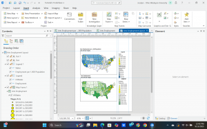
This chapter helped me to figure out how to share the information to an external source and make it understandable without having the GIS knowledge or software at your disposal. This chapter also went the quickest and was the easiest for me. I also struggled with this chapter a little bit as I used my personal laptop instead of the computer lab desktops which switching over, I had to relearn or figure some things out as they appear slightly different on my laptop.
Overall, these three chapters were a very good introduction to the GIS software, and I found it all very intriguing. The book does a very good job of explaining the process and breaking it down step by step.