Hi my name is Braidy Duncan and I am a sophomore this year, and am majoring in Environmental Science.

I did the quiz for this class Geography 291. While reading the first Chapter by Schuurman, I learned some things about GIS that I have never really thought about before today. For instance I never thought about the applications of GIS in anything other than an agricultural sense. So seeing that GIS is used in super niche ways was something very interesting to me. The optimization portion where Ian Mcharg was trying to find the best way to route a highway was something that really peaked my interest as optimization is something that has always intrigued me whether it be the optimization of space or time if you can optimize something it is an amazing feeling. I really like the idea of the first waves of GIS being done without computers and it is something that really baffles me that it can be done in the first place. The map of the Cholera outbreak is really cool to see. Seeing the correlations between the number of cases of Cholera and the water pumps associated to those areas was really cool, and in application it probably allowed the researchers to help put a stop to the outbreak way faster than it would have been stopped without the GIS systems. Something else that I have never thought about was that GIS systems are used everyday. The different ways in which geographic information can be utilized to help world processes is something that I really look forward to exploring within this class. So having read this chapter I am really excited to see all of the different maps that are out there and really see how far GIS imaging can go and personally I can’t wait.
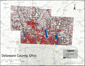
For my interest in soils I wanted to get to know where I am on a deeper level so I looked for a GIS image of Delaware Ohio.
Source:Delaware County Ohio. (2024, June 27). Cities, Villages & Townships – Delaware County. Delaware County. https://co.delaware.oh.us/cities