Chapter 9
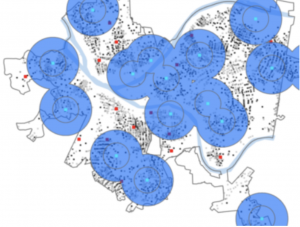
This chapter was quick and easy to follow. It focused on buffers, which help analyze proximity and find what’s near a location. I can see how they’d be useful for businesses and city planning by helping with location-based decisions. Another part of the chapter introduced scatterplots and the Multivariate Clustering tool to analyze data. I can see how these tools could be very useful to analyze data.
Chapter 10
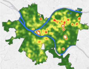
This chapter covered rasters and was pretty short and simple. It was my first time working with raster datasets, and I learned how to import them, create hillshade maps, and generate elevation contours. It also showed how there are multiple ways to display the same data, depending on what you want to highlight. The second tutorial introduced the Kernel Density tool to create a density map. The last section focused on ModelBuilder, which was a bit tricky but well explained.
Chapter 11
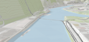
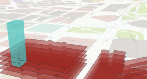
This was a short but interesting chapter introducing 3D modeling. The first tutorial covered navigating 3D scenes, and then we learned about triangulated irregular networks (TINs). One of my favorite parts was creating 3D trees with z-enabled features. There were a ton of options for symbolizing different tree types, which I didn’t realize ArcGIS had. Later, I worked with LAS Datasets, which I found confusing but still managed to complete. The last tutorials focused on 3D buildings. I struggled with getting the correct Z height, but got the idea. The final tutorial let me create an animation.