Chapter 9
The first tutorial involved using buffers for proximity analysis. I was able to get more familiar with the pairwise tool and use previous knowledge to fly through this. Tutorial 9-2 was similar but this time we used spatial overlay to get statistics by buffer area.
I liked tutorial 9-3, I thought it was fun and different than other things we have done. I did have to really use my knowledge for some parts where they did not explain things as well as the past. Towards the end of the chapter, I was unable to calculate the Userate, as I tried to fix it I continued to get the same error code. This meant I was also unable to make a scatterplot. I tried your turn in Tutorial 9-5 It challenged me and I’m unsure If I got the right answers. 

CHAPTER 10
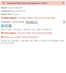
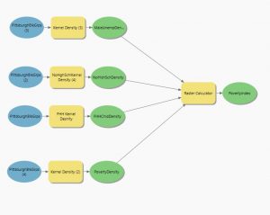
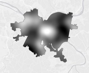
First tutorial started by inputting raster dataset into my project. I tried to do the Your Turn but got confused when I could not find the “Select Coordinate System” button. When trying to Symbolize my raster data set I could not figure out how to import from layer file. There was no button anywhere that said “options”. I had to symbolize the best I could by trying to match the colors myself. I just had to continue on and in 10-3 I worked on building a risk index model. This tutorial had some new techniques as well as old ones and I was able to get through pretty quickly.
CHAPTER 11
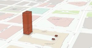
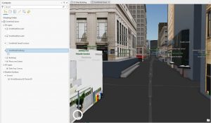
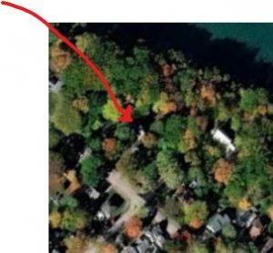
In the first tutorial it taught me how to navigate a 3d scene with a mouse and keyboard which was very helpful. For your turn portion I was able to find my house and mess around with different basemaps. Tutorial 5 taught how to work with 3d features and add floors to existing buildings. I also found it fun when editing the height of the tower in the courthouse. Tutorial 11-6 incorporated many skills I already understood but I was able to learn how to create floors to the US Steel building. As well as how to symbolize it to be more realistic and adhere to international building rules. The last tutorial was a great one to end on. It was interesting to learn you can make animations through the ArcGis Program. I wish I could have attached the animation, but I believe the file is too large to add into a post. Overall, I learned that this program is more than what I originally believed, going beyond my expectations.