Hey, my name is Abbie Grogan. I am a junior and I am a Pre-Professional Zoology major with a chemistry minor. I am a captain of the women’s lacrosse team and a part of Kappa Phi, the PreVet club, and I work as a vet tech. I enjoy relaxing in my free time and trying new food.

Going into this course, I have very limited knowledge of GIS systems and applications overall. I did know their importance but I was not aware of the vast variety of uses that they can be applied for. After reading Schuurmans first chapter of GIS: A Short Introduction, I enjoyed learning the history behind the GIS development and how its uses grew over time. From this I was able to determine that GIS analysis has had very impactful implications for cities, social trends, health patterns, and environmental issues. I did not know how widely they could be used. To be completely frank, I was not expecting to truly enjoy this reading but I was captivated by the unknown importance of this type of tool.
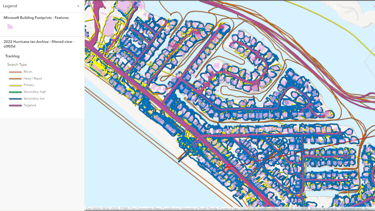
The first application I came across was emergency response planning. In emergency situations. One team called the Center for Robot-Assisted Search and Rescue (CRASAR) collected aerial imagery that helped to create vital GIS maps that visualized Hurricane Ian’s impact and guided emergency responders to find those in need of rescue faster than ever before. Using GIS, areas of risk and vulnerability are highlighted by combining critical infrastructure, hazard, and demographics data into a single map.

https://www.esri.com/about/newsroom/blog/hurricane-ian-searchers-shared-map/
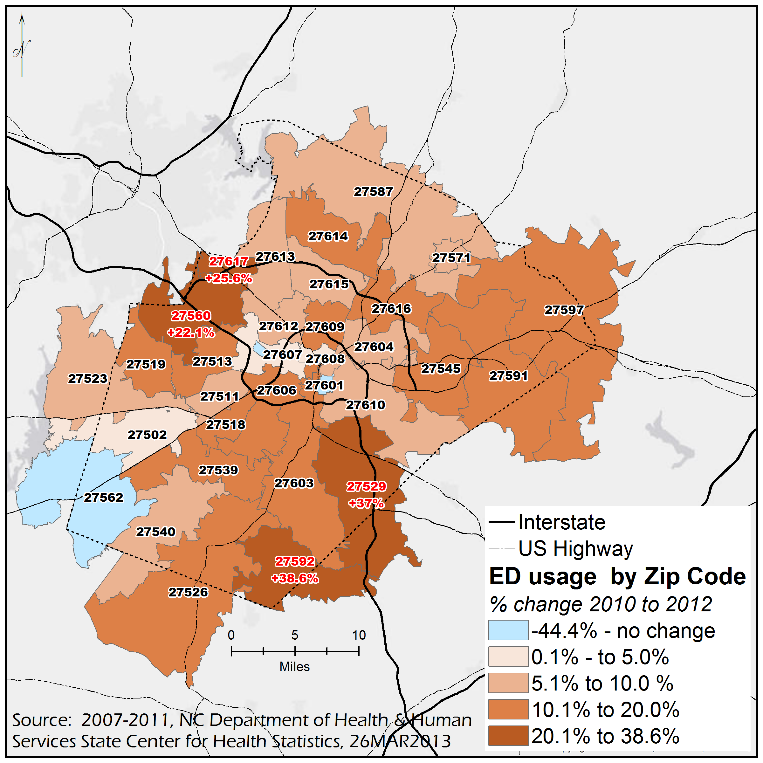
The second application I found was related to neighborhoods that use emergency departments within North Carolina. This specific GIS shows the changed in ED use over 2 years depending on the neighborhood they were in.
