Introduction
Hi, my name is Will Siegenthaler. I’m a junior majoring in Economics. I play lacrosse, enjoy playing basketball, and like to read in my free time. This is my first experience with GIS, and I’m looking forward to learning more about its applications and relevance in different fields.
Schuurman Chapter 1
Before reading Chapter 1 of Schuurman, I didn’t know much about GIS or its history. It was interesting to learn how GIS was initially viewed as just a computerized version of mapping and how its broader applications weren’t recognized early on. I found the discussion about how spatial analysis differs from traditional mapping to be particularly thought-provoking, especially the idea that GIS can layer and analyze data to answer complex questions.
The chapter also emphasized how GIS became a multi-disciplinary tool, used by geographers, architects, and others. It was surprising to read about the initial resistance to GIS, especially from cartographers who preferred traditional methods. Over time, though, it has proven to be far more powerful than paper-based systems.
One point I found compelling was how GIS can reflect user biases, including gender biases, which can have far-reaching implications. It raised questions for me about how the technology can be refined to minimize unintended biases. Overall, the reading showed me that GIS can be a valuable tool in fields like economics, urban planning, and environmental science, which I hadn’t considered before.
GIS Applications
- Crime Mapping and Analysis
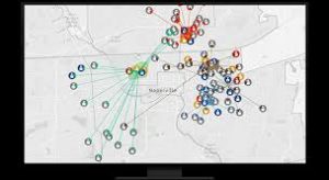
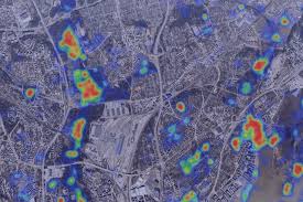
GIS is widely used in law enforcement to map and analyze crime patterns. Heatmaps created with GIS help identify crime hotspots, allowing police departments to allocate resources more effectively. For example, predictive crime mapping uses historical data to forecast where crimes are likely to occur, helping to improve public safety and reduce crime rates.

Source: ESRI Blog – Crime Mapping and GIS
- Urban Planning and Smart Cities
In urban planning, GIS supports the development of smart cities by helping planners analyze land use, infrastructure, and population density. For instance, GIS can optimize public transportation routes, map energy consumption, or assess areas prone to flooding. These tools enable planners to make data-driven decisions that enhance the quality of life in urban areas.

Source: GIS Geography – GIS in Urban Planning
