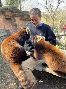
Hi! My name is Grace Kopelcheck and I am currently a senior majoring in zoology! I currently work at the Columbus Zoo and Aquarium as a seasonal zookeeper in the Animal Encounters region (right next to the sea lions!). I have also volunteered at the Ohio Wildlife Center for a little over a year, as well as have interned in the Asia Quest region for a semester! Currently this semester I am interning at Cosi with their animal care team!
When reflecting on the reading I had many comments and thoughts throughout the reading. Firstly when reading the first page I was shocked to learn that GIS can rationalize organ donations. I always thought that GIS was used for more land mapping, but I did not realize the full extent of the content GIS can create/explore. I also never realized the social implications of GIS and what it can do to expand on things other than land. It’s also interesting to read that GIS is considered to have an identity crisis. I think this is funny as well as interesting as I even thought of a different identity for GIS than what it has been used for. I also find it interesting how much we have utilized GIS even though it was stated in this paper that it was a newer technology. This use of newer technology becoming an upcoming feature for many companies and usage reminds me of AI and how this a new very utilized technology as well. It was also interesting to read how one challenge GIS faces is being able to draw strict boundaries represented with lines drawn from GIS. Overall this reading was interesting and gave me a better understanding of the capabilities that GIS has and can do.
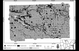
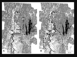
For looking into sources of GIS applicable/interesting to me, I used the key subject of Virginia Opossum (as they are my favorite animal) to find GIS application. I found two interesting articles talking about the population distribution of Virginia Opossum and how they move towards human populations due to food (Beatty et al. 2016). Another article tracked the same information however with road kill found and the findings of human influence land types and the amount of roadkill found had negative correlations (Kanda et al. 2006). GIS proves useful in tracking local populations of animals! Below are some GIS maps from both these articles that show the land that Virginia Opossum were found to inhabit (both dead and alive).


Beatty, W. S., Beasley, J. C., Olson, Z. H., & Rhodes Jr, O. E. (2016). Influence of habitat attributes on density of Virginia opossums (Didelphis virginiana) in agricultural ecosystems. Canadian Journal of Zoology, 94(6), 411-419.
Kanda, L. L., Fuller, T. K., & Sievert, P. R. (2006). Landscape associations of road-killed Virginia opossums (Didelphis virginiana) in central Massachusetts. The American Midland Naturalist, 156(1), 128-134.