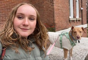
Hi guys! My name is Devyn Deal. I am a junior majoring in Environmental Studies. I have a great love for the earth and enjoy doing outdoor activities. I love to keep house plants and have quite the collection at home. Above is a photo of me and my sweet girl Nora having a little sit after a hike.
My first connection to Schuurman Chapter 1 is that I too had no clue what GIS was before coming to college. I found it very interesting to see the example of an early version of maps produced by GIS. It is extraordinary to see how far GIS mapping capabilities have come. I had never considered how game changing GIS technologies are in that humans can come to a vastly different conclusion based on the same data depending on weather they are reviewing the data via a numerical output, or through a visual output. It was interesting to learn there are two different definitions of what the GIS acronym stands for. In reading this chapter I learned the word sphericity. This chapter enlightened me on just how many uses there are for GIS. I had no clue there was so many questions and so many different types of research GIS was helpful in, I had only considered the ways presented to me in previous geography classes where we utilized GIS. For example I had never considered how valuable GIS could be in the economic world, or in public health. I am curious to learn more about how nonprofit groups use GIS to represent themselves. I would also love to learn more about how GIS and feminism intersects. I am curious what some proposed solutions would be in the discussion of how to represent barriers on a map that are fuzzy and not do not necessarily have a precise line, like the black bear and grizzly bear example.
The first GIS application I looked into was the conservation of loggerhead sea turtles as they are an endangered species. In the example that I found satellite transmitters were attached to female loggerhead sea turtles to track their movements. This data was used to better protect the species by having a better idea of where they most frequent. Before the use of GIS it was unknown where sea turtles went after laying their eggs on shore. This study found most adult female loggerheads from Georgia, North Carolina, and South Carolina migrate to the Mid-Atlantic Bight. This study was the first to track the movement of a large amount of sea turtles rather than just one in order to get a good idea of where their home base was.

https://www.esri.com/news/arcuser/0206/seaturtles.html?srsltid=AfmBOorGNPS9umDoCnAhQRYZB0wCvjcM5jIrVWBJtLHb9R7jnnTlEyuy

The second GIS application I looked into was habitat conservation. I found a study on the conservation of the Florida everglades. The everglades are home to 68 threatened species, three national parks, 12 wildlife refuges, and a marine sanctuary. Due to human intervention 50% of its wetlands have been lost and the water quality has deteriorated. The south Florida water district and the united states army introduced a restoration plan which was termed the “largest restoration project in world history”. It plans to rescue the everglades ecosystem through a series of ecological and water system improvements. The photo I provided depicts Comprehensive Everglades Restoration Plan projects, district lands, and developmental pressure on the everglades.
https://www.esri.com/news/arcuser/0704/iris1of2.html?srsltid=AfmBOopAvPcEMjX2qfDfTPC0ndXr92MZpRzmIHOLPACpdxO54JbmAiYz