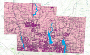
Zip Code – this data set holds all of the Delaware county zip codes, and sections them into the land that is held under that specific zip code
Recorded Document- this data set shows all points that are recorded documents in the City of Delaware’s County Recorder’s Plat Books, Cabinet/Slides and Instrument Records – including things such as vacations, subdivisions, centerline surveys, surveys, annexations, and miscellaneous documents.
School Districts- this shows all of the various school districts that are within Delaware county. This includes all of Delaware city schools, sunbury schools, olentangy schools, and more.
Map Sheet- this is all map sheets within Delaware County
Farm Lot – this shows all of the farm lots in Delaware county that have been identified by the US Military and the Virginia Military Survey Districts
Township- this shows all 19 different townships that make up delaware county
Street Centerline- this data depicts all of the roads, both public and private, in the city of Delaware by showing the centerline of the roads.
Annexation- this shows the Delaware County annexation and boundaries of land from 1953 and the present, that has been recorded with the delaware county recorder’s office, updated monthly
Condo- this data shows polygons that represent all of the condominiums in Delaware county that have been recorded with the delaware county recorder’s office.
Subdivision- this data includes all of the subdivisions of condos that have been recorded with the delaware county recorder’s office
Survey- this data is a shapefile that represents all of the land within Delaware county. It is represented through a point coverage shape file.
Dedicated ROW- this data set is a display of all lines that are designated as “Right-of-Way” in Delaware County
Tax District- this shows all of the different tax districts within Delaware county, published by the Delaware county suitors real estate office.
GPS- this data set shows all GPS monuments that were established in 1991 and 1997
Original Township- this data shows all of the original boundaries of the townships in Delaware County, before tax district changes shifted the shapes of the townships
Hydrology- this dataset consists of all major waterways within Delaware County, and was enhanced in 2018 with LIDAR
Precinct- this data consists of Voting Precincts within Delaware County Ohio, under the direction of the Delaware County Board of Elections
Parcel- this consists of polygons that represent all parcel lines within Delaware County
PLSS- this data shows all of the PubliC Land Survey System polygons designated by both US Military and the Virginia Military Survey Districts of Delaware County
Address Point- this data set shows all of the certified address points within Delaware County. This includes all homes, businesses, schools, etc with official address in Delaware County
Building Outline- this shows all of the building outlines in Delaware Ohio. This is different from the address point data set because two buildings might have the same USPS address point, but be two different designated buildings, for example on college campuses.
