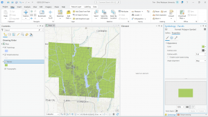
This week, without any reading and most likely the same as many of you did, I downloaded and prepared for the GOEG 291 final scheduled to be due next Friday. For this, I downloaded the necessary data from the Delaware County GIS Data Hub: the Parcels data, Street Centerline data, and the Hydrology data. I then organized this into a file labeled “Delaware GIS Data” on my laptop, extracted each dataset from its original zip file, and converted it to the necessary shapefile format. This created a new file folder for each data set that contained the usable data files. Once the files were in a usable format, I then created a new ArcGIS Pro map project and inserted the three dataset files. To do this, I selected the “Map” tab, then the “Add Data” selection under the “Layer” portion. This added each dataset as a layer on the “Contents” tab. Finally, I recolored the imported data layers (as they were all inserted as the same default pink color) to make each layer visible. As for the final project selections, I plan on doing the “selecting and classifying land uses”, “making new shape files from existing shape files”, and “mapping change” choices.