Chapter 7:
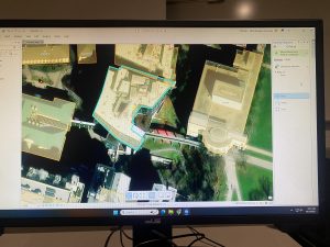
Chapter 7 introduced several tools for manual digitization through tracing. Using base maps, we learned how to create new feature classes and digitize features based on base maps or existing layers. We also used LiDAR data as a reference for heads-up digitizing. In addition, we practiced editing existing features and creating new ones for a university campus, including adding new structures, building additions, and renovations to existing facilities.
Chapter 8:
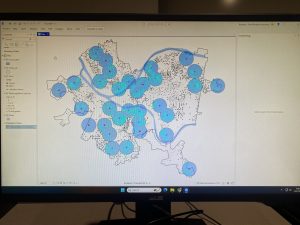
In Chapter 8, section 1 of this tutorial, we geocoded survey data collected by a Pittsburg arts organization that hosts an annual event. The geocoded survey data was used to explore potential marketing, philanthropy, and other communication opportunities with the organization’s patrons. In section 2, we built on the arts event data from section 1 by adding street addresses and more detailed location information for the attendees, which would be useful for marketing purposes. We also geocoded the data by street address to create unique point locations for each attendee on the map.
Chapter 9:
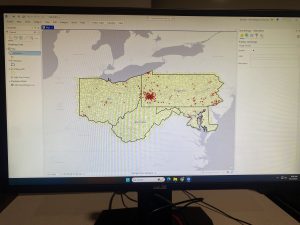
In this chapter, we moved beyond simply visualizing spatial data to actively using it to answer questions and solve problems. We explored four spatial analytical problems: Buffers, service areas, facility location models, and clustering. Our work included building buffers and using gravity models to estimate the nearest swimming pol to residents homes. This analysis helped determine which public pools should remain open during a budget crisis. We also performed cluster analysis to examine demographic and spatial patterns among individuals arrested for serious violent crimes. Additionally, the chapter introduced the concept of a network dataset, which is used to estimate travel distance or time along a street