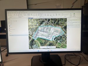
Chapter 7
- Editing polygon features
- Creating and deleting polygon features
- Using cartography tools
- Transforming features
I really enjoyed moving the features around and “fixing” the map. It felt like doing a puzzle. Creating polygons and outlining areas was also pretty cool. Everything in this chapter went smoothly, and I can see how this chapter would have some real-world applications in things like architecture.
Chapter 8
- Geocoding data using zip codes
- Geocoding street addresses
This chapter was super easy and short, I wish all of the chapters were like this one. The only issue I encountered was with the “create locator” tool at the beginning of the chapter, I think I accidentally made a copy of the output locator, which I fixed by just renaming it “PARegionZIP_CreateLocator1.”
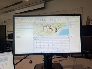
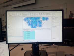
Chapter 9
- Using buffers for proximity analysis
- Using multiple-ring buffers
- Creating multiple-ring service areas for calibrating a gravity model
- Using Network Analyst to locate facilities
- Performing data cluster analysis
I felt like this chapter repeated a lot of things from earlier chapters, just using different methods to get the same results. This was all fairly easy, but it took me a while. I also liked the visuals that the maps created, I can see how this could be useful for someone who works in data analysis or something similar.