Week four was all about introducing the program by physically going through several tutorials on how to operate and understand it. I read the preface, chapter 1, chapter 2, and chapter 3 and did the corresponding tutorials with each section.
Chapter 1:
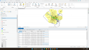
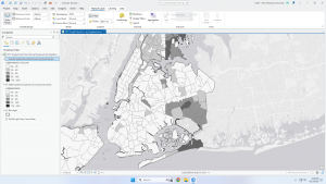
Chapter one was the beginning of making/using maps on ArcGIS. This is the first time I have done anything like this so there was definitely a learning curve involved but overall this chapter was easy to follow along and understand. A few things this chapter focused on were base maps and layers, navigating the program/controls, attribute data, and symbolizing maps. I really like the format of this book because as someone who is completely new to this, it doesn’t feel overwhelming and everything is laid out in very simple steps.
Chapter 2:
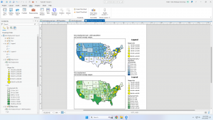
The goal of chapter two is to learn how to design and symbolize thematic maps. It worked through choosing layers and using spatial context in your map. This chapter was a little more difficult for me as it had more content and started to become more complex but overall it was still easy to follow and laid out well. Things that were learned in this chapter included symbolizing qualitative attributes, labeling features and configuring pop ups, filtering with definition queries, creating choropleth maps for quantitative attributes, displaying data using graduated and proportional point symbols, normalizing population maps with custom scales, creating dot density maps, and setting visibility ranges. In section 2.8 I was having trouble with the visibility range and finding “Out Beyond” as an option where only min and max scale were there. This chapter was helpful in seeing how easy it is to read the maps once you understand what you are looking at/what they are representing.
Chapter 3:
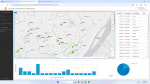
Chapter three focuses on sharing maps beyond ArcGIS users and with people who don’t have advanced GIS or mapping knowledge. This chapter was heavy on using elements in the ArcGIS online browser and showed how to use many of the available features. Things that were learned in this chapter include how to build layouts and charts, sharing maps online, creating a story in ArcGIS StoryMaps, and creating a dashboard in ArcGIS Dashboards. Overall, I thought this chapter was really helpful in showing how what we are learning can be used in real life.