Address Point: Represents all certified addresses in Delaware County. These addresses are
updated daily, with updates published monthly.
Annexation: Tracks annexations and boundary changes in Delaware County since 1853. Here,
annexation simply refers to territorial adjustments.
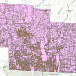
Building Outline: Contains outlines and structures of all buildings in Delaware County. The
most recent update was in 2023.
Condo: Includes all condominium polygons within Delaware County.
Farm Lot: Identifies farm lots within both the U.S. Military and Virginia Military Survey
Districts.
GPS: Contains all GPS monuments established in 1991 and 1997.
MSAG (Master Street Address Guide): Used for defining political jurisdictions in townships,
cities, and villages throughout the county.
Map Sheet: Represents all map sheets within Delaware County.
Hydrology: Maps all major waterways, rivers, and streams within Delaware County, enhanced
using LiDAR data.
Municipality: Contains data on all municipalities within Delaware County.
Original Township: Displays the original township boundaries before tax districts altered their
shapes.
Precinct: Contains data on voting precincts within Delaware County, sourced from the Board of
Elections.
Recorded Document: Includes recorded documents from the Delaware County Recorder’s Plat
Books, Cabinet/Slides, and Instrument Records that are not represented by active subdivision
plats. Used for tracking miscellaneous records in the county.
School District: Shows the boundaries of school districts within Delaware County.
Street Centerline: Represents the center of pavement for public and private roads in Delaware
County. This dataset was developed using address information.
Subdivision: Contains subdivision and condominium records for Delaware County.
Survey: Includes shapefiles of point coverage representing land surveys within the county.
Tax District: Defines tax districts as determined by the Delaware County Auditor’s Real Estate
Office.