Chapter 9
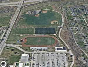
The beginning of chapter 9 was pretty easy for me. It focused on the different uses of buffers. The first part was using buffers for proximity analysis. The second section expands on this by introducing how to use multiple-ring buffers. Buffers are really important for real world applications. I had some issues with 9-4 and had to move on from that section, but the rest of chapter 9 was straightforward.
Chapter 10
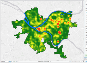
Chapter 10 focuses on the raster part of GIS. Until this point, most of the book was dedicated to vector feature classes. Raster layers are for things like topography and images of the earth, or continuous features. The first part of this chapter was importing a raster dataset into a file geodatabase. Tutorial 2 was making a kernel density map, which was the easiest part of the chapter for me. I had a little bit of trouble with 10-3, but eventually I got the hang of it.
Chapter 11
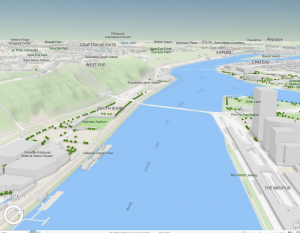
Chapter 11 was by far my favorite chapter. It was interesting and involved what I like the most, exploring maps from the 3D view. The first tutorial was getting used to the 3D view, and it was fun playing around with the keyboard and exploring the United States map with different basemaps. I was able to find my old high school with ease. The rest of the chapter was more work with 3D maps and buildings. For example, in tutorial 11-6 I added height to a building. In the same tutorial, I was introduced to a 3D layer that allowed me to see individual buildings on a street including textures and things like trashcans. It was cool and felt like an old videogame.