GIS Tutorial for ArcGIS Pro
Chapter 9
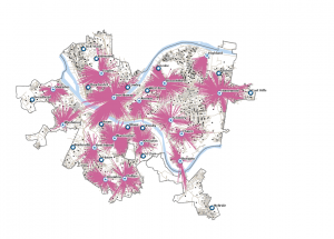
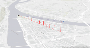
Tutorial 9-4
I didn’t have too much trouble with this chapter, but I wasn’t able to figure out how to adjust the Output Fields upon expanding Fields parameter of the Spatial Join tool in Tutorial 9-3 so I had to call it quits on that tutorial. Also, not sure why, but I didn’t see the option to select Weight in the drop down for Field Mappings after clicking Import Demand Points in Tutorial 9-4, but I still ended up with something similar to the image in the book.
Chapter 10
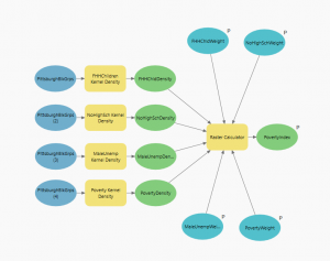
Tutorial 10-3
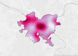
Tutorial 10-3
Everything was fairly seamless for this chapter. I couldn’t find the Green to Yellow to Red color scheme so I picked my own fun colors. I routinely forgot to save my model so my Poverty Index Tool didn’t show parameters at first in Tutorial 10-3, but I quickly realized my silly error and got things to work.
Chapter 11
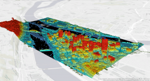
Tutorial 11-4
Tutorial 11-4
I ran into a couple issues in this chapter. I got a little lost in the sauce when digitizing the approximate location of the bridge in Tutorial 11-4, but I moved on and got to conduct a line of sight at the end of the tutorial. I also had some problems with the Summary Statistic tool earlier in Tutorial 11-4, which is weird because I feel pretty familiar with the tool, but I eventually got it to work. I wasn’t able to figure out how to create the movie at the end of Tutorial 11-7 either but, overall, not too painful of a chapter.