Chapter 4: File Geodatabases
I found Chapter 4 to be easy as it focused on how to import data into geodatabases and how to create different queries. This chapter focused on data how it can be used to modify the attribute tables in ARCGIS which you then are able to calculate and create different queries to get the information you need for new fields that you create for the attribute table. Overall this chapter was straightforward and easy to follow and I didn’t run into any issues.
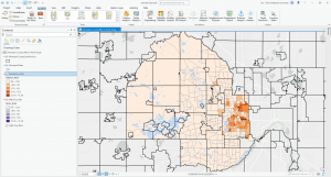
Chapter 5: Spatial Data
I found Chapter 5 to be the most time consuming chapter. This chapter looked at map projections, coordinate systems, and looking at and working with US Census Bureau spatial and tubular data. This chapter started off easy and I found doing the map projections to be simple and fun. Changing a map’s coordinate system was also easy and I found the first half of the tutorials for this chapter to be very straightforward and easy to follow. Likewise working with the US Census Bureau data was also easy to follow and this chapter also showed how to join data and create choropleth maps. Creating the choropleth maps was easy but time consuming as there were a lot of different factors to take into consideration and I somehow managed to spend a good amount of time on tutorial 5 of chapter 5. The rest of the chapter was easy.
Chapter 6: Geoprocessing
Chapter 6 was very easy to follow through. I don’t really have any comments on this chapter as it focused on different geoprocessing features and how to edit and change them. Overall very simple and easy.

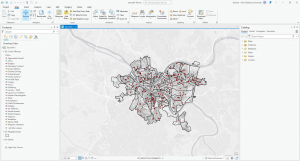
Chapter 7: Digitizing
Chapter 7 was really fun to go through as it looked at editing and changing polygon features and learning how to use cartography tools. Moving the features and using the different edit tools was very easy and fun to do. I also found it interesting the different cartography tools and how it is able to smooth out various polygons that represent land and water. The final tutorial of this chapter was the most interesting as it showed how to transform polygons.
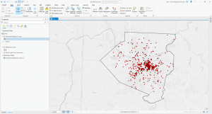
Chapter 8: Geocoding
Chapter 8 looked into geocoding and I ran into an issue with the collect events tool as I could not get it to work. This chapter was very short and so it was the least time consuming and was very straightforward with the instructions.