This section was harder and more complex than the previous assignment. I ran into a few problems where I don’t think my final maps were correct but I tried my best to work through them.
Chapter 4:
The first tutorial in chapter 4 focused on importing data into a new ArcGIS pro project. At first, this was easy but soon I realized I had messed up somewhere. I realized that I missed the your turn portion and was completely lost when the second half was talking about tracts. I did not realize this until I had already left the lab and thought that it must have been a problem within the program. Comparatively to last week’s assignment I felt like I didn’t fully understand the work I was doing in some of the tutorials and was really just following along with what the book said. I understood that different tools helped find different results but I wasn’t really exactly able to understand how they were doing that work.
Chapter 5:
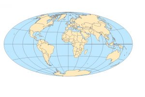
Chapter 5 begin by working with world map projections. It taught us how to change the given map into a different type of projection such as the Albers equal area projection. In tutorial 5-3 we worked on setting projected coordinate systems. It was mentioned that there are many ways for setting a maps coordinate system and regardless to the coordinate system apply you can always change it in the map properties menu. I enjoyed tutorial 5-6 about downloading geospatial data from the USGS National map viewer. I found it interesting that we can download data and input it into our own ArcGis program. I encountered a problem while trying to download the correct document as it was not working. I tried various methods to extract the contents from the downloaded file and then put it into the program but it was just not working. So I was unable to complete this tutorial. I still read through the tutorial and have a general understanding of what I was going to have to do.
Chapter 6:
Chapter 6 started off with a tutorial about dissolving features to create neighborhoods and fire divisions and battalions. We used skills we had learned in the first part such as opening attribute table and sorting different fields. We learned about the pairwise dissolved tool and what it is used for. We learned how to merge features and created a new NYC water layer that included all of the water features into one. I found this chapter to be less intriguing than others that I have completed.
Chapter 7:
Chapter 7 was the most fun tutorial chapter for me during this section I liked being able to actually move things around on the map rather than just him putting data into different tools like the last couple tutorials. It was fun putting the correct shapes of buildings back where they’re supposed to be and learning how to rotate them and change their size. Learning how to use the vertex points was a little bit of a struggle at first but I understood it after messing around with it for a little bit. We learned how to smooth a green space polygon. The result was a new feature class of smooth polygons for the golf courses. Tutorial 7-4 was a little bit harder than the last few. I had trouble transforming my building to fit into the smaller shape. I had to redo this step multiple times for it to finally work.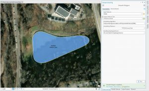
![]()
Chapter 8:
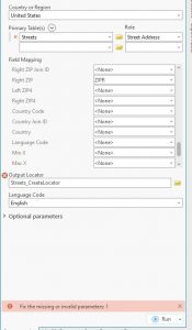
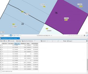
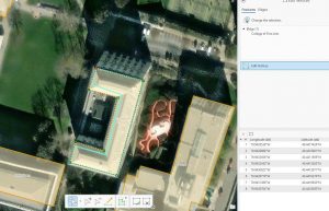
Chapter 8 was the easiest set of tutorials I’ve done so far because there was only two. It started off strong and I was able to complete tutorial one. However in tutorial two I ran into a problem when trying to use the create locator tool. I tried putting in the correct settings and running it multiple times without being able to get it to work. I attached a picture of what it looked like I am not sure what else I could have done.