Chapter 3: I began by finishing the remaining tutorials for this section learning how to integrate with aspects of the online GIS system which was very interesting. I unfortunately could not get my maps to share with the online program, so to accomplish these tutorials I had to use maps already shared by classmates. However, I was able to accomplish and create all the other features on my own within the web system.
Chapter 4: The first two tutorials were interesting because I had to start from scratch and open a project with the regularly set base layers and build from there using database information in the esri folders. It was really helpful to learn how to do this, and I felt like I got much closer to actually being able to create a whole map from scratch on my own, which is obviously one of my goals in taking this course. While doing the third tutorial I was able to save and import the definition query but it would not appear in the mapping system again. I could not find what error was occurring so I moved on to the other queries in the chapter, which will definitely prove helpful in the future when working with large datasets and trying to understand different variables. Tutorial four was quick, it reminded me of how to create a map using simple data and graduated colors, it was pretty basic but at the very least made me feel accomplished. The next tutorial was pretty similar, I just had to add graduated symbols to the map which was a refresher but I was able to accomplish this with no issues. Finally, in tutorial 6 I was able to join the crime type data and manipulate the symbols to make data visualization easier.
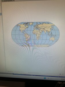
Chapter 5: The first tutorial taught me how to change the type of distortion that is used in a 2D map of the world in GIS to be useful for different regions and have different rates of distortion. The second tutorial was the same but exclusively for the United States. Tutorial 3 was useful to learn more about how to use the coordinate systems within the maps and changing and manipulating the the coordinate system of a map. For the fourth tutorial, I was not able to locate the data file within the chapter 5 folder, it was not a part of my initial esripress download which is stored on my external hard drive. So I moved on to the fifth tutorial, which I spent a ridiculous amount of time extracting data from the US Census Bureau, but eventually found the proper way to integrate it all into the map. Finally, I moved on to the 6th tutorial, which involved adding even more data on things like bike stations into this map.
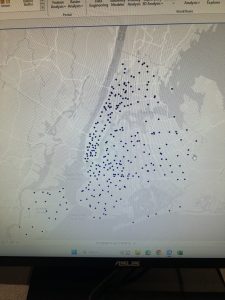
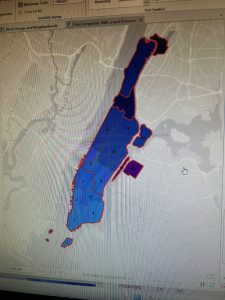
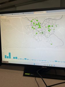
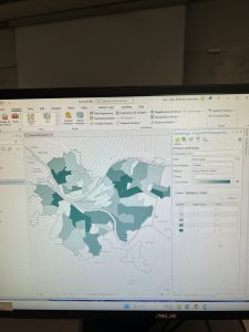
Chapter 6: I began with creating the map of New York City fire battalions which taught me how to dissolve and merge boundaries within the data of the map. I found this very interesting and I was able to execute all the actions without too much issue. Next, I used the instructions in tutorial 2 to clip the streets in the Upper West Side which was relatively simple. Then, tutorial 3 had me merge all the water features in the area of Manhattan. Tutorial 4 taught me how to merge two datasets into one with the police and fire stations of New York. Tutorial 5 was useful to find intersecting features which in this example were the streets of Manhattan and their fire companies. Tutorial 6 was all about calculating and comparing geometric attributes of the mapping data which in this case was the landuse of Brooklyn. Finally, tutorial 7 was useful to learn more ways to analyze counts of data within regions in this case the amount of people with disabilities within a fire companies jurisdiction. Overall this chapter was the smoothest one I’ve completed so far, and I actually remembered to take some pictures while I was doing it.