Chapter 4:
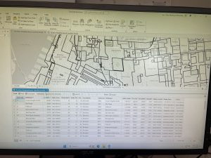
Chapter 4 goes more in depth with working with databases which are basically just places where a collection of data is held for a certain topic. The first task in the tutorial was learning how to import data into ArcGis, putting a data table into a file geodatabase and then utilizing the database into the map. Then continuing on with tables the next part covered how to modify attribute tables and joining a data table with an attribute table. After this, it was a lot of in depth tasks of getting useful information from these tables like filtering the range of when certain crimes occur. Coding has come up a lot in this chapter which was very confusing to me since I know nothing about coding but for the most part if I followed the tutorial I was fine. Overall I feel like I’m starting to get the hang of things and this chapter went by pretty fast.

Chapter 5:
Things started out pretty simple and easy to follow but I feel like as the chapter went on it took me a lot longer to find things and the tutorials have started to get less descriptive. To start out I learned about all of the coordinate systems that ArcGis has, where to view them and put them to use.I found this part pretty easy and the tutorial matched up well with the software and other websites I had to visit to gather more information from. After this the tutorial goes over working with vector data, using conversion tools to import shapefiles into geodatabase so that they can be used on the map and converting other various file types. The next part got a bit more complicated with working in outside websites for the US census maps and data tables. For some reason section 5-5 took me too long and I had to do a lot of guessing and rereading to figure out how to get the end product and I struggled to join the 2 data tables together in the end to make the choropleth map.

Chapter 6:
Chapter 6 was all about geoprocessing which is basically a framework and set tool for processing geographic data. The purpose of this is to build study areas and perform various tasks. Firstly, I started out with dissolving features in Manhattan, New York to create neighborhoods. I didn’t really understand what dissolving really was but with a lot of these new things that I am learning with ArcGis, you kind of have to trust the process. The data from this section was then used to create a useful map in which emergency response teams can easily identify fire divisions and population. Overall though this chapter went by pretty fast and wasn’t too hard to do.

Chapter 7:
This chapter was pretty straight forward and went over things like editing polygon features, transforming features and using cartography tool which I enjoyed doing.

Chapter 8:
For whatever reason this chapter was so frustrating and I really only got the first part done before everything just got so messed up I couldn’t figure out how to continue.