Chapter 1:
I was pretty intimidated to start using this software because I’m not very good with computers. It took me a while to really get going with and finish this chapter but by the end of it I had a better grasp of what I was doing. This chapter covers the basics of using Arcgis such as adding and removing a basemap, turning off and on layers, reordering feature classes, and exporting a map. Section 1-2 goes more into depth into navigating various features. From this part I learned how to use a pop-up window, zooming in, using bookmarks and searching for features. As the tutorials went on somethings got easier but I started having more problems with not being able to follow the instructions to a T and not being able to find what was being asked. Sometimes after looking for a long time I would eventually find it or I would just have to move on like at the end of 1-3. In the second half of chapter one I learned how to work with attribute data which could be tedious but I started to enjoy it. Finally, I learned how to symbolize and label features and then show the map in 3D which was my favorite part of the chapter.
.
Chapter 2:
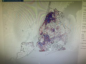
Chapter 2 had a lot more parts than chapter 1 so even though I had a better grasp on what I was doing it still took me a lot longer than expected. Nevertheless, I learned a lot of interesting and useful things like symbolizing qualitative attributes by using different symbols and labels. A highlight from this was honestly looking at all of the color options and their names in the symbology pane. I enjoyed seeing all of the layers start to come together to make a cohesive map in this section and learning how to manage pop ups to provide more information without mudding up the rest of the map. When it came to creating a coropleth map things became a bit more complicated and I found myself having to reread a lot but I eventually got it down. For the life of me I could not get the 3D map to work in 2-4 which I was very sad about because I like the 3D maps but I had to move on, I will probably go back and do some problem solving, though. As the chapter went on I learned more about having graduated points on graphs and customs scales that fit the population and then lastly making dot density maps with visibility ranges.
Chapter 3:
Chapter 3 was a lot shorter but dealt with a different format that before so it took me some time to learn where the different tools were. The first part went over building layouts to display maps and charts in one space which I found very useful for future use in inserting maps into presentations and papers. The later section was where I learned how to share maps online and switched to using ArcGis online with different tools. I got lost on a lot of things in the later parts of the chapter but I got most things figured out after a while. Creating a dashboard in ArcGis was tedious with many steps but the book made it pretty easy to follow even if I had to reread a few times. I think this process what a bit different that what I did before because it was like I was creating the dashboard for someone else and I wasn’t really sure what a dashboard was but I then understood and saw the usefulness in this application for possible future jobs I would go into.
