GIS Tutorial for ArcGIS Pro
Chapter 1
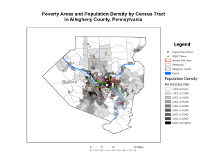
Tutorial 1-1
Tutorial 1-4
I really appreciate how explicitly detailed the instructions are for each tutorial. Once I got familiar with how things are saved and such it was pretty smooth sails. I think the only hiccup I had was accessing the hyperlinks for individual urgent care clinics. I tried to poke around figure out why they weren’t showing up in my pop-up window but I ended up just moving on.
Chapter 2
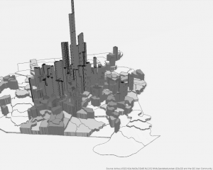
Tutorial 2-4
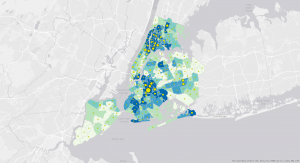
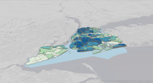
Tutorial 2-5
Things went well for this chapter too. I wasn’t able to drag the Over Age 60 Receiving Food Stamps layer above the 3D layer heading in Tutorial 2-4 despite my efforts to trouble shoot, but I still ended up with something that looks similar to the map in the book. For Tutorial 2-8, I couldn’t find “Out Beyond” in the Visibility Range group of the Labeling tab, so I selected <Current> as the maximum scale and the minimum scale because I speculated that doing so would also cause the ZoningLandUse labels to disappear when I zoom in or out. I repeated this with the Lower Manhattan bookmark and it seemed to also achieve the goal of removing the school points and borough labels when zooming in and out.
Chapter 3
Tutorial 3-1
I had a pretty easy time following along with the instructions for this chapter as well. I wasn’t able to find how to enable the pie chart in the map configurations for Tutorial 3-4, but I was able to enable the serial chart and table. Overall, minimal bumps in the road and I feel somewhat comfortable navigating the program and ArcGIS web maps.