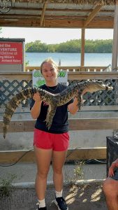
I’m Izzy Fry! I am a Freshman Environmental Science and Zoology major, and I’m on the field hockey team. I’m from Dublin, OH.

It’s really cool to learn about all the applications of GIS because I didn’t know it had so many uses in various fields. I also did not know that the technology and concepts were developed in the 1960s. It is also interesting to learn that in the early days manual maps were preferred for the process of overlaying information even into more modern times. It was really interesting to get a little bit of a window into the history of cartography while learning about GIS. I had also not thought much about how the availability data and scale of a GIS based project can impact what is actually able to be produced. It was also very interesting to learn about how GIS can be used in terms of public health, specifically in the example of a cholera outbreak and locating the cause. Additionally, agricultural uses for GIS are very interesting because of the possibility of considering so many variables together. I’m excited to learn more about the possibilities of GIS.

I learned that GIS can be used in zoology for a variety of projects including gaging habitat suitability. This particular map is from “Modeling habitat suitability for endemic Grizzled leaf monkey (Presbytis comata) using geospatial machine learning approach” performed in Indonesia in 2022, by a team of researchers. This is very interesting because without GIS technology it would be very difficult to visualize this data especially in a comparative manner.

I also learned GIS can be used for resources that are important to humans including water quality. This map is from “GIS Mapping for Distribution of Ground Water
Quality in Udaipur” also performed in 2022. Which is interesting in terms of global health, public safety, and animal habitats.