Hi! My name is Camryn Henderson, and I am a freshman. I am an Environmental Studies and Theater double major with a minor in Politics and Government. I am from Wadsworth Ohio, which is near Akron.
2. Schuurman reading
This chapter was an introduction to GIS, but instead of being a guide on how to use it, it instead it dove into why it is used, the best applications for it, and explained its importance to not only geography but all areas of study. Before reading this chapter, I was unaware of the problems that can occur from using GIS, and I didn’t know that there could be significant faults in using it. I also found the history of GIS interesting, as I feel it gave better insight into what the program is used for and showed a clear difference between GIS now and originally. I did not not know much about GIS in general before reading this and I found that it gave a good overview of the general knowledge needed to do well in this course. I did not know that there was a difference between “mapping” and “spatial analysis” but learning about the differences between the two was super interesting. Spatial analysis is a term I have heard come up a lot in Environmental Science classes so learning a little bit more about what it is and vast amount you can learn from it was helpful. I chose to take this class not only to fulfill a requirement but also because as I have been doing research for internships, and possible future jobs I have noticed how important it is to be familiar with GIS, and spatial analysis; however I knew very little about what kinds of things I could use GIS for, and this book gave me more insight. Other than for urban planning and other environmental focused careers, I had not heard of GIS being used; however it can be used for sales, transportation, and health professions. This chapter provided me with baseline knowledge that I will be able to use throughout the semester.
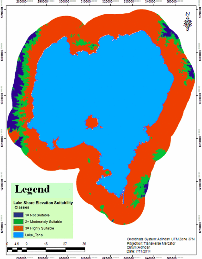
3. Buruso, F.H. Habitat suitability analysis for hippopotamus (H. amphibious) using GIS and remote sensing in Lake Tana and its environs, Ethiopia. Environ Syst Res 6, 6 (2018). https://doi.org/10.1186/s40068-017-0083-8

This is a GIS image of the elevation sutiability for hippos in Ethiopia near Lake Tana. In the article where I found this analysis I found many others, all covering different criteria and their respective suitability. They were able to reclassify the data and determine suitability by elevation in this case.
Sarma, P. K., Mipun, B. S., Talukdar, B. K., Kumar, R., & Basumatary, A. K. (2011). Evaluation of Habitat Suitability for Rhino (Rhinoceros unicornis) in Orang National Park Using Geo-Spatial Tools. International Scholarly Research Notices, 2011(1), 498258. https://doi.org/10.5402/2011/498258

This image is from a similar study to the first one; however, this time it was focusing on the conservation of rhinos. Due to rhinos being endangered it is very important for their habitats to be as preserved and suitable as possible. This study focused on suitability in different parts of a National Park in India.