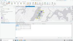
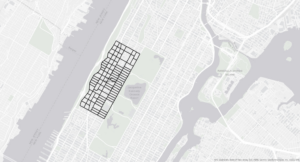
Chapter 4- This chapter dealt a lot with incorporating databases and data tables into ArcGIS Pro. This was the first chapter where we created our own map at the beginning instead of starting with one of the templates and preset data/feature classes. I think that creating the folder connections was slightly confusing and that I may have messed this part up slightly because my map did not look quite the same as the picture in the book. I think this part of the book is helpful because it teaches you how to import data sets and isolate variables to look at data easily. The first part of this chapter also showed me how to join a feature class attribute table with a data table. Once you join these two, you can then calculate the sums, and in the tutorial, I was able to calculate the percentage of the population that is less than 20 years old. Again, I think this is a really efficient way of isolating certain portions of the dataset that are more relevant to what you may be interested in. The ending of the second tutorial was slightly confusing, as it was coding in Python, which I have very little experience with, but I tried my best and followed the book closely to perform these actions. Some of the commands and buttons that the book mentioned were not in my Contents pane, so some of the tutorials were a little difficult. Also, this chapter went over how to make a date-range selection query and how to save it and use it later. This action selects certain points that fall within the date range specified. I also created a query for crime types, which selected only certain types of crime from the entire dataset. The queries can be used for a multitude of things, and the book even went over how to search for a specific person who committed a crime based on specific attributes. This chapter also built on knowledge from a previous tutorial and had me make a choropleth map, which I had to turn back a few chapters to remind myself how. I also reviewed how to make graduated symbols on a map.
Chapter 5- This chapter went over map projections and different coordinate systems. Some of the tutorials were pretty short and just went over basic actions like how to change the coordinate systems, so this chapter went by pretty fast. Also, many of these tutorials went over how to use government databases to download geospatial data into ArcGIS and then project the data on the map. I was able to extract the raster features for Hennepin County and display land use and water features (although I think my screenshot of this map may have been left behind on one of the computers in the lab). As many other people have mentioned, the 5-5 and 5-6 tutorials were a bit messed up, and I was actually able to locate the correct columns in the Excel spreadsheet, but for some reason, my spreadsheet would not import correctly and display in ArcGIS, so I’m not sure what was going on. One thing I have noticed as I’m moving through these tutorials is that ArcGIS Pro updates very frequently, but the textbooks are not able to keep up with these updates quick enough, so many times the directions do not entirely match the locations and names of commands on ArcGIS. Other than the hiccup with the database, I was able to move through chapter 5 well.
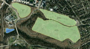
Chapter 6- Chapter 6 took a little time because I had to be really particular when manipulating the data to dissolve the block groups. Chapter 6 overall went a little more in-depth about the variety of tools available on ArcGIS Pro, like the Pairwise Dissolve tool, Clip, and some others to either combine or clip certain parts of the map to study them better. I was having trouble with some of the steps in Chapter 6-2, in the Your Turn section where we had to use the Select by Location tool to find where Manhattan Streets intersected with another layer. I think I played around with all of the options in the Select By Location section to the point where it at least looked like the picture in the book, and that was the closest I could get. Also, this chapter went over how to merge feature classes, and I was able to merge the bodies of water within New York City and all the waterfront parks in New York City. Another tool that I learned to use in this chapter was the Union tool, and I was able to calculate the total areas and acreage selected using this tool. Overall, I think this chapter was a little challenging, but it gave me a better understanding of some of the geoprocessing tools in ArcGIS Pro.
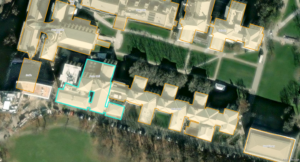
Chapter 7- I actually really enjoyed the content in chapter 7, so this chapter seemed to move by really fast for me. This chapter went over some cartography skills and how to edit polygon features so that they fit the basemap better. Sometimes, the building polygons are not quite in the right spot, so you have to manually select them and move them to be in the right spot. Other times, you have to add vertices or rotate the polygon so that it fits well. I was having a little bit of trouble with the vertex points when I had to cut out some of the polygons in a U-shaped building, and the points weren’t placing initially, but I got it after repetitively clicking for a while. Also, sometimes polygons can be in one big massive shape over 2 different buildings, so you have to manually split the polygon and go into the attribute tables to add in the two specific names of the buildings. This chapter let us practice creating a feature class again, then we got to actually create polygons over oddly shaped parking lots. Cartography tools like the Smoothing Tolerance were also used to smooth the edges of grassy areas and ponds/lakes when the edges are a bit harsher than they are in real life. I had a bit of trouble rotating the building in chapter 7-4, but I was able to do the rest of the tutorial where I classified the layers.
Chapter 8- This chapter was very short and only had two tutorials that were both pretty easy. This chapter mainly went over geocoding and we were working with very large sets of data. Essentially, this chapter went over how to rematch addresses from a datasheet. I was surprised that it had data in Ohio too! Again, there’s not much to write about in this chapter other than the tutorials were pretty easy to understand and we were able to work with some ZIP codes and manipulate the symbology again.