Chapter 1
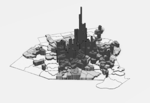
This chapter of tutorials helped me understand the foundational concepts needed to use ArcPro easily. I found the information I learned in this chapter useful in establishing the basics for navigating ArcPro for the upcoming chapters. Overall I gained a solid introduction to ArcGIS, learned how to navigate maps, worked with tables of attribute data, got an introduction to symbolizing and labeling maps, and worked with 2D and 3D maps. My favorite part was the 3D map.
Chapter 2
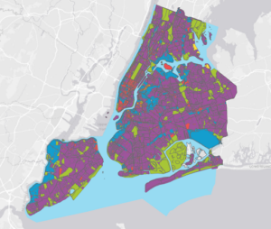
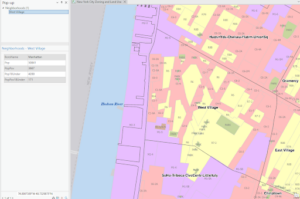
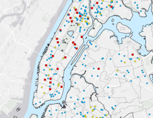
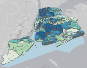
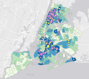
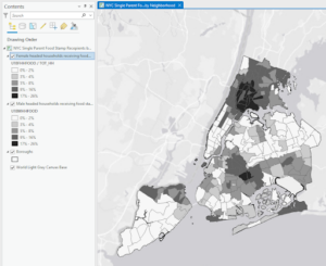
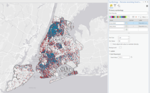
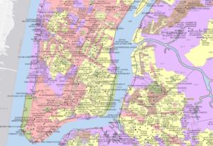
This chapter had a lot of tutorials but I liked how quick they were. Here, I learned how to symbolize maps using qualitative attributes and then add labels to them, as well as how to use definition queries to create a subset of map features. The chapter also taught me how to symbolize maps using quantitative attributes, understand 3D scenes, and symbolize maps using graduated and proportional point symbols. It was also interesting to see how normalized maps are created with custom scales, how dot density maps are created, and how to add visibility ranges for interactive map use. The only hard part about this chapter was finding the bookmarks it told the user to zoom in on in some steps. I had to keep googling parts of New York because the book just assumed I knew where West Village and Lower Manhattan were. I also really liked how colorful the maps were.
Chapter 3
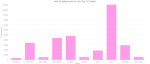
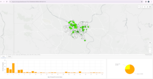
Although this felt like the longest chapter, I found this one interesting because of how it used ArcGIS online. Making the interactive reports and maps was fun. This chapter taught me how to build map layouts and charts, as well as how to share, use Map Viewer, and create and use Storymaps and Dashboards all in ArcGIS Online.