Getting to Know ArcGIS by Amy Collins and Michael Law: chapters 1, 2, 3, 4, and 5
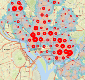
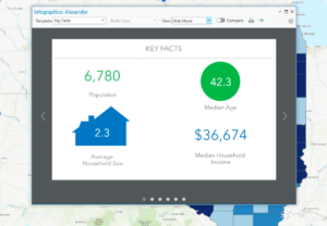
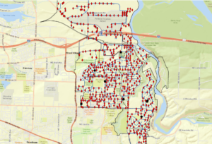
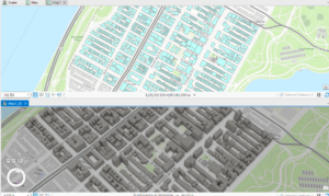
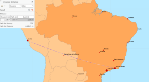
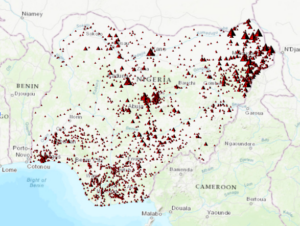
While increasingly frustrating in tasks, I enjoyed working with these few chapters as it’s the first real “hands-on” activities we’ve been able to do in this class. The first chapter was focused on the basics of GIS, much like we read in the previous book. It was a good refresher, as jumping into five tutorials was a good amount to take on. The key takeaway was that GIS is all about connecting spatial data, information that represents real-world locations and the shapes of geographic features and the relationships between them, and attribute data, information about spatial data. The first chapter then opened up into talking about how information has become more widely available within the past few years, as government agencies and NGOs are becoming more willing to put their data out on the internet. The principles and concepts remarked in the first book are reiterated once again, and the authors also make a point to talk about the difference between ArcPro and ArcOnline. The second chapter starts with the first tutorial of the assessment, with mapping the relationships of schools, walking distance to schools and transportation safety issues in Washington DC. The second assessment focuses on distance between major cities, looking at ranking population in datasets and classifying countries by air pollution statistics. The second chapter also works with 3D modeling in New York City. In all, the second chapter focuses on extracting parts of datasets, tabular data, data statistics and connecting spatial datasets. The third chapter works on mapping food deserts and obesity rates in Illinois counties, using attribute tables and diagram features to display data with the map. The fourth chapter works on building and maintaining a dataset, this time for Troutdale, Oregon, a suburb of Portland. This exercise puts you in the shoes of a city planner keeping track of data for the city. This chapter helps build geodatabases, create features and modify features. Finally, chapter five focuses on the continent of Africa, specifically the countries of Rwanda, Nigeria and South Sudan. These exercises focus on managing a repeatable workflow using tasks, creating a geoprocessing model and running a python command and script tool. I found myself getting frustrated toward the end of this assignment, as the directions became less explicit from the authors. I have to constantly remind myself to go slow, remember what I’ve learned from the previous chapter, and try my best to figure out a solution before seeking help from a fellow student or Dr. Krygier. I think I’ll go through these exercises again once I have more free time to better understand the steps and become more comfortable with the program.
“The principles and concepts remarked in the first book are reiterated once again, ”
now they are stuck forever in your head.
“I found myself getting frustrated toward the end of this assignment, as the directions became less explicit from the authors. I have to constantly remind myself to go slow, remember what I’ve learned from the previous chapter, and try my best to figure out a solution before seeking help from a fellow student or Dr. Krygier. I think I’ll go through these exercises again once I have more free time to better understand the steps and become more comfortable with the program.”
Yeah, it’s a lot and it does build over the course of the tutorials. The less explicit instructions as you go on is a pedagogical attemtp to get your brain a bit more engaged. And running through this again is a good idea. The final will also help you wrap your brain around this all via applications.