Uible Week 3

Chapter 3 

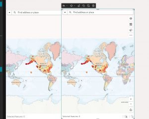
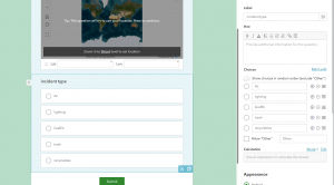
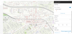
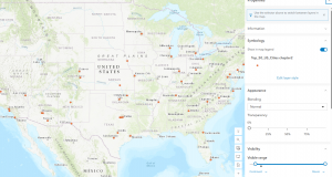
Chapter 3, Experience Builder, was very interesting. It covered much more than the first two chapters, went deeper into specific topics, and explained things some of us grew up with. It’s like widgets, which is really interesting. It also covered some basics that are actually helpful for understanding this whole math experience, like Maps/web builder, which is useful for a lot of things, and we’re learning that directly, so it might be something someone wants to explore for their final. I wonder directly this specifically how these maps are actually used compared to others it said in the tutorial I would like a hurricane wave of where like what if and where it specifically could hit, and that’s interesting, but I wonder what the directly some of these kind of maps and how


Chapter 4

Chapters for Mobile GIS is kind of an interesting as it talked about a lot of things we’ve been growing up with like GPS satellite stuff like that to help us figure out directions. It also talked about how it can be very helpful in making sure nothing happens, so that part was interesting. Refresh of how this actually affects other things which were really interesting cause I never thought as like Weather and like warnings about like flash floods, and stuff like that we’re based off GIS and so definitely gives me a whole new, understanding of other things specifically the GPS and like figure out how to get to a destination foster and so you like reading this and try to understand it has helped me definitely more understand of what like GIS GPS was specifically for and very helpful, especially in situations of mapping and you don’t know how the GIS system has definitely helped make getting specifically a lot faster under the new technology

Uible Week 2

Chapter 1

Chapter 1 briefly introduces GIS and other key factors we covered in our class introduction before we started reading this book. It also goes over some other key features, such as some basic information about web GIS, some types that you know we might need or how to do things, basic plans of how specific GIS apps work, some of the archetypes of what GIS has, and Components of GIS, so a lot of it is going over stuff we would’ve covered in the readings of what GIS is. It also shows us some ways to path GIS applications, which is really interesting. It also shows that attachments have been a popular DATA service. The how-to tutorials cover some of the stuff, like adding features from the things to layers, and they’re very helpful. The tutorials explain what can cause trouble with these activities, especially since some parts can be confusing.  Not all of them include visual directions to help students. Some do, and some don’t, so it varies, but overall, seeing specific GIS examples is very helpful.

​

Chapter 2 covers how to make smart maps and how to do it with GIS. First, it covers the different kinds of maps and how they’re used, including the strengths of each type. It also gives examples of what they look like and describes what they are and how they’re used. It’s very helpful to see from a personal viewing point because we see some of these in our day-to-day life, such as election maps and maybe population density heat maps, stuff like that, and it’s very helpful to see them in other visual form, also describes what  pop-ups are detailed  and gives us explanation of what each of these things are maybe a video in them and other important information especially if you’re trying to story tell some other thing like imagery other things that we would need to make a story it also explains how to use the storytellingGIS for storytelling such as going up the maps the narrative, the story and how we can show these things using multiple kinds of media , some images, maybe even a video also explains that we could do a guided tour or an explorer tour.

Uible week one

Hello, my name is Henry. I’m from South Florida. I’m a senior here. I am a history major and a geography minor. After I graduate, I want to teach history or geography in high school, using tools like GIS to teach geography. I took Geography 291 last semester, and it was probably one of my favorite classes here at OWU. It was also the class I spent the most time planning and trying to understand because I didn’t know about GIS until I started taking geography classes. After poking around in my account, you know, I was really surprised after I clicked on the ArcGIS blog that people would be posting stuff till this day and also the community forums that people would be posting things that they’re doing, which is really surprising because you know not hearing about many people talking about GIS outside of here at OUW . It’s really interesting to see how other People are talking about it. Also, the other things, like the tutorials and ways to get help, can take you directly to resources that might help with something causing trouble during the experience, which is really helpful because GIS can be confusing sometimes, and it’s good to have extra help outside of Dr. Kryger. in the get started one of the first things I noticed was it’s just really helpful to specially to people are coming either back to GIS or looking to like start working with it, especially online version compared to the desktop version one of the first things I want to look at was work with Maps and this gives you a great introduction of how to view things how to set up directions and actually had a create them or share them into them to other people and that’s very helpful because sometimes even reading things over or talking to someone about how to do it having an extra way to read it or look over things is very helpful. Another one was the notebook notes and having them ready for whatever you need to, like maybe collecting data on something so you can instantly add it to your GIS map, and it’s just interesting to see that some samples, especially slightly further down, in it, of sample notebooks of what they look like and maybe notes of them, and it’s helpful to see some examples of that primarily because this looks like something that could be used for this class.
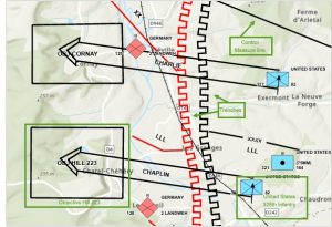
GIS has made understanding battles much easier because it can depict troop movement, the battle’s actual geography, and the defenses and offensive maneuvers each battalion or army used. Take, for example, the Battle of Gettysburg. Many troop and army movements weren’t fully understood until tools like GIS became available. Now you can also easily display battle maneuvers and how things were done, making the battle and its movements easier for people to understand and learn about. 

Reimagine a historic battle with visibility analysis | Documentation 
The next one I pointed out was the National forests. Surprisingly, a lot of people forget that national forests exist, and a map like this that pinpoints where they are, how big they are, and where they are in the region is actually helpful. When I drive up from where I live now in North Carolina, I didn’t realize I was going through a bunch of the areas near national forests or going through them directly, but not having stuff like GIS where I. Where they are on the map, it now helps because now this gives me a way to, in case I want to go stop after a long drive to go into one of the national forests in Virginia, West Virginia, North Carolina, or South Carolina, it gives me something to do and knowing where they are definitely gives me more of something to go look for, especially trying to pinpoint things in these areas. 
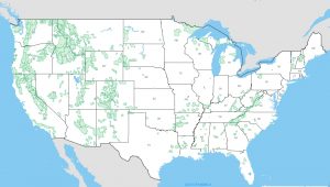
ArcGIS Web Application