Benes, Week 7-9 (Final)

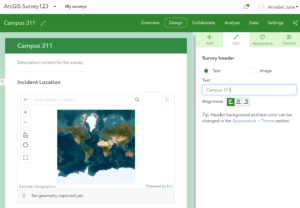
For the final project I decided to make a survey that would be populated into a data map and then create a 3D map with an existing data set.

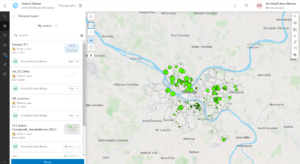
Survey: I decided to do a survey that would then hypothetically be created into a map with various data points. This survey will be looking at how many pets (dog, cat, or other) people have on campus and what type (ESA, Service, or Other) and where they live. This will then be populated into a map that shows the different residential halls and how many pets live in those areas. 

Link: https://arcg.is/qCr5z1 

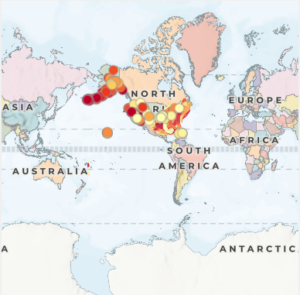
3D Map: I wanted to explore the mountain ranges around the world. This is because I am from Colorado and find it really interesting to see the different mountain ranges around the world. The 3D Map illustrates different mountain ranges and elevation high in a 3D view. The link is provided below.

Link: https://arcg.is/1XLCm40 


Benes, Week 6

Chapter 7

  • Chapter seven was really interesting to go through. I liked how we got a new perspective with the scene viewer and how it was more complex with the data. I did have some trouble with some of the tutorials but for the most part I got the concepts.

Benes, Week 5

Chapter 6:

  • This was a really interesting chapter. I thought that the tutorial went smoothly there were some areas that I couldn’t complete but for the most part I understood the concepts. I really liked being able to see different tools that can be used for data collection. Like in the beginning tutorials working with the dashboard and imputing data with various forms.

Benes, Week 4

Chapter 3: 

  • This tutorial was harder to understand. I don’t know if it was the book or the program. However I was able to work with the program and get some information from the tutorial. Personally I am finding these tutorials harder than the desktop version maybe its because the small screen on my computer or the book is not updated as it should be. 

Chapter 4: 

  • This tutorial was interesting. I liked seeing a different program that stems from ArcGIS. Again some of the information wasn’t clear so I didn’t get the full understanding but made it through the majority of the tutorial. I thought it was cool to see the new applications and a new way to express data and gain more knowledge about topics through surveys. 
  •  

Benes, Week 3

Chapter 1: 

  • First off it was really interesting to see all the advantages of Web GIS and it seems more friendly to use than desktop GIS.this seems to be a program where you can heavily connect to various data and people to gain information and learn.I didn’t quite fully understand the information about hosted and nonhosted feature layers but it might make more sense down the line. The tutorial was a little hard for me to understand, I wasn’t able to download the files correctly. Therefore I am planning to set-up a meeting to discuss that. 

Chapter 2:

  • The beginning of this chapter talks about hosted layers more in depth which was helpful. I thought it was really cool to see the sample smart-mapping styles. I think the idea of storytelling through GIS is really cool. In the previous course we did a little storytelling but I am interested to see more components. I was struggling again to get the download correct therefore I wasn’t able to complete the tutorial. 

Benes, Week 1

  • I am Annabel Benes, a senior from Denver, Colorado. I just completed the GIS 291 therefore I am excited to see what comes next with GIS 292. I enjoyed the first course and look forward to learning new information for the rest of the semester. 
  • Under my esri it said I didn’t have access, not sure what I missed in the login but I will set-up an appointment to figure it out. It was really cool to see all the different courses that could be taken. I also think it’s cool that we have access to looking at the blog and forums so we can have a further understanding of everyday applications. 
  • I think ArcGIS online is really interesting. especially since you can access it anywhere from your personal computer and not be tied to a specific space. The notebook feature seems really cool and a good place to write down ideas and more in a consistent area. the wide range of data that can be shared and accessed is really cool./ being able to see various maps and content is really helpful. overall I already feel like this is more user friendly and will be easier to work with. 
  • This was a very informative tutorial. I thought it was good to get a refresher about topics stated in GIS 291. I feel that this might be easier to work with but we will see.  

  • The two courses that seem cool to learn about are Create smart surveys and forms and creating an underground scene. 
  • Two applications that I wanted to look into were Urbanization in Africa and Bears of the World. I thought these maps were really interesting and provided a lot of information and detail.