notes:
- C1
- in 1.3 number 4 is that I do not see a basemap that is labeled “Community Map” which is strange as I remember using that same basemap for some story maps that I have recently made. I decided to use the “Streets” basemap instead as it looked like the closest one to community map.
- The configure pop-ups button is just called pop-ups in the settings toolbar
- It was pretty cool making a web map that can previewed with mobile phone dimensions, especially considering how useful it could be as so much information in the past 5 or so years has been consumed simply on our phones
- C2
- Page 41 shows all of the smart-mapping styles; I love these so much i cant put my finger on why but they are just so interesting to read and especially to play around with them when deciding which one to use to represent data and even what type of data suits each style the best
- 2.1 number 6 there is no state location type, only a region location type that uses the state field instead
- I am not a fan of the color theory of red being gains, as i often see in media that red can also effectively be used as losses and blue for gains as well, instead i like a color like green for gains
- As protest i changed my gain arrows to pink !!!
- 2.3 number 5 globals is not a button, it is called profile variables
- Despite backtracking the settings and rechecking the csv sheet, the bargraph in the city pop-up menu does not want to show, even when i selected it in the configure chart, it shows the space where it should be but it does not show any information
- 2.5 number 21 there is no place map button, just click save
- 2.5 number 24 there is no map action option in the block palette, there is adding a map and media action but no map action
- Oh okay it wants us to use the media action button!!!
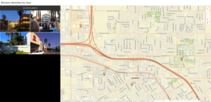
My story map!!!!: https://arcg.is/1ubG1n
An application that could be created from these two chapters would be a story map based on a compilation of birding trips and what you saw, heard, and felt during the trips! Maps could be inserted into the story map using spreadsheet data of bird sightings over an extended period of time with location data on where you went birding, where you spotted specific birds, pictures of the birds (or even if you got your own in the field), a description and overview of the specific birds that you saw (linking to other informational websites), and possibly a comparison to the amount of birds that are commonly and uncommonly found in the areas versus what you saw!
Point data on where specifically you saw each bird based on external devices like ebird.org or by simply placing points on a map and running a story map through each of the points, explaining the amount and different types of avians seen at each location, and maybe a link to recent research about the birds hast were seen or just links to website explaining their range or behaviors in greater detail.