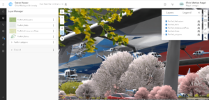
This tutorial was fine in my opinion, I did get stuck at step 5 but I managed to figure it out with some help. I feel like the 3D aspect about this tutorial was also interesting. To be honest I don’t have too much to say about it. This tutorial is probably ranked 3rd or 4th on my list. Not because of difficulty but just because I didn’t find it as intriguing as the rest. Using Ā the skillset from this tutorial though I think it’d be Ā cool to make an application about the population density in NYC but primarily the 5 boroughs.
Month: April 2024
Howard Week 6
Chapter 7
3D is a really cool new-ish thing, so it was interesting to learn about it on a GIS level. I had done some 3D work in GEOG 291, but struggled figuring out how to make it function.Ā
As expected, there’s a lot of different apps and definitions talked about in this chapter. So many elements in scenes, which are a large part of 3D app creations, web scene and web scene layers and all the different mini categories included in that, different products that you can make 3D apps with, you name it.Ā
The different products, while they mainly mush into one in my brain, are cool. I canāt believe so many popular movies were made with ArcGIS CityEngine!! Yet another regular thing that secret uses GIS. I also appreciated the explanation of the difference between VR, AR, XR, MR and the metaverse. A lot of more techy people already know about that but I never learned. Iād like to see some examples of combined VR and real life environments, and how that would look. I didnāt even think about Indoor GIS and how that might be used and how it is lacking in data. And then there’s a bunch of different products for indoors, of course. City creation in GIS is also cool.Ā
Because the field of 3D is so vast and slightly confusing in my brain, it’s a bit hard to think of an original app idea. The tutorials used population and making a web scene plus all its aspects as app examples. What is most understandable to me is the idea of showing population as 3D, so something similar to that could be showing population of a certain type of animal in each state as 3D? Maybe an endangered/threatened species? Iām not sure exactly. I think it could be cool to see and would be helpful for the general population, though. Iām not sure if Iāll do that for my final app but it would be interesting if I did.
Howard Week 5
Chapter 6
It was interesting learning about all the aspects of spatialtemporal data and what it can be used for. It’s very multiversital, including things like live feeds of moving objects, perimeters and changes, and live pictures and videos from cameras, for example. There’s so much that involves this type of data that it’s hard to keep track of!
There are so many different offshoots/products of ArcGIS that Iām unsure how to remember them all. ArcGISVelocity, ArcGISGeoEvent Server, ArcGIS Arcade, and ArcGIS Mission, from this chapter alone arenāt too distinguishing right away and I feel like Iāll have to go back in chapters or google which one means what in the future.
I think the use of real time data is really important for agencies like emergency response, environmental agencies, companies gathering information and feedback, you name it. It’s interesting that you can do it through GIS.
An app idea for this chapter would be using ArcGISVelocity and creating a big data analytic item. The book describes that item as allowing āusers to access and analyze big data repositories of historical observations. Big data analytics are typically used for summarizing observations, performing pattern analysis, and incident detection. Big data analytics can be configured to run once or scheduled to run on a recurring basis.ā To me, looking at and analyzing something big such as natural disasters are really interesting and important. I would create an app that includes data on tornados that hit Ohio, and since it can run on a recurring basis, it would get automatically updated. I wonder if thereās a way to separate out the data to only include higher level tornados to see where and when they hit. I might do this for part of the final.
Schtucka week 7-9 (final)
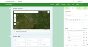
For my first app (chapters 1-4), I focused on chapter 4ās creating a survey using Survey123. I created a survey that would be used to find the most walked route on campus for the morning and afternoon hours. The answers from the survey would be compelled and the most common answers would be mapped to show the most common route from the earliest response time-12pm and then 12pm-the latest response time.Ā
https://survey123.arcgis.com/share/09361ba2dc554b61846fb93a5ce7a6a0Ā Ā
For my second app (chapters 5-8), I dialed in on chapter 7ās area of 3D scenes. In WebGISās living atlas, I found data on the U.S. Forest Service showing all the different forests from the National Forest System along with their regions. Using this, I created a 3D scene app that allows the viewer to see the different regions of forests by color, and the 3D aspect is that each forestsā shown heights are representative of the area they cover in acres. Along with this, the app also shows the forestās name over their polygon. Viewers are also able to click on each forest and read a pop-up window about the forest. This allows the viewer to analyze which region has larger forests, and if there is any particular forest they wish to look into more, they are able to get basic information about it.Ā
Katterhenrich Week 6
Chapter 7
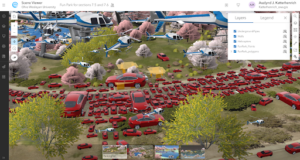
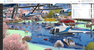
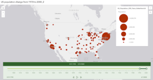
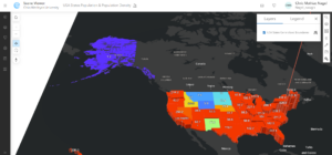
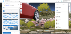
In this tutorial, I used a story map to explore scene viewers and different types of scene layers as well as a thematic scene map with a layer showing the USA population and population density. I like the 3D maps because it displays the data in an engaging and unique way. In the final couple of sections of this tutorial, I created a web scene of a park design using 3D symbols like cars, boats, planes, and trees. Using the elevation aspect was interesting because it allowed more variability in the placement of the features that were meant for the sky or underground. I was a little confused during this part because there were already symbols on the scene that I did not put there, but I later learned that the scene was public and there were symbols on there that other users had placed. I liked using the symbols in this tutorial so I think it would be cool to use this tool in my final project, it could be fun to recreate a scene somewhere in Delaware.Ā
Katterhenrich Week 5
Tutorial 6Ā
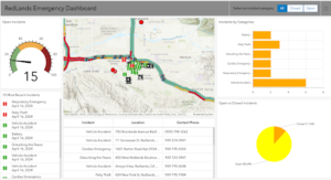
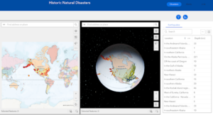
In this tutorial, I created another web map using real-time layers and made a dashboard based on this web map, I thought was cool because it displayed continuous data and even photos in real-time. In another section of this tutorial, I added a selector that allowed users to filter the dashboard so that it shows specific types of incidents based on any filters that were selected. I also was able to animate the time-series data in web maps and web apps. I found this part to be interesting because it displays the information and data in a way that is easily understood by users. I think I would like to utilize the real-time features from this tutorial in my final project, because of the engagement aspect of it.Ā
Katterhenrich Week 4
In the tutorial for chapter 3, I was able to create a 2D and 3D web experience using the Experience Builder in ArcGIS. The screenshot below shows the final webpage I created. The tutorial guided me through how to add many different widgets that all carried out different functions, it also showed me how to style these and edit actions and animations. I think it would be good to utilize the web experience builder tool from the chapter in my final project, I like how interactive it is.
In the tutorial for chapter 4, I used ArcOnline to design a survey and collected and viewed data using this survey. In another section of this tutorial, I learned how to create an editable feature layer with attributes and domains with attachments and templates, using this layer I was able to configure a web map. I also created an ArcGIS quick capture project using the layer I created previously and collected data.Ā This was not my favorite chapter but I can see how useful the survey might be if I decided I wanted to gather data myself for my final project.Ā
Hagans Week 6
This tutorial was very short and interesting. I was able to get most of the steps completed, but a few of my scenes turned out a little different than the ones in the book. I enjoyed learning how to symbolize the 3D objects in the park scene, and I liked how much variety of symbols ArcGIS provides. It was also interesting to learn how to display population density on a 3D map, although I think we did this a little in GEOG 291. A few of the buttons are labeled differently from what the book says to look for, so some of the tutorials took a little longer just to search for the right buttons. I also am beginning to realize how easy it is to manipulate and symbolize a scene to show very specific things. This chapter also went over ways to make 3D scenes realistic by adjusting the size or height at which the 3D symbols are placed in the scene. I think some of the scenes they have us practicing on may be a little crowded with cars and helicopters! Using techniques from this chapter, I think it would be a cool idea to use either the Delaware GIS data or another set of data I could find to symbolize a certain area in a 3D scene. For example, I could symbolize trees, benches, and other features of downtown Delaware, or another area with that available data.
Schtucka week 6
One of my favorite aspects of ArcGIS was the ability to make 3D map renditions, and so I am able to complete those from WebGIS as well! 3D maps in WebGIS, however, are referred to as either web scenes or 3D scenes. The book states some of its own examples of 3D scenes as giving a wider ability for story telling, helping with architectural ideas, urban planning, stimulations for defense, and creating films. I would also like to add to that list that 3D scenes allow for views to get a greater understanding. Sometimes, normal maps and scenes are hard to understand from their 2D view. Whatās even more interesting about 3D scenes is that they are able to add an āX-rayā feature to a scene, allowing the viewer to move in and out of the objects to see what is inside. Furthermore, 3D scenes also allow those looking at them to see how sunlight or other implements might impact an area that a 2D scene wouldnāt be able to do. This allows for a further analysis of the scene and its contents. 3D scenes are able to be broken down into two different types. The first type is a photorealistic scene. A photorealistic scene is supposed to look as close to real life as possible. They utilize photos and texture features to recreate it to the best of their abilities. Typically, they are best used to show visible objects (like a city). The second type is cartographic. These use a 2D mapping technique and transitions them into a 3D scene. A lot of the time, these use attribute-driven symbols: height, size, color, etc. They do this to display physical, abstract, or invisible features.
I am not exactly sure what I would make from this chapter. I think I would pick an already created map and turn it into a 3D scene or take a feature in the map and turn it 3D. This would create a cartographic scene as opposed to a photorealistic scene. I think it would be interesting to take a 2D map of campus and have a pop up window for one of the buildings that would be a 3D rendition of it and allow it to be x-rayed.Ā
Ā
Nagel Week 6
Chapter 7 was quite extensive in the intro but it did reintroduce 3D aspects, something which I found highly interesting during GEOG291 and is also one of my favorite aspects of GIS. There’s something about looking at it that sort of… tickles your brain? I’m not sure how else to say it. Anyways, Chapter 7 discusses the different types of 3D viewing such as extended reality (xr), virtual reality (vr), augmented reality (ar), and mixed reality (mr). I have had experience with AR and VR outside of class but that’s a different story. Chapter 7 also discusses different types of scene layers and how to create them, how to create web scenes in the scene viewer (which the tutorial goes into detail on) how to change 3D symbols in the scene viewer.
The tutorials themselves were a bit of a mixed bag. The chapter was a bit shorter than normal and went by quicker than others but it had its issues. Half the items were not where they were supposed to be and it took a significant amount of time to locate the items it wanted me to find. I’m not sure half of it was even correct as I had to guess whatĀ half of the selected items were. I also don’t think some of the 3D web scene icons worked correctly. For starters I don’t think Tesla’s are able to drive on water and I’m also fairly certain though I could be wrong that there is a bush reaching into the stratosphere in the mountains of California. I’m also fairly certain for 7.4 that there are no helicopters flying around which are bigger than the alien ships from ‘Independence Day’. My computer was also running extremely slow during this section which hasn’t happened before. 4.5 and 4.6 both went by relatively quickly albeit with the same problems of things being severely out of proportion. The slice feature was pretty interesting to play around with though.
As for an application idea, luckily this time I have a few more ideas. Given that I am an avid angler, I could theoretically create an app which shows a 3D layout of one of my favorite areas on the water back home in Cleveland.