Final:
- For the final project, I chose Chapter 5 which is based on Geoprocessing with Python
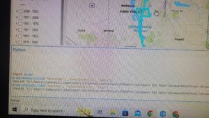
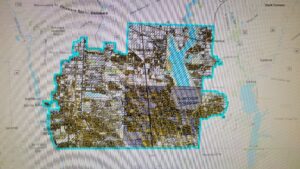
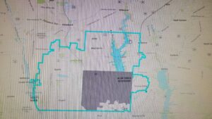
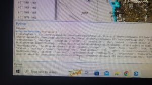
- Here, I used the dataset from my 191 Finals and hard-coded the “Clip – Analysis” tool for the Olentangy School District. I clipped all other (four) shapefiles to fit into this district, so only the data from this particular area could be seen
- I had no motives for doing so except to see how these data files intersect and if I can actually put into use whatever I’ve learned from the chapter.
- Having the dataset from 191 helped as I was just redoing the project in a much more elaborate way without using tools that were developed by some other programmer but by using my own code.
- Here are some of my pictures: (Forgot to take them while I actually did this so I had to re-do it, in order to get “proof” that I actually did it):
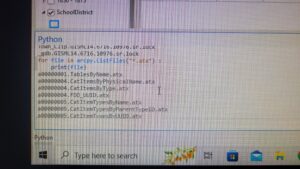
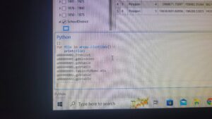
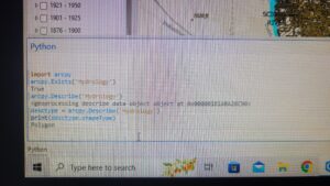
- For the second chapter I chose Chapter 6, I know you said they need to be between 1-4 and 5-8 but I found 5 and 6 the only ones to be actually application based.
- Chapter 6 is based on Exploring spatial data so I started by using functions like Exists, and Describe to get started.
- Exists returns true and false depending on if a dataset exists and describe, describes the data set of a file. A function shapeType can also be used with Describe the shape type of a dataset.
- I also played around with List_Fields() and List_Files.
Here are the pictures for that:
I enjoyed taking this class a lot! Overall, I didn’t have much trouble completing tasks except getting the Python Terminal set up. One piece of advice I would have would be for prospective students to take 191 before GIS 193. That class helped me a lot with understanding GIS concepts before I learn how to use Python to implement them.