For my final experience I made a webmap of notably bad intersections and interchanges in the greater Boston Area and put it in an experience. Then I made a survey123 form so people could choose which of those intersections was their least favorite which I also put in the experience. Finally I set up a list widget in the experience that would display the results of the survey according to how many times each intersection had been selected. In this way I combined application ideas from multiple chapters into a single GIS experience.
Author: mghuntington
Huntington Week 5
Chapter 7
3d web scenes! This was a super interesting chapter. I’ve already done some 3d GIS stuff both last year in 291 and also in Remote Sensing this year with Drone2Map. We also learned about the differences between digital elevation models, digital surface models, and digital terrain models in Remote Sensing. The use of feature layers to create 3d objects is a weird way of going about 3d modelling and placement but I suppose this isn’t meant to be an animation software. The different scene types are very interesting. The different use cases for integrated meshes vs point clouds etc. are very interesting.
App Idea
3d web scene of my home neighborhood in Newton MA. Nobody from around here has ever been to my home area so it could be fun to show people.
Huntington Week 4
Chapter 6
The week 6 chapter and tutorial taught me about spatiotemporal data, and with that it exposed just how horrifyingly easy it is to get live access data from things like traffic/security cameras. I knew intellectually what the “Internet of Things” is but seeing the all the ways it can be put to use with just an hour or so of work is quite frankly terrifying. GIS dashboards are insanely useful for end-user data displays and they seem like a lot of fun to make stuff with.
Application Idea:
An app that tracks your real time progress along a selected route and compares it to previously recorded times like ghost racing in Mario kart.
Huntington Week 3
Chapter 3
The flexibility and customizability of the experience builder is pretty amazing. Once again the relative simplicity of webGIS is a breath of fresh air. UI design is intuitive and the widget combination process is easy to understand and iterate upon. I can’t see myself using this too much because I don’t plan on making super complicated interactive stuff but it certainly useful to know how to do.
Chapter 4
AHHHH I hate mobile stuff. This whole “post-pc world” thing is absurd. One day sure, but phones just aren’t there yet. They’re finnicky and slow too dumbed down to be useful. I suppose learning this stuff is important for the future but for now its just irritating. All that being said, mobile data collection is fascinating, and the addition of AR and VR support to webGIS is pretty exciting.
Project Idea
Just based on the suggestions for survey123 applications at the end of the tutorial I think it would be really funny to make a crime reporting app and call it something like “brother eye” or “big brother” to really hammer home the 1984 vibes. Honestly I just don’t like working with phones so I don’t find any of these ideas interesting.
Huntington Week 2
Chapter 1
Most of this is just going over stuff we learned last week with the introduction, I don’t really have a lot to add here. The simplicity of the web app over the desktop app (GIS pro) is a welcome change, and the utility of creating web apps directly in the application is quite useful for setting up website data. I also really like the ability to share and work on maps as a group which makes collaboration much easier.
Chapter 2
Smart mapping is actually awesome, I have seen webGIS story maps used in things like New York Times articles and learning how to make them could be really fun. The level of customization with each type of web app is breathtaking, and on the other side I really appreciate the auto-filled suggestions for things like UI design to be super helpful given how overwhelming the customization can be.
Applications
A pop-up map of my favorite places to visit in my hometown would be a fun (if simple) project to make. Given how most of the people at this school are from the Midwest a map detailing some of the best places to visit in Boston could be a fun way to show off my area. It could also provide information about the easiest routes to reach the selected location via public transit or the addresses of nearby public parking lots.
Huntington Week 1
Hi I’m Max, sorry I took so long to actually start doing the homework. I’m a junior environmental science and geography major. I’m from Newton Massachusetts and I love maps. I really like making maps, I really enjoyed the 291 class and I am currently enjoying remote sensing. Other than maps I like playing videogames, reading fiction, and fighting. I run the Medieval Combat Club here at OWU and if you ever want to try sword fighting you should come check it out Tuesdays and Saturdays at 430pm.
Getting Started Article Notes:
- I didn’t know webGIS could do collaborative work. I think it would be super fun to work on one big map with a few other people at once.
- I like how much more simple and straightforward a lot of the UI design is for webGIS is. Arc is fun but it can get kind of annoying trying to find all the hidden functions.

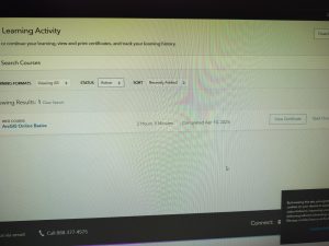
Proof of completion
Interesting web courses:
ArcGIS Pro: Essential Workflows
The Systems Approach to ArcGIS: An Introduction
https://www.arcgis.com/apps/View/index.html?appid=e59532bdfb334b1da691f74e7e879685
Here’s a cool map of all recent volcanic and tectonic activity
ESRI also has a Roads and Highways tool that lets you plan routes check traffic conditions etc.