Asp – Week 4

Chapter 5 talks about the advantages of hybrid and on-premises Web GIS deployments as alternatives instead of using fully arranged ArcGIS online. On-premises deployments allow companies and organizations to keep control of their setup which is very useful when valuable data must stay secure or when reliable interest access is not a guarantee. Hybrid deployments take the flexibility of cloud services with the security of on-site setup which offers the best of both options. ArcGIS enterprise can be accessed on local servers or cloud platforms like AWS or Microsoft Azure and also includes portal, server, web adapters and the data store to manage the take care of GIS content. 

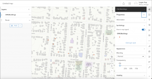
A very important benefit of on-premises GIS is the ability to have special datasets like feature layers, complex geoprocessing services and imagery services. Departments within a company can talk together in groups and share content which helps improve efficient workflow while also keep the data secure. Catching tile layers is another critical aspect of improving performance  that is discuessed in this chapter. 

Chapter 6 talks about the use of spatiotemporal data in GIS which includes both time and location dimensions to track patterns and changes. Some examples are weather events, disease outbreaks, urban growth and traffic congestion. The internet of things plays a pretty important role in spatiotemporal GIS by providing networks of sensors and connected devices that are constantly collecting data. Collecting this data allows companies, organizations, reseachers and cities to track conditions as they happen and respond quickly to certain events. 

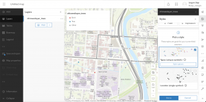
The ArcGIS GeoEvent Server is a very important and crucial tool for getting and processing spatiotemporal data. It can analyze, filter and distribute live data to maps, feature layers and dashboards while also getting historical data for future analysis. ArcGIS online has dashboards and layers that enable people to visiualize trends over space and time, monitor complicated operations and animate temporal patterns. Having these tools are valuable for decision making in public health, emergency management, transportation planning and many other fields in the world.  

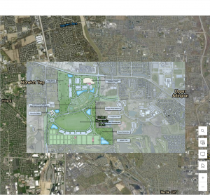
An application idea I could make using concepts from chapter 5 and 6 is a city wide environmental monitoring dashboard. 

Asp – Week 3

Chapter 3

Chapter 3 focused on ArcGIS Experience builder which allows us all to create a highly customizable web app using the data on GIS. Unlike Web AppBuilder, experience builder allows us to have full control over layout, interactivity and design which lets us combine widgets, maps and text in multiple ways. The chapter talked about responsive design so that apps look good on desktop, mobile and other electronic devices. Some widgets include maps, lists, search tools and charts. You can also connect data sources, create interactive dashboards and apply filters. The chapter also talks us through building simple experiences and also highlights the importance of user experience which is also called UX design and helps with creating effective GIS apps. One useful piece of advice is that experience builder allows us to design conditional visibility for actions and widgets which is similar to how field maps control what fields are being displayed.

Chapter 4

Chapter 4 explores mobile data collection tools in ArcGIS. Survey123 allows us to create smart forms that guide users through surveys with photo attachments, location capture and conditional logic. Field maps is a helpful app for collecting lines, polygons and points in the field including related records and offline collection. QuickCapture helps simplify rapid data collection with large buttons, photo capture and automated location which is ideal for surveys and field inspections. AuGeo is a reality app that visualizes points of interest in real space and offers a unique way to explore data. The chapter mainly talks about conditional visibility, attachments and user input configuration across all these apps. 

Application idea

An application idea I have which was inspired by both of the chapters I read was to create a campus trails and parks map showing all the parks and trails near/around Ohio Wesleyan’s campus. This would allow people to explore nearby parks, walking trails and the campus buildings.

Asp – Week 2

Chapter 1

Chapter 1 introduced me to the fundamentals of ArcGIS Online and how Web GIS allows data, maps and applications to be shared and accessed by anyone around the world. I was able to learn how to create a feature layer from a CSV file, add attachments and even build a web app using the Attachment Viewer template. Web GIS is powerful because it makes mapping both interactive and collaborative with advantages like easy access, cross-platform compatibility and low maintenance. I also learned about the key components of a web map that are basemaps, operational layers and tools which work together and makes information functional, clear and visually appealing.

Chapter 2

Chapter 2 was all about smart mapping and storytelling. I learned how to publish feature layers using geocoding, style them using smart mapping and enhance pop-ups with arcade expressions, charts, and images. This chapter also talked about ArcGIS StoryMaps which can combine maps, text and multimedia for telling spatial stories. The use of sidecar and swipe blocks allows users to explore relationships and change over time making data easier to understand. I liked how smart mapping can reveal patterns like population changes or housing trends without needing to analyze each data point manually.


Application Idea

One potential application I could do is a StoryMap that would showcase how Hilliard, Ohio, which is where I am from has grown over the years by showing new housing areas, schools and parks. This would include photos of local parks and pop-ups with graphs showing population growth. I could also do a section on Ohio Wesleyan University where I can map out key campus buildings and green spaces while using a swipe block to compare how the layout of campus has changed over time. This would help in visualizing community development and environmental balance here in Central and Delaware Ohio.

Asp – Week 1

Hi my name is Logan Asp and I am a freshman here at OWU. My current major right now is Data analytics and for this weeks post, I took the quiz for Geog 292, read the syllabus and schedule and also scheuled a meeting with Dr. Krygier. 

ArcGIS can help us map 2D and 3D data spatially. It is also a cloud-based platform that can create apps, web maps and can share geographic information with other people.

I completed the ArcGIS online basics course. Throughout the course the 2 things I learned were the layers that are drawn on top of the basemap are called operational layers and a tile layer is a collection of prerendered images or quick-to-render vectors that can be rapidly.

Under the training section, two other courses that interested me were manage an ArcGIS Online Organizaton and Field Data Collection and Management Using ArcGIS.

Two Applications I found using Google Scholar were:

  1. Using ArcGIS geostatistical analyst
  2. Spatial statistics in ArcGIS