Datta – Week 4

CHAPTER 5: ArcGIS Enterprise

  • Used for more private (but still shareable) instances of WebGIS
  • Uses User-managed infrastructure, such as user-managed hosting
  • Allows for geoprocessing, which is not offered in public GIS.
  • Combines the ArcGIS portal and server to work.
  • To run an ArcGIS enterprise server:
    • Server must either be licensed as GIS server standard
    • ArcGIS portal must be connected to the GIS server
    • Data Store should be configured as a relational database and a tile cache
    • Web Adaptor must be installed in one instance of ArcGIS enterprise
  • There are various tile layers which are pretty self explanatory from the title, Raster Tile, Vector Tile, Feature Tile
  • ArcGIS data will either be referenced or copied.


APPLICATION: This is obviously very useful for enterprises, but I remember Krygier mentioning that ArcGIS can be used for fictional cartography, so my immediate thought was to use something like this for a DnD game, weirdly?


CHAPTER 6: Real Time GIS

  • Real Time GIS is used to handle that which moves change or appear continuously and would need constant updating
  • ArcGIS Velocity, ArcGIS mission
  • Space-time data can be separated into several categories
    • Moving data (things that are actively moving as data is projected)
    • Discrete (events that happen and need to be reported instantly)
    • Stationary (stays still, value changes)
    • Change (i assume you know what change is)
  • Time is usually measured in start point and duration time
  • IOT: network of objects used to survey data
  • Smart City: A city which can monitor in real time resources and data and help manage the city effectively
  • Real time GIS (Geoevent and Velocity) digests data, processes it, and presents the data in real time, unlike other systems which require manual input
  • Two ways to do real time: Poll and Push
    • Poll asks the server for new data once in a certain amount of time, usually 30 seconds
    • Push pushes data from stream services to a web client (automating the manual input?)
  • Dashboards can be used to quickly present real time data to people who need it
  • Mission is like a Real-Time GIS mixed with what I think is a task manager and messageboard?


APPLICATION: Something like mission, but for students? Make a university map (internal and external if possible??) and allow them to input assignments they have to do and the rooms they have to turn it into. Would be most helpful for freshmen in the labyrinth that is SCSC in my opinion.

Datta – Week 3

CHAPTER 3: ArcGIS Experience Builder

  • Allows you to customize your GIS experience
  • Mobile Focussed, 2D and 3D
  • Creates HTML and Java apps without programming
  • Templates, Widgets, and themes all available to make it even easier
  • Easy to share and upload onto the web
  • Widgets are the same sort of website widgets you’d expect
  • Unique to ArcGIS’ experience builder is the ability to port ArcGIS Online or portals to ArcGIS online within the website innately
  • You can also code your own widgets if you know HTML

CHAPTER 4: MOBILE GIS

  • Mobile GIS has the added benefit of portability location awareness, as well as real time information and data collection ease
  • Mobile tends to have less bandwidth and RAM space so more complicated GIS projects can’t be ported
  • You can make feature layers viewable and editable by multiple different people, which allows data integrity while also keeping the feature available for editing
  • Can be made in browsers or in native applications or both at once
  • ArcGIS Fieldmaps combines various different ArcGIS products and allows for a team to use GIS for field work of any kind
  • Fieldmaps can collect user data, can allow people to download maps for offline use, etc
  • Can track mobile users in real time
  • ArcGIS Survey123 is a survey product, presumably connected to location for GIS usage
  • ArcGIS Indoors mobile allows you to map the inside of buildings like any other GIS map
  • ArcGIS Companion is a generic app for ArcGIS
  • LBS – service on mobile which considers the device’s geographic location
  • VGI is spatial data collected by citizens as opposed to professionals
  • VR is a simulated 3D map in space


APPLICATION:

  • Using the Experience Builder and Mobile GIS could make something similar to websites/apps like Inaturalist or Merlin Bird ID where users submit data which can be mapped spatially by scientists. I think both would be necessary for this.

Datta – Week 2

CHAPTER 1- The Absolute Basics, And a Brief History

  • WebGIS is cheaper and more user friendly than typical GIS
  • Can be used for all sorts of applications- even daily life.
  • ArcGIS is hosted by amazon (booo. Insert thumbs down here.)
  • COVID had a major boom on ArcGIS usage (and cloud usage in general)
  • The John Hopkins COVID-19 tracker was an ArcGIS project
  • Hosted vs Nonhosted:
    • Hosted data is data stored in the cloud database
    • Nonhosted is data which is stored locally


CHAPTER 2 – Basic info on layers and Pop-ups (and some other stuff)

  • Types of Hosted Layers:
    • Feature Layers
    • Web Feature service layers
    • Tile Layers
    • Vector Tile
    • Vector tile service
    • Scene
    • Image
    • Map Image
  • There are quite a few ways you can style your map, all which best convey different information
  • Pop ups are a way to display further information
  • Arcade allows you to post more info that isnt in an attribute field
  • Living Atlas is a database of datasets which are usable by anyone with an ArcGIS account
  • WebGIS stories is fast and easy to use and make


TUTORIAL:

I did the 2nd Tutorial which goes over how to present population change patterns and such on a story map.

Datta – Week 1

Hello! I am Kheya Datta and I have a Biology major with a minor in ENVS. I did the Syllabus Quiz and already have a GIS account from last semester. I signed up for the meetings.


ArcGIS allows us to map 2D and 3D overlayed with various features, such as infrastructural plans, scientific data, etc. The online variety allows us to share and collaborate on projects without the hassle of emailing files to each other and for better public maps in the form of webapps.


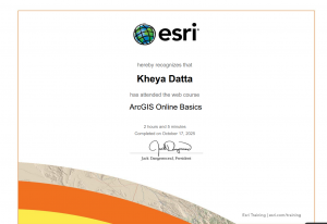
I completed the Online Basics course


2 applications I’ve found:
– I don’t believe it’s actually public but DelCo Water (my internship place) uses webGIS to map quite a bit of stuff, such as influent points for where they take in water for the reservoirs to inevitably be processed into drinking water

– NOAA also does some mapping of harmful algal blooms, especially in the great lakes region. This is useful if you study algae but also I don’t think the average tourist wants to swim in water that’ll give them cancer (https://coastalscience.noaa.gov/science-areas/habs/hab-monitoring-system/cyanobacteria-algal-bloom-from-satellite-in-western-lake-erie-basin/)