
Author: jbkrygier
Krygier – Week 6 – Chapter 7

The last of the chapters for this course! This one is pretty easy.
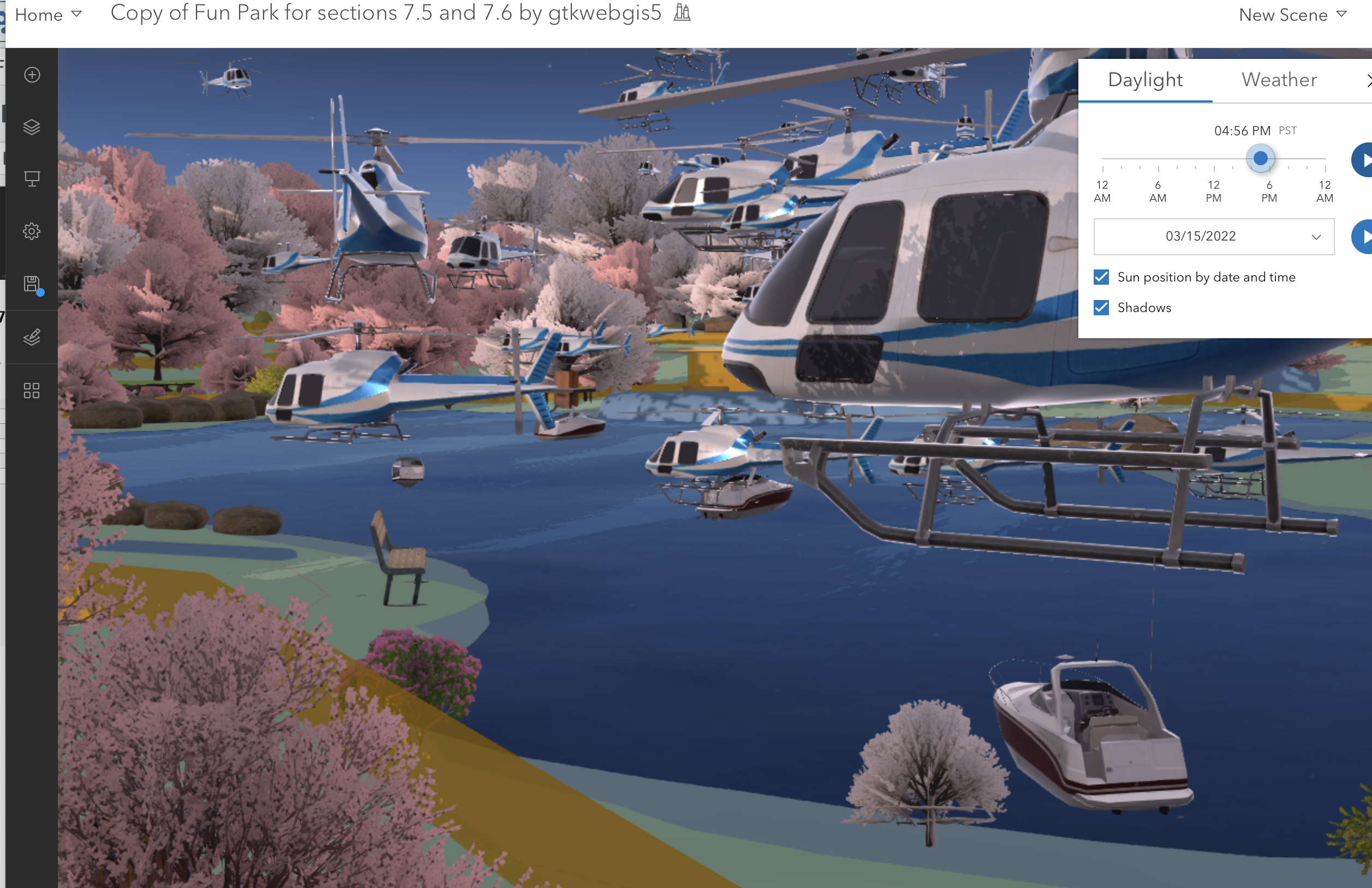
Chapter 7: 3D Web Scenes
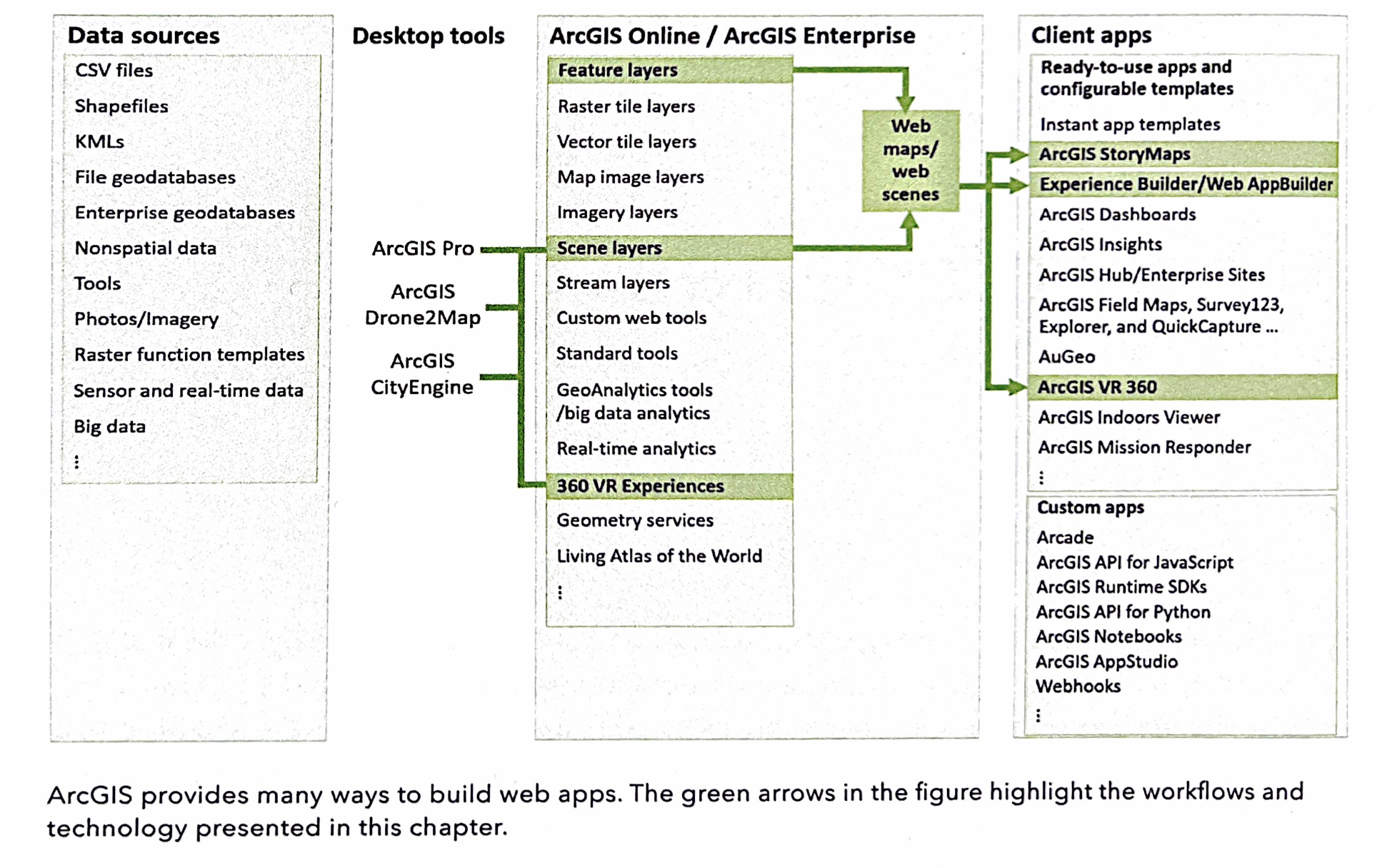
Basics of 3D GIS
• photorealistic and cartographic
Main elements of scenes
• surfaces: continuous; elevation usually
• features: on, above, or below the surface: stuff
• texture: symbolization
• atmospheric: lighting, fog
Web Scenes and Web Scene Layers
3D across ArcGIS
Creating Web Scenes
VR, XR, and the Metaverse
Indoor 3D GIS
3D Mapping + Urban Planning & BIM (Building Information Management)
Tutorial 7
7.1: Explore
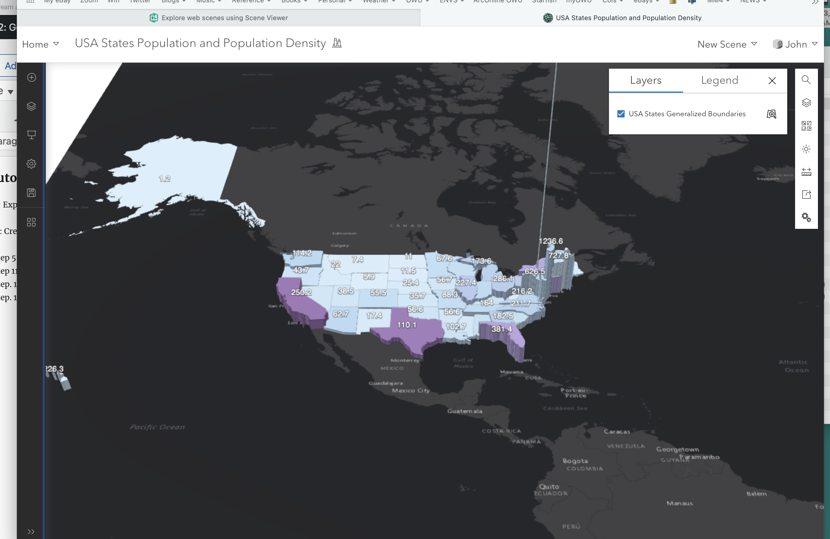
7.2: Create a Thematic Web Scene
• step 5, p. 247: choose Browse, then My Content, then Living Atlas
• step 11, p. 248: not reverse but “flip” color ramp
• step. 11, p. 248: select population density (not pop per sq mile)
• step. 12, p. 249: select population density (not pop per sq mile)
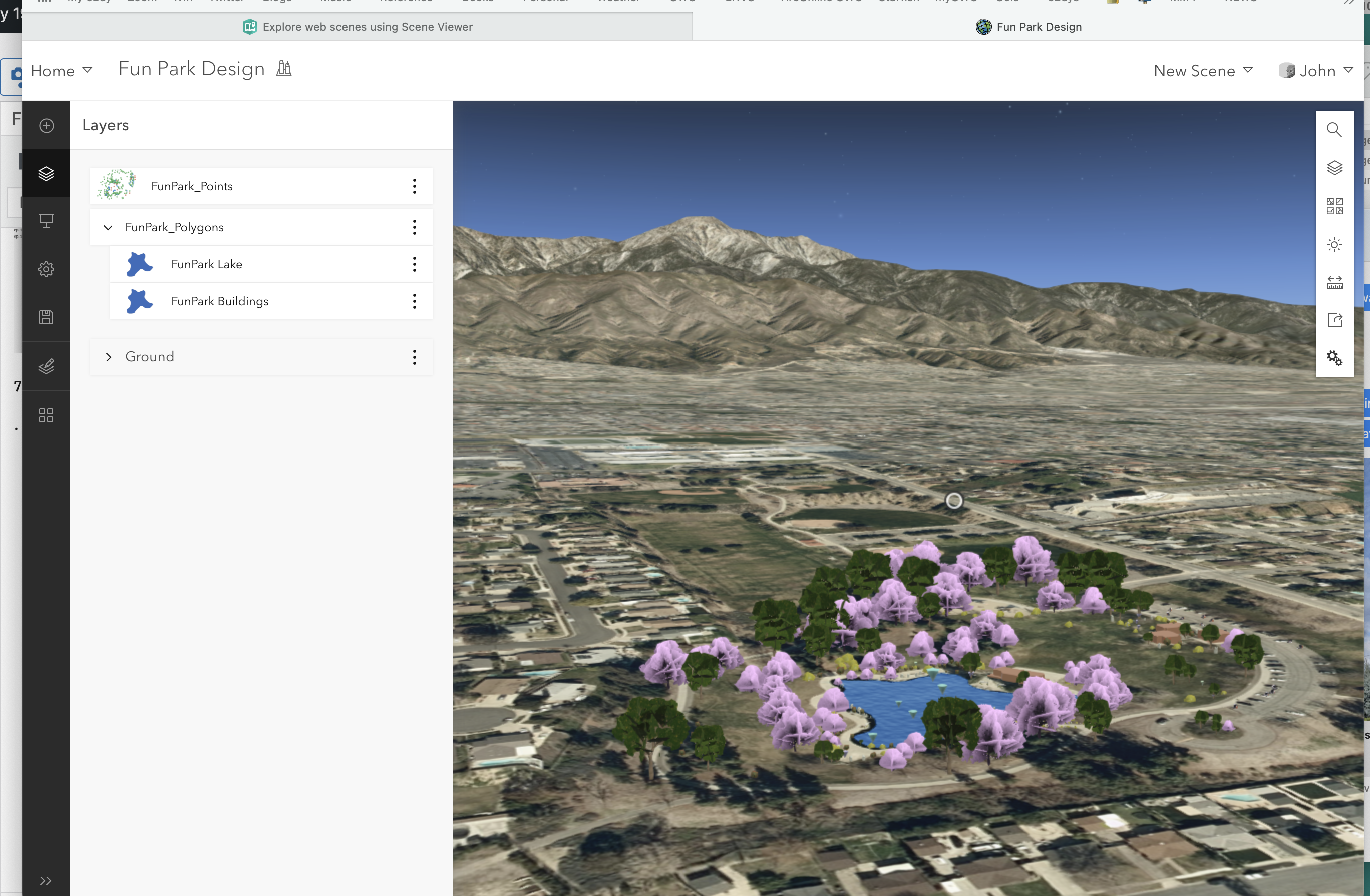
7.3. Create a Web Scene using Feature Layers and 3D object symbols
• step 4, p. 251: hit the + symbol (upper left) then Browse Layers then ArcGIS Online then search.
(do this for the rest of the chapter when you add layers)
7.4. Configure Elevation
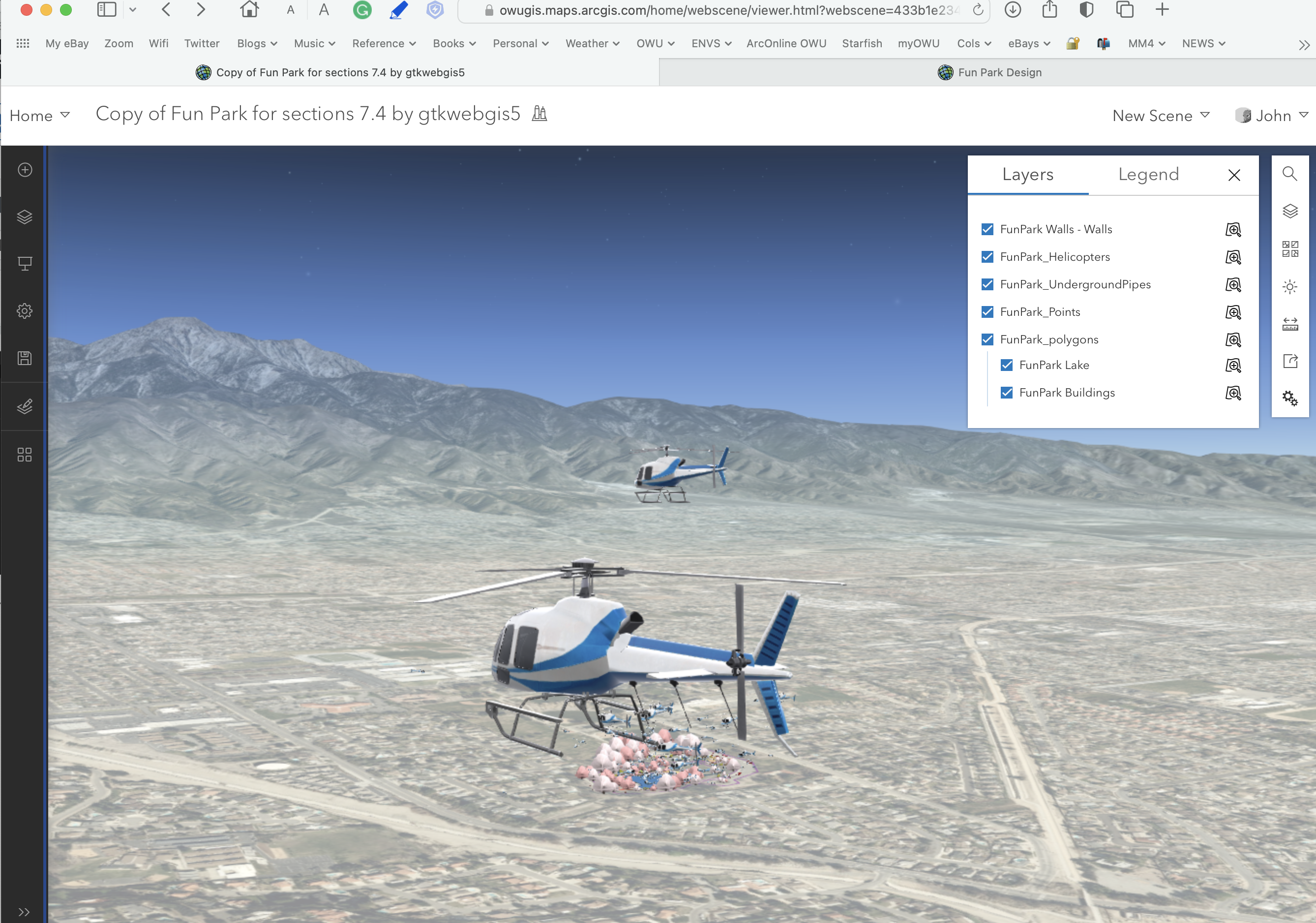
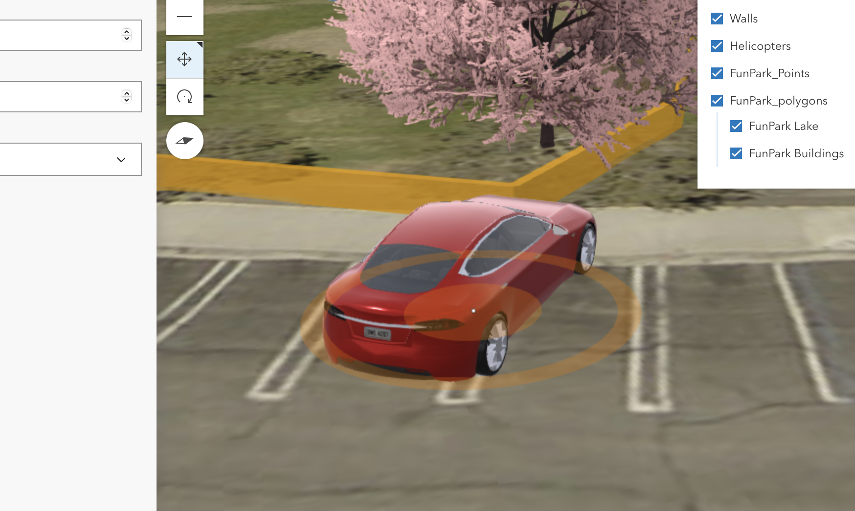
7.5 Edit Feature Data
• shitty tesla parking
and the last step.
Krygier – Week 5 – Chapter 6 (skip 5!)

Thus we begin another fine chapter of GTKWGIS. As noted, skip Chapter 5 and just do Chapter 6.
Chapter 6: Spatiotemporal Data and Real-Time GIS
Spatiotemporal data, IoT, Real-Time GIS
• Details and definitions of spatiotemporal data
• Internet of Things
• Smart city / Smart homes
Cloud, Server, and Client Tech for Real-time GIS
• high demand for fast computing of large amounts of data
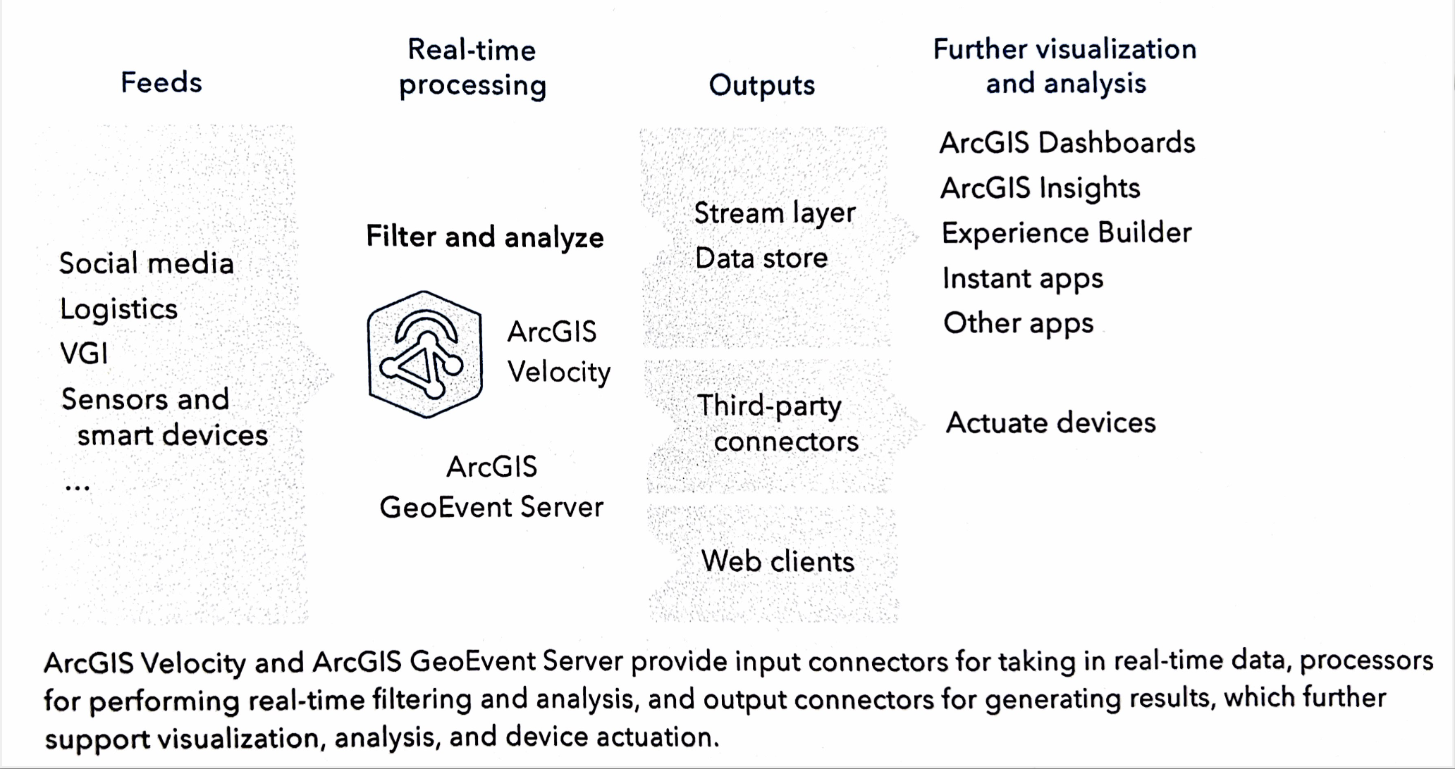
ArcGIS Velocity and ArcGIS GeoEvent Server
• ingest
• process
• output
ArcGIS Velocity
• runs via ArcGIS Online
• components
• feed items (inputs)
• real-time analytic items (alerts, actions)
• big data analytic items (access to large existing data sets)
Deliver Real-Time data from Servers to Clients
• poll (say, data grab every 30 seconds) and push (data serving)
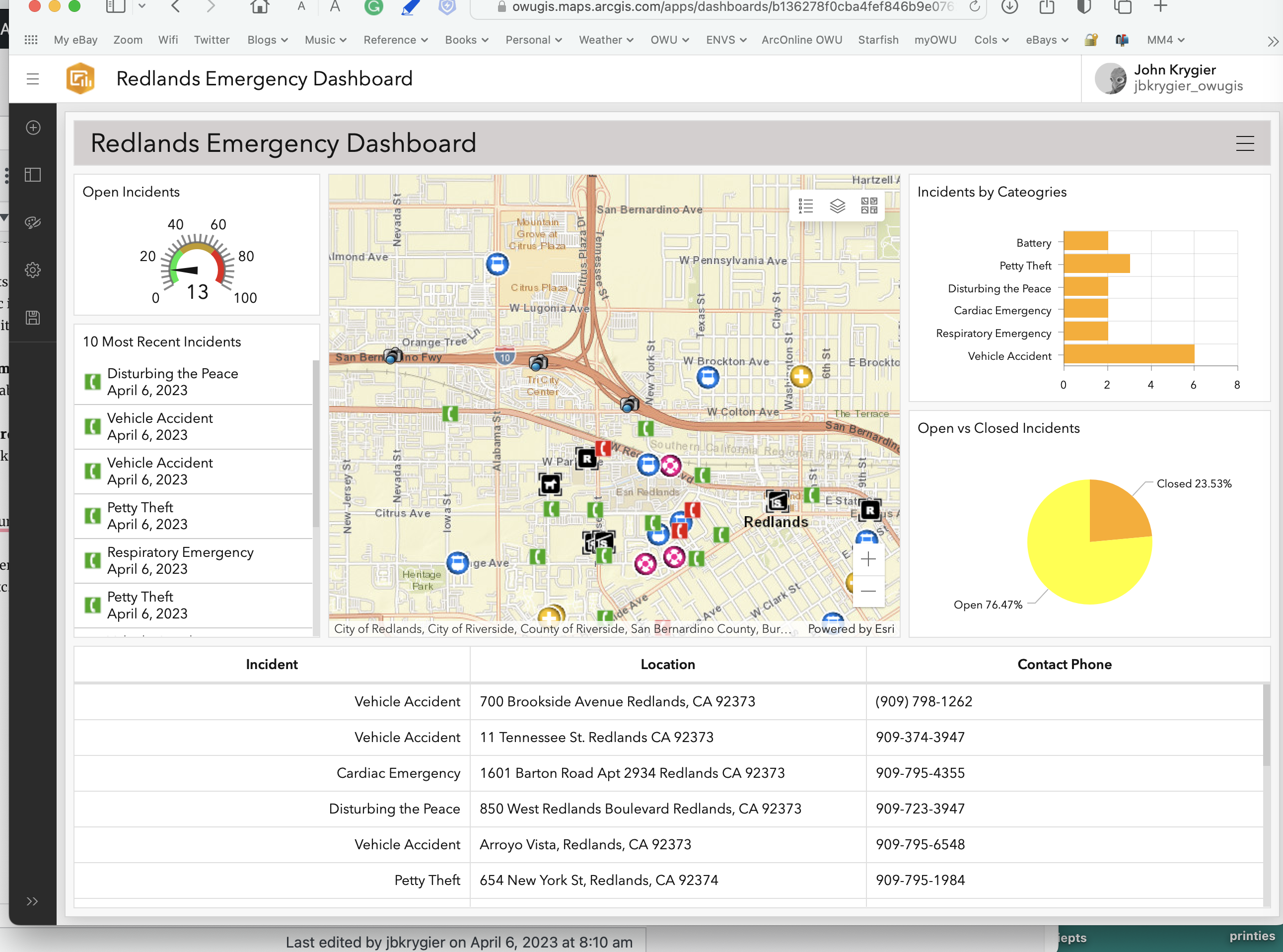
ArcGIS Dashboards
• monitor and track
ArcGIS Mission
• real-time communication and situational awareness SW
Animating time-series data
• animation and etc.
Tutorial 6
6.1, 6.2 Completed: easy with no major glitches in the tutorial!
6.3 Completed
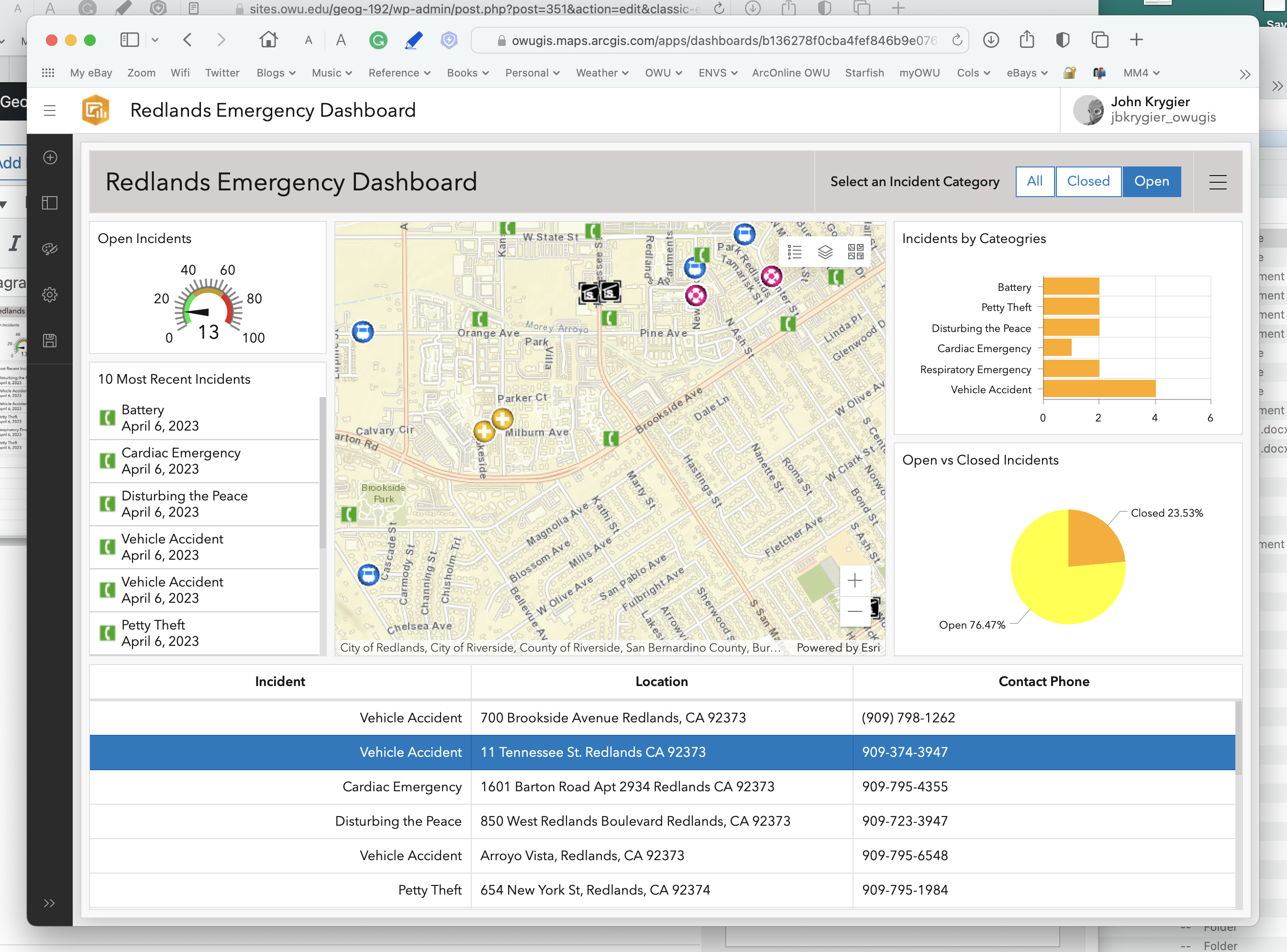
6.4 Configure advanced formatting using Arcade
• ok: hit the wall with step 3. The highlighted code, as typed in (on my mac) is not working. Sometimes there are issues with the characters (there are, for example, different kinds of parenthesis). But I used the auto-complete in the coding and it still gives me an error. give this a try and if it doesn’t work skip to the next section. The only thing I can think of is to try on a PC (which I’ll do later).
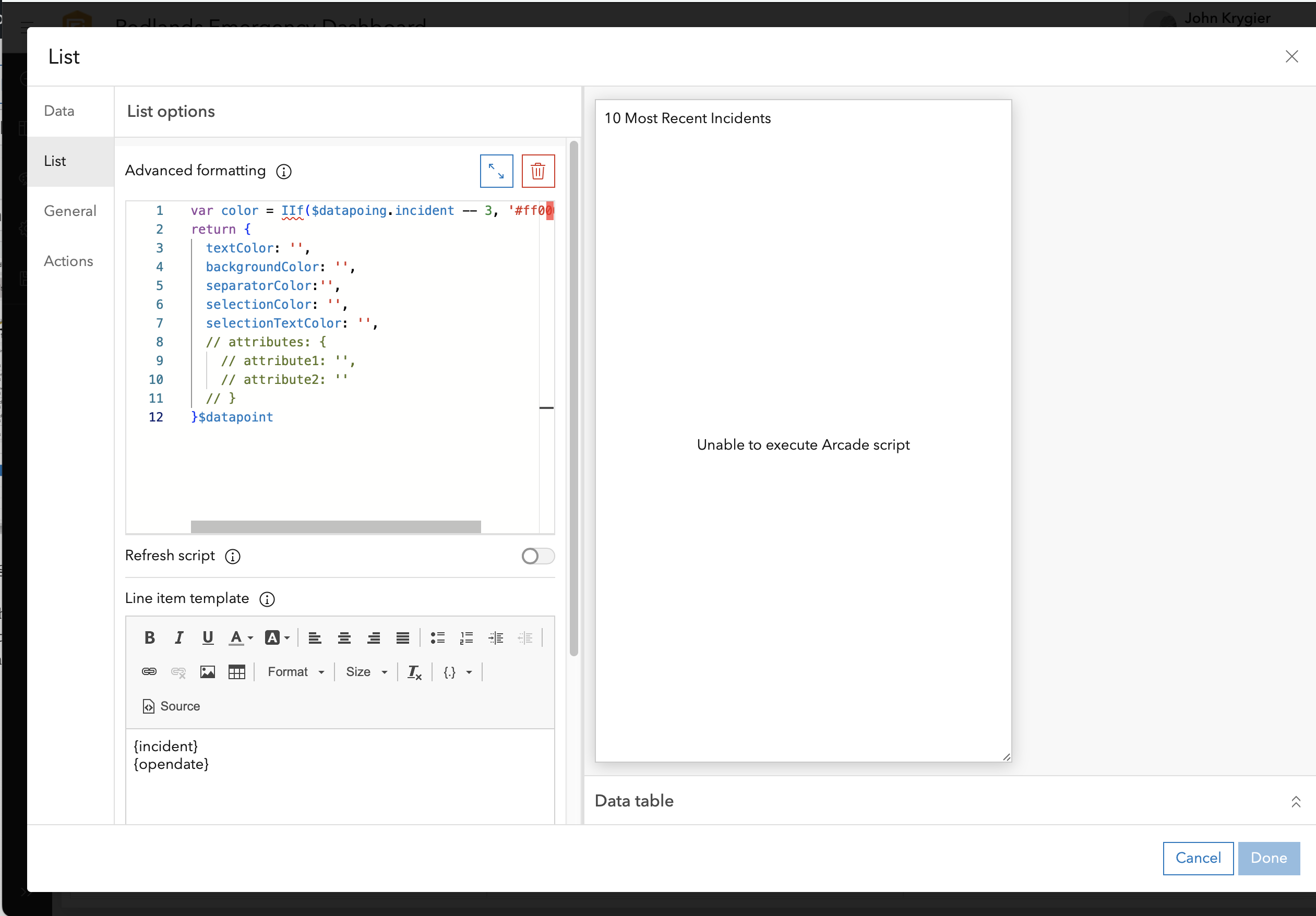
6.6 Animate Time Series Data
Krygier – Week 4

Ah, two more delightful chapters in Getting to Know Web GIS.
Chapter 3: ArcGIS Experience Builder
Note the increasing functionality (increasing options, complexity, time it takes) as we move from StoryMaps to Instant Apps to Experience Builder (this chapter).
Basics
Using Experience Builder to Create Web Experiences
“Web experiences” (mleh)
Workflow
• Premade template or from scratch
• Theme
• Source data
• Add and configure widgets
• Refine layouts
• Save, preview, publish, share
Basic components
• at least one page, pages and windows are building blocks
• widgets added to pages and windows
• one theme per WE and each page can have a template
• pages have headers footers and body (this is like HTML)
• menu widget can be added to alow navigation between different pages
• windows only have body content
• each page or window has an outline view, showing all widgets
Widgets
• JavaScript and HTML components with specific functions
• basic widgets: app tools. Map, legend, layers, query, filter, edit, chart…
• layout widgets: containers helping to organize widgets. Section, row, column
Settings for Widgets:
• content (data sources, links, etc,);
• style (size, position, color, etc.);
• actions
• message: listens to tiggers and automatically does something
• triggers
• targets
• actions
• data actions: click and do something (export data)
Editions of Experience Builder (EB)
Tutorial 3
• pg. 86: after you add the “Views Navigation” widget, make sure it is not blocked by the white top of the image. It said “please add a section to use this widget”. I dragged the image down and the navigation widget worked
• pg. 89: Preview button is at top, near left, a right pointing triangle in a circle.
• pg. 92: If the Dynamic Content Pane menu is not showing up, move the text block a bit to the right and down.
• pg. 102: for step 9: you have to include the HTTPS: https://bit.ly/3pGylar
• pg. 103: for step 17 “Regular tab” seems now to be “Default”
Well, here it is. The end of chapter 3
Chapter 4: Mobile GIS
Moblie GIS: Concepts & Advantages
• mobility (devices)
• locational awareness
• ease of data collection
• near real-time information
• large volume of users
• versatile communication options
Requires mobile devices, OS, wireless communication, positioning tech
Feature Layer Issues
• need to make feature layers open to editing, adding, removing data, attachments
• editor tracking
• full access to a subset of editors; fewer access options to public
• Feature Template: what can be done to a feature layer (data integrity & ease of editing)
Mobile App Development Strategies
• browser-based
• native-based: via an app on a phone, tablet
• hybrid:
API: Application Programming Interface
ArcGIS native apps
• suite of native apps provided by ESRI
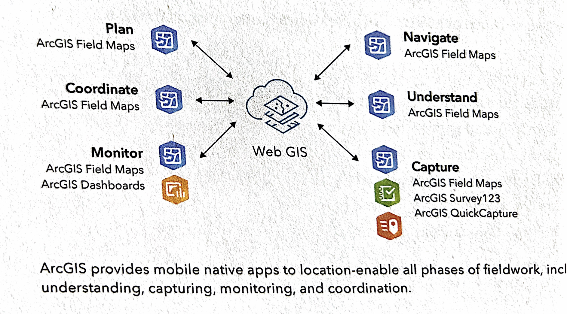
ArcGIS Field Maps
• Fieldwork, project owner, dispatchers, mobile workers
• map-centric data capture
ArcGIS Survey123
• ArcGIS QuickCapture:
• ArcGIS Indoors
• ArcGIS AppStudio
Other stuff
• LBS, VGI, VR, AR
Tutorial 4
4.1: Design a survey for ArcGIS Survey123
 |
https://arcg.is/0nWrHe0 |
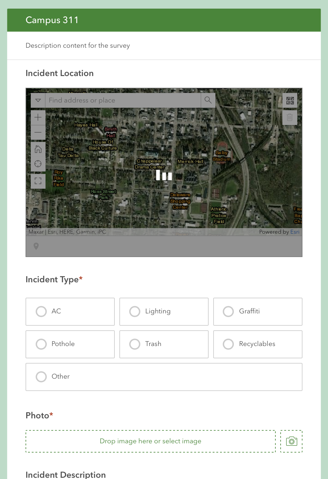 The survey.
4.2 Survey123 to collect & review data
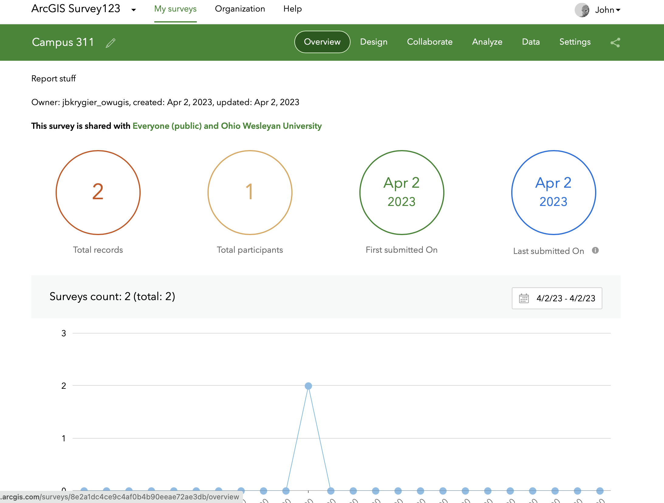
The survey after I added two incidents via my phone using Survey 123
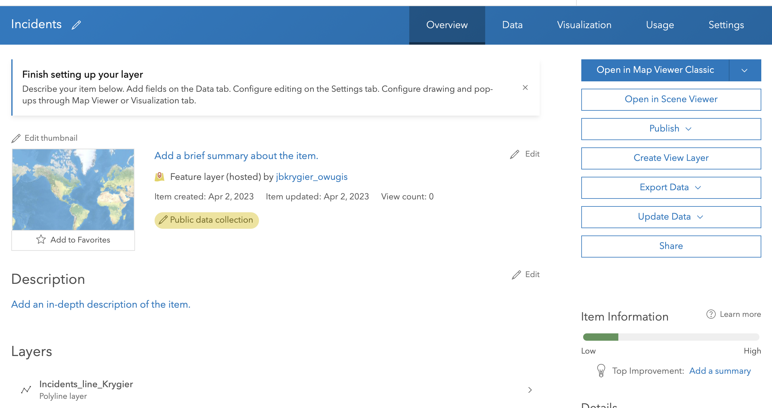
4.3. Create an Editable Feature Layer with Domains
Step 4: it’s not Blank Layer but instead Define your own layer
Step 13: “Typed text style” should (I think) be Incident Type
Step 17: Change style icon is the tiny icon with the triangle/circle/square under the layer name
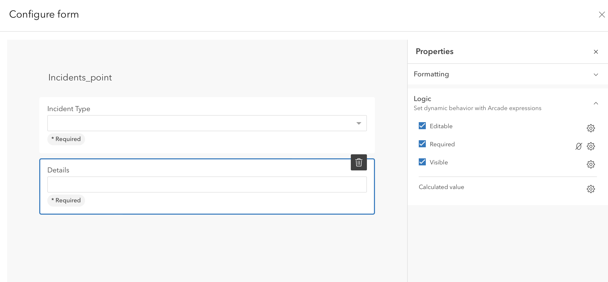
4.4 Configure a web map and a form with conditional visibility
Step 2: no Community Map base map. Choose a different one.
Got stuck at step 13 (see below). It’s possible the “Conditional Visibility” option (which is not there) has been moved to the Logic tab, where you use Arcade to create the expression. Saved and shared. Skipping to next section for now.
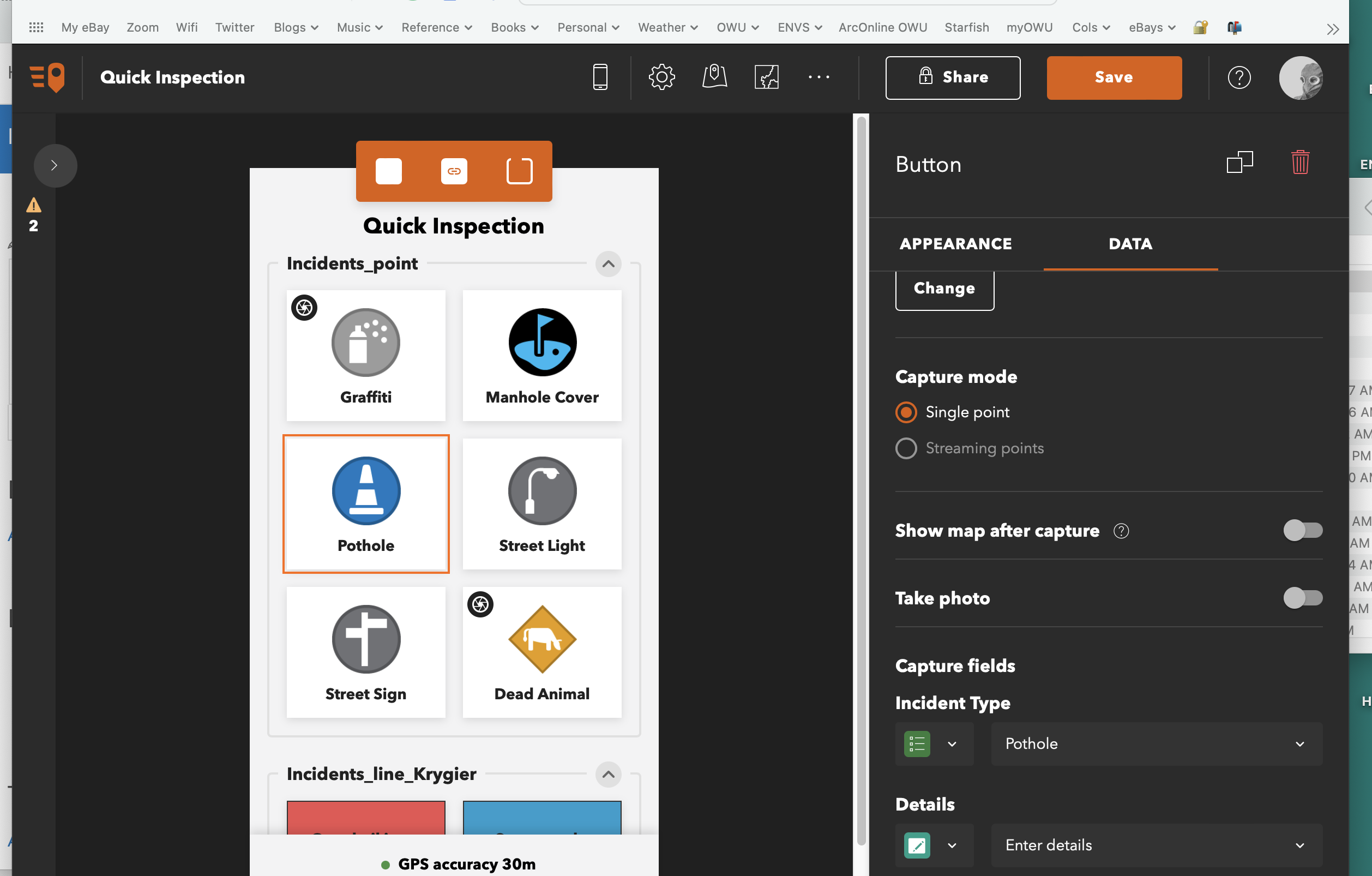
4.5 Collect data using the ArcGIS Field maps mobile app
Just collecting data with FieldMaps app from phone
4.6 Create an ArcGIS QuickCapture Project
Step 7: the App Launcher is the 9 tiny boxes icon upper right corner. Quick Capture is under this menu.
4.7 Collect Data using QuickCapture
Just collecting data with Quickcapture app from phone
4.8. Prepare data for use with AuGeo
Some puttering with augmented reality
Krygier Week 3
 We had an unfortunate incident with a house guest this weekend. A memeaplogy.
Preface: I didn’t assign this but it’s always good to glance at it.
• stuff about updates to this new edition
• lots of jargon. yeesh.
• the tutorial stuff: go.esri.com/gtkwebgis5
How to Use This Book
• I have, I hope, set up all of your ArcGIS Online accounts for Publisher-level access. You should be able to see that in the information about your account. Also, make absolutely sure you are using your OWUGIS ArcOnline account and not a free account.
• We have full blown access to ArcGIS Onliine so don’t bother with the evaluation or trial versions.
• Downloading the exercise data: URL above; there is lots of stuff, click on Full Book Exercise Data on the left side of the screen.
• it plopped on my Mac Desktop as GTKWebGIS folder, with chapter folders inside. Yay.
Chapter 1: Get started with Web GIS
- workflows: ESRI uses this term ALOT
- I’ll just let you know that I created a crowdsourcing (the public could add data to an online ESRI map) back in 1998 and is summarized (with missing links – it’s so old) as Public Participation Visualization: Conceptual and Applied Research Issues. You all were probably not even born then,
- “Science of Where” – corporate jargon – but lots of interesting applications for sure
- ArcGIS Online (SaaS) vs. ArcGIS Enterprise (I don’t think we have access to the latter, or at least we are not running it)
- emergence of GIS web servers (that’s the research I did in the late 1990s!) I’m old!
- one to two way information flow: that’s me too, back in the olden days
- portal technology: fancy way of getting access to tons of data
- cloud GIS: like custom built mini-GIS software that runs on a broswer (rather than using all of ArcGIS Pro)
- mobile: field work, in vehicles, etc.
- visualization (more of my background; shifting from just viewing data to the idea that you can interact with and think and understand and learn new stuff; tools to do this; 3D, virtual reality, modeling)
- static vs. real time data
- AI and web GIS: scary
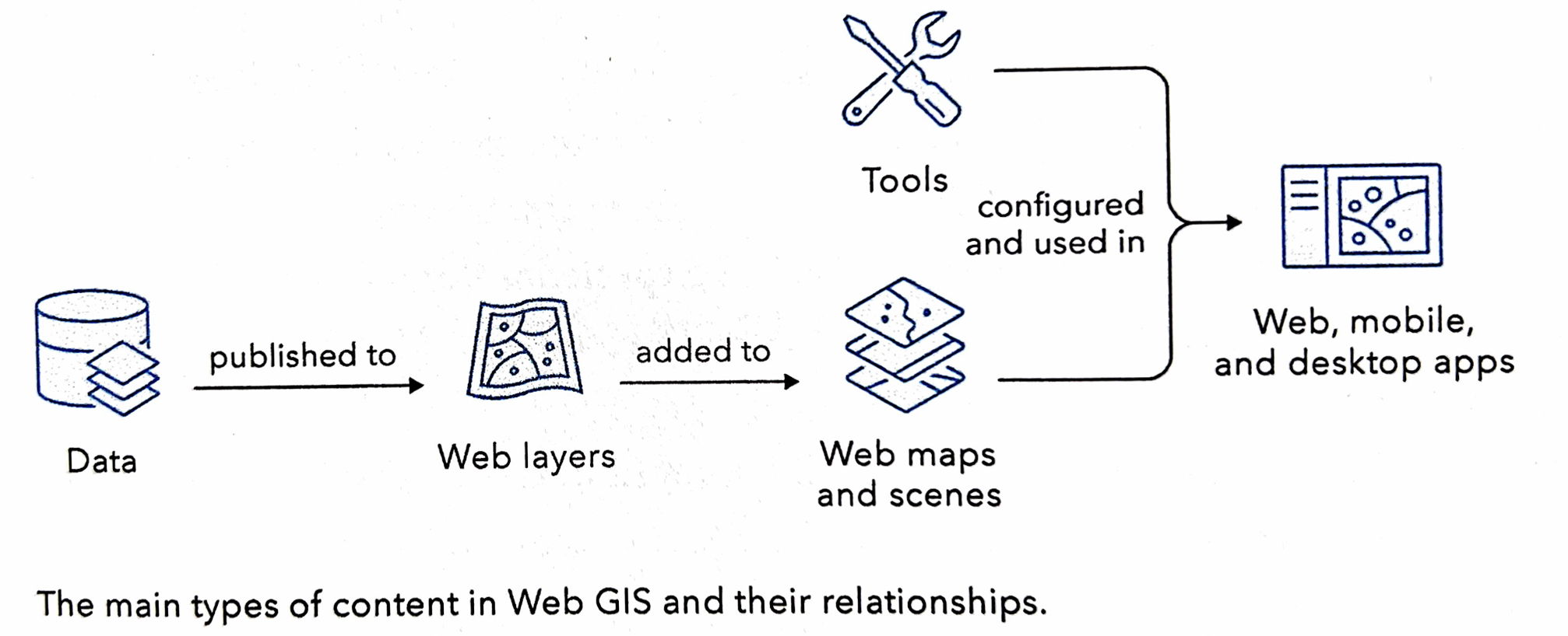
Web GIS Information Model: this is worth looking at a bit more carefully for background
- user privileges: I’m the master of the OWU ArcOnline site and can adjust these privileges for you
- metadata
- sharing
- content: data, layers, tools, webmaps, scenes, apps
- Apps: you can creat these but there are also specialized Apps that ESRI proides. We have some of these, like Drone-to-Map
- ArcGIS User Types
- Basic compenents of a Web GIS app: basemaps (background map stuff), operational layers (data of interest – say mapped out sites of invasive species), tools (function on the operational layers, also sometimes the basemaps)
- Web Services = web layers & web tools (in essence provide users with functionality via the web)
- Feature layers: this is vector data (point, line, area)
- hosted feature layer: hosted by ESRI
- non-hosted feature layer: hosted by user (like you, using OWU site)
- Web maps vs web scenes
- Paths to building Web GIS applications: “workflow” – how you put together applications that users can access via the web using the data and layers and tools and functionality of ArcGIS Online.
- Attachments: for example, we could make a web map application for OWU and Delaware that locates PDFs of projects that focused on those areas, say a PDF about restoring the Delaware Run along the old part of campus, linked to a polygon of that area. Also, images, sounds, etc.
Tutorial 1: Simple map application with attachments.
- some minor glitches but all were easy to figure out

Application: I changed the text on the course schedule:
- Include a few-sentence description of an application based on ideas from chapters 1 & 2, using your own data or the Delaware Data (from Geog 191). This edition of the tutorial includes ideas under “Assignment” (p. 35 in the 5th edition of the tutorial).
- My example application: A map, similar to the one from the tutorial, showing the locations of the ENVS 399 Sustainability Practicum projects for Spring ’23. Proposals (PDF), images (PNG), etc. for each location.
Chapter 2: Smart Mapping and Storytelling with GIS
- web layers, web apps, StoryMaps
- web app workflows for StoryMaps (below)

- feature layers: focus of Ch. 2 is hosted feature layers
- smart mapping: syles illustrated p. 41
- pop-ups
- ArcGIS Arcade: expression languages for adding your own info to data hosted by someone else
- ArcGIS Living Atlas of the World: updated in minutes/hours
- ready to use data created by ESRI and other folks
- incoporate in your own map apps.
- basemaps, imagery, boundaries, human data, infrastructure, environment
- StoryMaps
- uses block formatting (annoying but common for web design)
Tutorial Ch. 2: Web GIS app of population change using ArcGIS Story Maps
- geocoding: address matching (link address or geolocation data – street address, zip code, etc.) to location
- notice (p. 51) that you are using credits! You each have 1000 credits (which cost money – but we get them free as part of our educational deal. If you work for an organization, this is where you spend money doing stuff with ArcGIS Online)

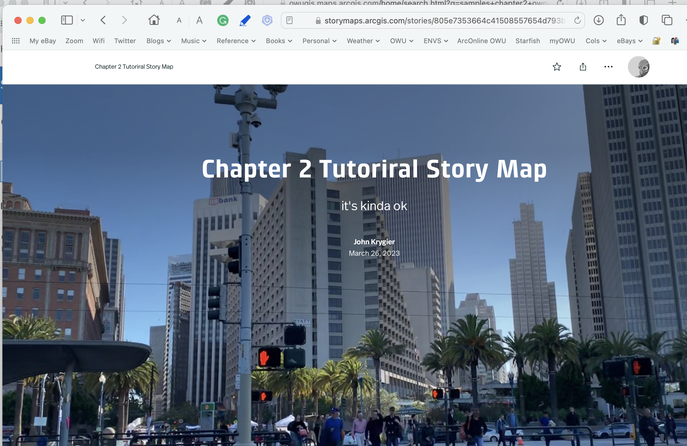
The finished StoryMap: https://arcg.is/fa5Wb1
and so on…

Application: I changed the text on the course schedule:
- Include a few-sentence description of an application based on ideas from chapters 1 & 2, using your own data or the Delaware Data (from Geog 191). This edition of the tutorial includes ideas under “Assignment” (p. 35 in the 5th edition of the tutorial).
- My example application: A Story Map, similar to the one from the tutorial, telling the story of the Chimney Swift Tower project since the idea was first proposed a decade ago with proposals (PDF), images (PNG), information on chimney swift migration (from central America) etc.

Krygier Week 1
 This is your instructor, John Krygier, late on posts. I plan to follow along and do the work in the class as the tutorial (Web GIS, 5th edition) has been updated since I did it last year. I’m already behind.
I hope the tutorial has fewer challenges, as it just came out last year. Regardless, as I’ve said repeatedly, please do your due diligence in completing the chapters in the tutorial and note any issues. If they are minor, don’t worry about it. If they are issues that stop you from completing a significant part of the chapter, note them in the blog posting and direct my attention to the issue.
I have given you access to “educational materials” for the class, and actually broke the rules and took the paper copy of the tutorial home with me this weekend.
I’m signed up and into ArcGIS Online and on this blog as requested.
I’ve poked around the ArcOnline account in the past, and also looked at the training materials. What a treasure trove!
I googled around and found these neat applications:
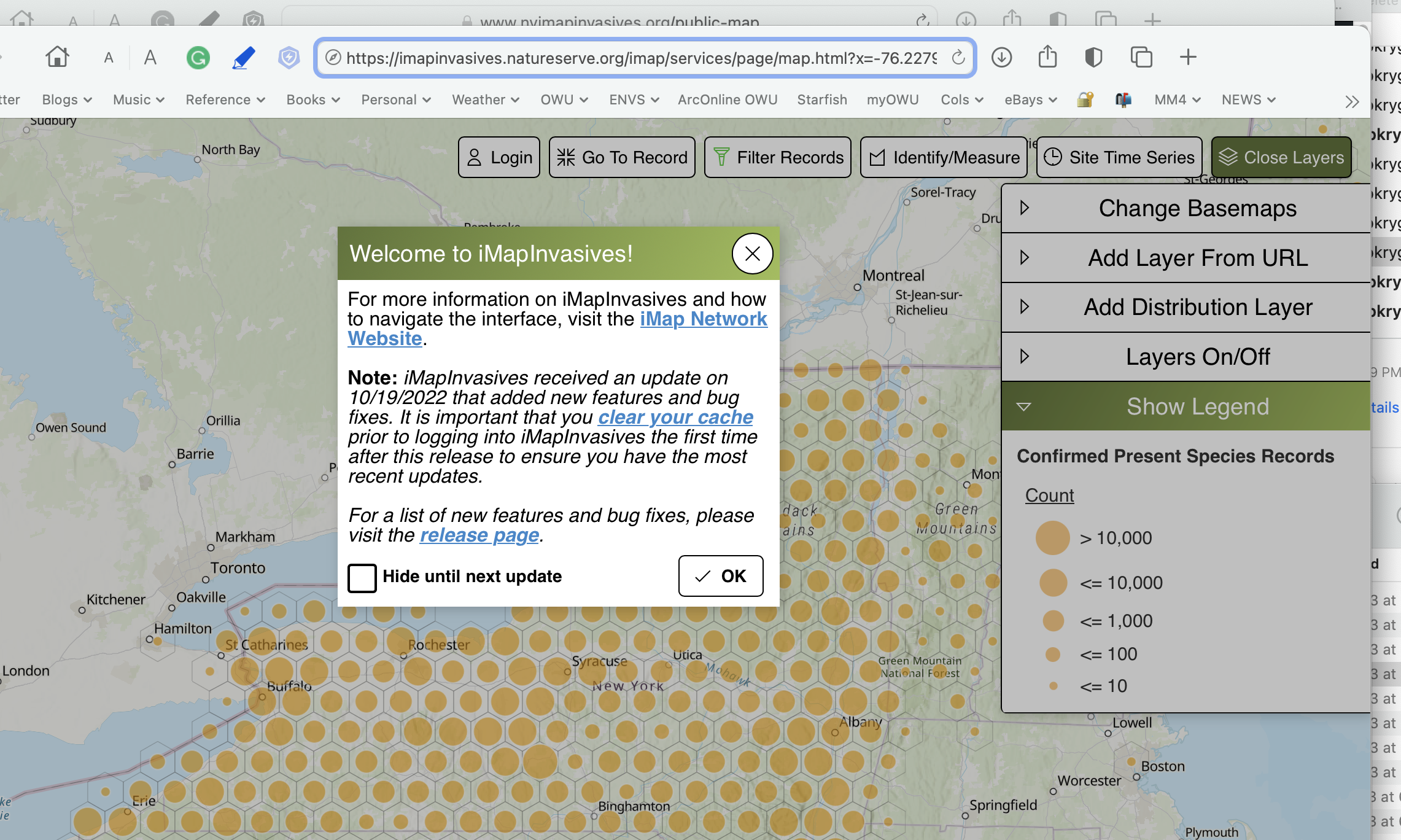
This is the iMapInvasives site created to allow the public to add invasive species they have spotted to the database of invasives for the state. This is an example of citizen science. https://www.nyimapinvasives.org/public-map
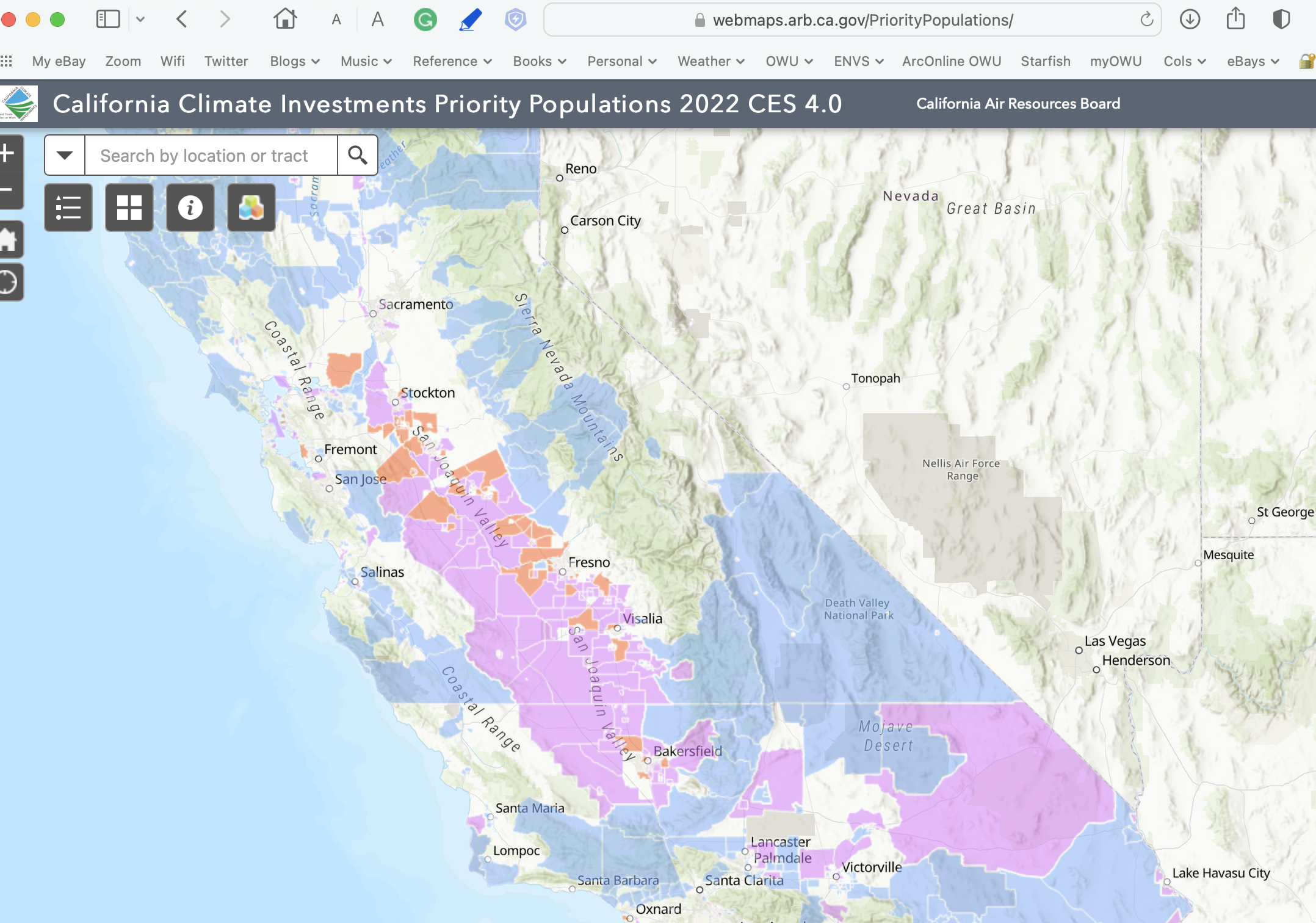 This example is providing access to data, probably generated in ArcGIS Pro, related to climate change mitigation in relation to low-income communities. https://webmaps.arb.ca.gov/PriorityPopulations/


Geog 192: Offered Module 2, Fall Semester, 2022

Geog 192 is a new course, quasi-independent study, to learn online GIS (ArcGIS Online). It is a module 2 course (10/17/2022 – 12/15/2022) and will be offered subsequent semesters during module 2.
I’ll update the schedule before this course starts mid-semester.