Gensler – Week 3

Chapter 3: 

This chapter primarily revolves around the creation of web-based apps and using them to show how data has changed over time within an area. The chapter focuses on how to set this up with the picking of source data sets and how to configure and add widgets to meet your objectives. Widgets are components within JavaScript and HTMLthat execute a list of given and focused functions. This chapter details two main types of widgets: basic and layout. Basic widgets are very functional and can perform as app tools . These include map, legend, layers, queys, filter, chart, elevation profile, and many more. Layout widgets are containers that hold and organize widgets on pages and windows. This type of widget includes section, column, row, fixed panel, sidebar, and more. Overall, widgets are exceptionally helpful and vital to getting the most out of your maps. The book then went on to say that customizable widgets are only available to use on WebGIS. I went through the tutorial for this given chapter and learned firsthand many of the other concepts that were presented to me. This was a great experience for me and was very rewarding. 


Chapter 4:

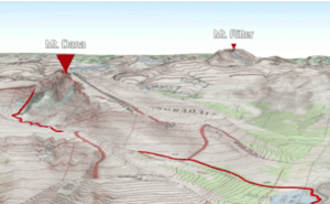
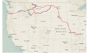
This chapter was all about mobile GIS and its many applications and uses. I thought that this was a really interesting adaptation of WebGIS as it allows for people not only to connect from anywhere and share information and ideas, but to directly look and interact with their maps as they are on the site of said maps. This also opens up WebGIS to many more people to have access to this type of information. Mobile GIS also allows for more applications to be used including VGI and AR/VR. Overall this is a really cool adaptation to an already very useful tool. Being able to access GIS data on the phone makes perfect sense as they already have state of the art gps technology. The tutorial for this chapter was also very helpful and interesting. 

Gensler – Week 2

Chapter 1: 

  • This Chapter taught me several key benefits and use of WebGIS. I thought that it was really interesting how WebGIS supports users from all over the world and allows them to share and communicate data with one another. The idea that companies and individuals can share this data simultaneously is really cool and a great use of technology. Using this chapter and the given tutorial, I explored WebGIS and the fundamentals of this application. Some of the things I particularly enjoyed reading about were the use of base map and operational layers and many of the tools that go into those layers. Even from just these two layers, a lot of data can be interpreted and analyzed. I also really enjoyed reading about how WebGIS is planning to evolve with growing technology and how this application will change in the future. This makes me interested in how AI will be adapted within GIS and many of the services that WebGIS provides. 


Chapter 2:

  • While reading this chapter and completing the given tutorial, I learned about even more layers that can be used within WebGIS and how they add even more room for potential analysis. This chapter also touched heavily on ArcGIS and how it differs from WebGIS. I enjoyed reflecting back on my time using ArcGIS earlier this semester. I used what I learned in terms of layers in the chapter and applied them within the tutorial for this chapter. This process wasn’t too difficult and I like how the user interface is set up and how user friendly WebGIS is. 

Gensler – Week 1

Hi, my name is Cooper Gensler and I am a sophomore and I majoring in environmental science and geography.

This week I completed the syllabus quiz and I have my account still have my account from GEOG 291.

After reading “Get Started: What is ArcGIS Online,” and I learned all about the main uses and benefits of using ArcGis Online. I enjoyed learning about this application and how it differs from the desktop version of ArcGis. 

I then completed the ARCGis Online Basics. This was a great introduction and tutorial into ARCGis Online and learning the difference in base map and layer maps and the main uses for those. 

I looked on google and found the distribution of nine-banded armadillos in the US. While I knew they were prevalent within the southern United States,  I had no idea that they were sometimes found within Ohio and Indiana which I found pretty interesting.

https://www.mdpi.com/1424-2818/17/2/138