Becker Week 3

Chapter 3

  • ArcGIS Experience Builder allows you to combine functions from multiple apps and provides more functionality than any one ArcGIS instant app
  • Experience Builder includes premade widgets that provide functions such as mapping, table view, querying, charting, and reporting

Basics of Experience Builder

    • Allows you to create unique web experiences using flexible layouts, content, and widgets that interact with 2D and 3D data
    • Key features:
      • Creates HTML and JavaScript apps without programming
      • Creates 2D and 3D web apps that work well on desktops, tablets, and smartphones
      • Includes out-of-the-box widgets that can be flexibly remixed and configured
      • Flexible layouts to build apps that are mapcentric or non-mapcentric and can display them on a rolling screen or fixed pages
      • Make a widget respond to actions of another widget
      • Provides framework for creators to make their own widgets
    • Template – Theme – Data – Widgets – Layouts – Publish
  • Basic widgets- functional widgets that perform as app tools
  • Layout widgets- containers that help organize widgets on your page/window
    • Setting panel for a widget has:
      • Content- data sources, links, behavior, and other settings of widget
      • Style- defines the size, position, background, border, color, box shadow, animation, transition, and other settings
      • Actions- make widgets talk and work with one another
  • Message actions- listen to triggers and perform actions automatically
  • Data actions- provide button for users to click
  • Triggers- events generated by source widget
  • Targets- perform actions responding to the trigger
  • Actions- specific business logic that the targets perform
  • 3 Editions of Experience Builder: 
    • Embedded in ArcGIS Online
    • Embedded in Portal for ArcGIS
    • Developer edition

  • My idea for this chapter is to use the Web Experience setup to create a 2D and 3D mapping of droughts and food shortages in the Midwest. People could use these maps to get a visual representation of the relationship between the two.

Chapter 4

    • Mobile devices are becoming the main way to use Web GIS (Mobile GIS)
    • Concepts and Advantages
  • Mobility
  • Location awareness- can use GPS, cellular networks, Wi-Fi networks, etc. to pinpoint location of mobile device
  • Ease of data collection
  • Near-real-time information
  • Large volume of users
  • Versatile means of communication
    • Technologies for GIS
      • Mobile devices
      • Mobile operating systems
      • Wireless communication technology
      • Positioning technology
    • Mobile limits speed, memory size, battery power, etc.
    • Many organizations need to share data with the public and simultaneously allow members within the organization to keep that data up to date. Hosted feature layer views provide a direct way to do this
  • Data integrity- feature template for a layer that represents schools
    • feature template can have preset symbols and default values for one or multiple fields
  • Browser-based approach- access these apps through mobile web browsers
  • Native-based approach- apps downloaded or installed on mobile devices
  • Hybrid-based approach- combination of browser and native based approaches
  • Native apps/fields operations: ArcGIS Field Maps, ArcGIS Survey123, ArcGIS QuickCapture, ArcGIS Navigator, ArcGIS Companion, ArcGIS Earth, ArcGIS Mission Responder, and ArcGIS Indoors mobile viewer
  • ArcGIS has offline mode to still be functional when disconnected from internet
  • ArcGIS Field Maps Capabilities:
    • Collect and update data using the map or GPS.
    • Download maps to your device and work offline.
    • Collect points, lines, areas, and view related tables.
    • Design easy-to-use smart forms.
    • Attach photos to your features.
    • Use professional-grade GPS receivers.
    • Search for places and features.
    • Support high-accuracy 3D data collection capabilities.
  • Allows organizations to track where mobile workers have been and where they currently are (Invasive???)
  • ArcGIS Survey123 Capabilities:
    • Design smart surveys with predefined questions that support domains (which appear as the choices in drop-down lists) and feature templates, default values, embedded audio and images, and simple (for example, if the answer to one question is yes, show a related question; otherwise, do not show the related question) and sophisticated rules.
    • Capture field data using an intuitive, formcentric data-gathering solution.
    • Store survey results in hosted feature layers that you can share with organization users.
    • Perform online and offline data collection.
  • Ways to design smart forms: Web Designer, ArcGIS Survey123 Connect
  • ArcGIS QuickCapture can allow for data collection in quick situations like a car driving by
  • ArcGIS AppStudio provides place to build apps across platforms

An idea I have using the ideas from this chapter is to create an app that allows users to input good hiking places near our campus. With this app, it would be easy for Ohio Wesleyan students to find fun places to go enjoy the outdoors.

Becker Week 2

Week 1

Chapter 1

    • First GIS developed in 1960s by Roger Tomlinson
    • Advantages of Web GIS:
      • Global reach
      • Lots of users
      • Low cost per user
      • Cross-platform capabilities
      • Easy to use/maintain
    • Web GIS Applications
      • Mapping and visualization
      • Data management
      • Field mobility
      • Monitoring
      • Analytics
      • Design and planning
      • Decision support
      • Etc.
    • Web GIS can be used in everyday contexts all the way up to governmental contexts
  • Arc GIS Online- software-as-a-service (SaaS) offering of Web GIS hosted on AWS and Microsoft Azure
      • No hardware infrastructure to maintain
  • Arc GIS Enterprise– Web GIS product that organization can acquire and deploy
      • Four basic software components
        • Portal for ArcGIS
        • ArcGIS Server
        • ArcGIS Data Store
        • ArcGIS Web Adapter
    • Web GIS has evolved 
      • From closed websites to open geospatial web services
      • From One-way to two-way information flow
      • Portal technology
      • Cloud GIS
      • More Mobile Web GIS users
      • From 2D to 3D maps (and VR)
      • From static data source to real time and spatiotemporal big data
    • All content items have metadata
    • Types of content items:
      • Data
        • CSV, shapefiles, GPS Exchange Format (GPX), JavaScript Object Notation, photos, imagery, geodatabases
      • Layers
        • Feature layers, tiled layers, vector tiles, map image layers, etc.
      • Tools
        • Perform analytical functions like geocoding, routing, creating PDF files, summarizing data, finding hotspots, and analyzing proximity
      • Web maps and web scenes
        • Map (2D) or scene (3D) comprises one or multiple layers and allow for sophisticated layer configuration
      • Apps
        • Mapcentric programs that can be used on mobile devices, in web browsers, or on desktops
    • Basic components of Web GIS app:
      • Basemaps
      • Operational layers
      • Tools
  • Hosted– web service is based on ArcGIS-managed data
  • Nonhosted- web service connects directly to user-managed data
  • Feature layers posted to ArcGIS Online are always hosted
  • Attachments are an emergingly popular data source
  • Attachment Viewer is an instant app template that allows you to quickly build an app that presents spatial data with an intuitive feature-by-feature viewing experience
  • Other apps allow staff to take pictures in the field and attach them to GIS

One application of the ideas from this chapter could be to label restaurants I’ve visited in my hometown and displaying how I rate them. I would do this in Berea, Ohio and again limit myself to places I have eaten at.


Chapter 2

  • Web layers are building blocks of web apps
  • Most common types of feature layers:
    • Hosted feature layers
    • Hosted Web Feature Service Layers
    • Hosted tile layers
    • Hosted vector tile layers
    • Hosted Web Map Tile Service layers
    • Hosted scene layers
    • Hosted image layers
    • Hosted map image layers
  • Ways to publish hosted feature layers:
    • Create feature layer from own data
    • Create feature layer from existing template
    • Create empty feature layer and define your own fields interactively
  • Smart mapping enables users to visually analyze, create, and share professional-quality maps easily and quickly with minimal cartographic or software skills
  • Examples of smart mapping
    • Heat map
    • Color and size
    • Compare A to B
    • Relationship
    • Dot density
    • Predominant
    • Type and size
    • Continuous timeline
    • Vector field
  • Pop-up windows show geographic information and deliver geographic insight
  • Arcade– portable, lightweight, and secure expression language written for use in ArcGIS to style, label, and add values to layer pop-ups
  • ArcGIS Living Atlas has lots of data for usage
  • Good web layers, maps, and apps are fast, easy, and fun
  • ArcGIS StoryMaps provides a set of web-based story-authoring tools that can combine interactive maps, multimedia content—text, photos, video, audio, and intuitive user experiences—to tell stories about the world
  • Sidecar– special immersive block with a side-by-side reading experience
  • slideshow block- uses horizontal scrolling to emphasize your media
  • map tour block– take a curated set of places and guide your audience through them one point at a time
  • swipe block– interactive experience that allows readers to compare two maps or images
  • timeline block– illustrate a series of chronological events in three layout options: waterfall, single side, and condensed
  • I had issues around halfway through the tutorial that I couldn’t seem to figure out

I could use this to do a spatial pattern tracking map of natural factors in my hometown. I would do it there because there are lots of ways that nature is being incorporated in the city layout.

Becker Week 1

Hello! My name is Bret Becker and I’m a junior here at OWU. I’m a Physics and Environmental Science double major, and I like to sleep a lot.

I took GEOG 291 in the first half of the semester, so I already messed around with my ArcGIS account. While reading through the site, I learned that you could use ArcGIS Online to create apps. I also learned that they could customize the website for a specific course’s desires if wanted.

I learned more about how to find different features available with ArcGIS Online and I also learned more about the levels of sharing and why to choose each one.

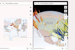
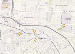
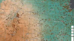
One application of ArcOnline I found was to use it to map greenhouse gas emission factors to study them by area.

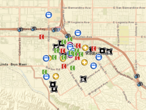
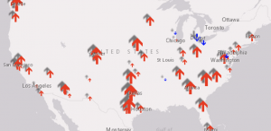
Another application I found was to use it to map solar panels in the United States.

Solar Infrastructure in the USÂ