Hi! My name is Lauren Hollinger! I’m a sophomore from Canton, Ohio majoring in Data Analytics and Geography.
- Spend a Few Minutes Poking Around Your Account (2 Comments)
-
-
- Something interesting I found in the My Settings tab is you can customize your units of measurement (US Standard/Metric) and set a default map viewer. This would be useful for different projects/data/locations.
- Some more resources I wasn’t super familiar with, but found interesting: The training tab takes you to a number of courses you can complete, the forum/community tab is a place where users can share information and ask questions, and the Blog tab takes you to a number of blog postings of different projects and even tutorials.
-
- Use ESRI Resources to Learn a Bit (Get Started: What is ArcGIS Online?) (2 Comments)
-
-
- The ArcGIS Notebooks seemed very interesting to me. I would like to explore this interface at some point to see how Python coding and analysis can aid in GIS visualization.
- Another thing I learned was about apps. You can create your own apps that will help users and yourself interact with maps and visualizations you make. You can add different content and data to these apps. There are different steps and considerations to take into account when creating an app. These include thinking about your audience, the components you want to include, and what type of app will best suit your needs.
-
- Complete Web Course: ArcGIS Online Basics (2 Comments and Pictures)
-
-
- I thought the apps were a very interesting component of ArcGIS Online. I hadn’t really interacted with these before and I liked how they could give viewers of your map a more digestible and interactive way to view and sort information.
- I also liked the different sharing levels within ArcGIS online. I like how you can keep your projects private to you and your administrators while you work on them, share between groups for more collaborative projects, and even make your projects visible to the public or everyone within your organization. I also think it’s really useful how you can create different groups within your organization and provide them with different data. This differentiation could be really useful in a workplace with a lot of different departments and jobs.
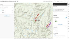
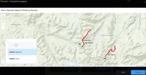
- Pictures:


-
- List 1 or 2 Courses that seem Interesting
-
-
- The lab course Collecting and Visualizing Data with ArcGIS QuickCapture seemed interesting to me. I like how it appears to be a fast and simple way to collect data in the field, which would save researchers time.
- The Going Places With Spatial Analysis course also interested me. It’s a 6-week free course starting in January. It says it’s a good course for people who know “something about data analysis” and want to gain a deeper understanding of implementations of spatial data. So, I think it would be a fun course to take at some point with my data background.
-
- Look into a few GIS Application Areas
-
- One application I found interesting was from the U.S. Department of Energy’s National Energy Technology Laboratory. They did a study of the active Newberry Volcano in Oregon. As you scrolled through the information in the black panel on the left, the map to the right would change to reflect the geologic and volcanic features they were talking about. Plus, I learned that California’s Death Valley actually structurally influences this volcano’s basin, and I went there this summer so I thought that was super interesting. This was made in ArcGIS Online with the StoryMaps feature. Link to this story map: https://netl-doe.maps.arcgis.com/apps/MapSeries/index.html?appid=2259f4a750fa44e5a2827e57100309fc
-

- 2. Another interesting application I found was the use of ArcGIS online to predict models for Natural disasters. Over the summer, my boyfriend made a connection with someone who works for FEMA in Washington, D.C. so, I got to learn about how FEMA utilizes ArcGIS for natural disaster relief, cleanup, and predictions. So, I searched for one of their maps. This one is a predictive model for a hurricane located off the coast of Mexico. The link to this ArcOnline Map: https://fema.maps.arcgis.com/apps/dashboards/aa7bd84d448c4d74ae268335162167cc
- Complete Delaware Data Inventory (I already completed this in 291)