Chapter 1: Get started with Web GIS
Objectives:
- Grasp the concept and advantages of Web GIS
- Global reach, large number of users, low cost per user, better cross-platform abilities, easy to use and maintain
- Understand the deployment patterns of Web GIS
- Esri managed and customer managed
- Learn the components of the new-generation of Web GIS
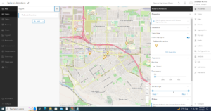
- Portal which represents a gateway for accessing all spatial products in an organization. Helps to organize, secure and facilitate access to products
- Understand the technical evolutions and trends in Web GIS
- From closed websites to open geospatial web services
- From one-way to two-way information flow
- Portal technology is becoming essential
- Cloud GIS delivers GIS functionality and ready-to-use contents
- Mobile is becoming the pervasive Web GIS client platform
- Map visualization goes from 2D to 3D and virtual reality
- Data source goes from static to real time and spatiotemporal big data
- Web GIS is becoming more intelligent
- Understand the concepts of web services and hosted feature layers
- Main content types: Data, layers, web maps and scenes, tools and apps
- Hosted layers refer to a situation in which a web service is based on ArcGIS managed data, stored in the ArcGIS Online cloud database or in ArcGIS Data Store
- Publish hosted feature layers from CSV files
- Learn the workflow for creating web maps and web apps
Example Application: A map, like the tutorial, showing locations of former fraternity and sorority houses in the historic Northwest neighborhood of Delaware. Images (PNG) and text from the Delaware Historical Society for each house and possibly alumni quotes.
Chapter 2: Smart Mapping and Storytelling with GIS
Types of hosted feature layers:
- Hosted feature layers
- Hosted Web Feature Service (WFS) layers
- Hosted tile layers
- Hosted vector tile layers
- Hosted Web Map Tile Service (WMTS) layers
- Hosted scene layers
- Hosted image layers
- Hosted map image layers
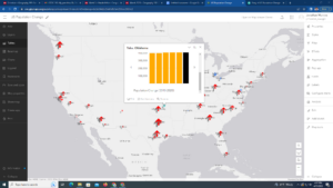
ArcGIS Living Atlas of the World
- Dynamic collection of layers, maps, tools and apps produced by Esri and thousands of contributors
StoryMaps
- Storytelling (used this so many times for Ashley Allen’s classes and other final projects)
Link to StoryMap: https://arcg.is/1L5D1u0
Example Application: Interactive StoryMap visualizing the population change/decline in Newfoundland and Labrador fishing cities.