App 1: Story App
https://storymaps.arcgis.com/stories/55108ead79bc42979a28e6dfd510a0b9
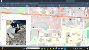
For my first application, I collected the locations of cats around the campus and immediate area- as well as some other cats that I wanted to showcase not limited to this area- in order to create a map. Clicking on the points provides brief descriptions of each cat including if they are outdoors, can be pet, and a picture or two of them. From that point, I created a story app, called “Delaware Cats: and other notable felines,” where users can interact with my map and learn a bit about the risks of allowing pet cats to freely roam outdoors such as contracting diseases, fighting, cars, etc. I also provided a video where users can learn about spaying and neutering cats since feral cat colonies are an issue in many areas- including Delaware- and spaying and neutering improves the animal’s quality of life. Then, I concluded with a couple of image galleries of my cats alongside a very old picture of me and my old cat Snoopy.

App 2: Instant App
https://owugis.maps.arcgis.com/apps/instant/3dviewer/index.html?appid=ac103aa3dd7b42af91bd020ab6386692
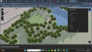
For my second application, I created an Instant App of my 3D Web Scene of the Blue Limestone Park. I added trees, cars, swings, benches, a table, and other playground structures using the fun park layer from the seventh chapter. Unfortunately, the models would not cooperate with me enough to rotate, so everything is facing the same direction. In addition to that, the sizes of the trees are misleading- many appear much larger on the map than they do in reality. Regardless, this scene can be used to gather an idea of what the park is like and the amenities that it has to offer visitors.
