My name is Jenny Koob, I am a freshman at OWU and an Environmental Science major with a minor in Geography, and I am hoping to add another minor in Economics as well. I took GEOG 291 in the first half of this semester, and I learned a lot about the basics of ArcGIS, how to operate its functions, and more about geospatial data in general! The information I gained from the course helped me feel more confident in my geography minor. As I completed GEOG 291, I read the text Getting to Know Web GIS 2022, 5th edition. I have also completed the quiz and all the preparation requirements needed for this week.
I spent a bit looking around the ArcGIS website and found a lot of previous posts from past years: OWU campus maps for both “outside wifi” maps and “teaching spaces”, as well as maps from Geography 353 with data for trees, water, census, etc. To my account, I added more to my Profile, such as my nickname, a profile picture, and a short description of who I am. Under “Training,” I found it really cool that there’s a place to go for an opportuties toward individuals and groups in GIS that can help better understanding and attain goals. Another thing I found was under the ESRI community, you have access to tons of people’s ideas, where individuals have posted ideas on skills or developments, and you can even add your own post idea to the community! Overall, it was pretty easy to navigate the website, not only because I have used it before, but all the mechanics are all easy to follow and to the point.
I also read the “Get Started: ArcGIS Online”. The reading explains everything ArcGIS Online includes, such as creating web maps, web scenes for 3D data, making web apps, notebooks, and more. I like the option of sharing and collaborating, allowing individuals to share content and work as groups if they want to, while also leaving room for those who want to keep their work private. WebGIS also allows the user to create map areas for taking maps offline, and allows editors to get the latest updates on maps. I lastly just really like how accessible ArcGIS Online is, being able to pull it up quickly on a web browser and mobile devices is really convenient.
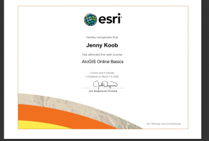
I also completed the GIS training course in ESRI, and it took me longer than I anticipated! I learned a lot about what makes parts of the GIS mapping important, and the tests really made sure I was paying attention. I took a screenshot of my completion as well.
I also found two articles in Google Scholar that I think are really interesting!
The first is an article called “Participatory GIS to inform coral reef ecosystem management: Mapping human coastal and ocean uses in Hawaii,” and basically discusses coastal ecosystem management as well as how GIS, or PGIS, is used to track human-caused effects on the corals! I found this article by searching “ArcGIS coral reefs,” and it was credible as a highly cited work.
Here is the link to the article:https://www.sciencedirect.com/science/article/pii/S0143622814002884

The second article I found was on honeysuckle, a known invasive species in Ohio and many parts of the US. This article was based on research done in Cincinnati, OH. It discusses the importance of early detection in invasive species, as well as how remote sensing methods can be a valuable tool for increasing knowledge about spatial patterns and predictors of invasion!
here is the link to the article:”Detecting Invasive Amur Honeysuckle in Urban Green Spaces of Cincinnati, Ohio Using Landsat-8 NDVI Difference Images” https://doi.org/10.3368/er.38.3.139

