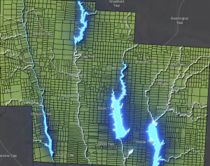
For my first app I decided to use basic ideas for chapter one to create a map that highlights the accessibility to water sources in the Delaware County in relation to the farm lots. I made added effects to make the water ways stand out against the farm layer, and emphasize their location.
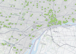
For my second app I decided to use ideas from Chapter 7 to create a 3D map detailing the locations of subsidized housing in the county I live in (Wayne County Michigan). The 3D pattern clearly shows the distribution and density of the housing, and how densely packed the housing is in the city of Detroit compared to other cities in my county, including my city Taylor.