Chapter 7 introduced me to 3D visualization and how it can transform spatial data into immersive and interactive environments. I was very interested in how scene viewer allows users to convert basic 2D GIS data into 3D scenes with points, many types of polygons, in the sky and undergound features. Chapter 7 made it very clear to me that 3D GIS doesn’t only just make maps look more appealing but it also helps people explain spatial relationships such as underground utilites, building heights, sunlight and shadow changes throughout the day.
One of the most interesting parts of the reading to me was when it talked about VR, XR and also MR technologies how these overlap in the theory of the metaverse. The idea that GIS data can help construct real looking 3D worlds whether it’s for gaming, urban planning or emergency training this shows how geography and virtual design are becoming more secure than ever. I also thought the ArcGIS indoors and ArcGIS urban was very cool. Having these tools to use for 3D mapping can help us go beyond just outdoor areas and shift into interior spaces and city planning.
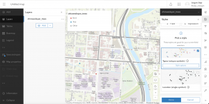
Application: Using the information from chapter 7 I could create a 3D web scene of the Ohio Wesleyan University campus. I tried to make my map look good but this was the best I could do unfortunately. My map isn’t good at all compared to others but I added different types of trees to the campus of OWU.