Chapter 7 was about 3D web scenes. Web scenes bring advantages in data visualization, analysis, and communication. People often find web scenes to be more interesting and easier to understand compared to 2D maps, which I totally agree with. It gives an easier and quicker way to understand the size and positions of objects. Scenes are either photorealistic (re-create reality using photos) or cartographic (takes 2D mapping thematics and moves them to 3D). There are 4 main types of elements: surfaces, features, textures, and atmospheric effects. There is a combination of both 2D and 3D layers to provide the best and smoothest experience. Learning about the use of VR in a web map sounded quite amazing to me and I would like to experience it. The chapter also mentioned XR, and the Metaverse. ArcGIS can also be used for indoor mapping and urban planning. I have always had an interest and preference of 3D maps because I think they are easier to understand and they allow me to get a better idea of the meanings of the data.
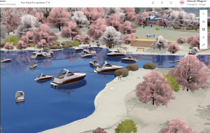
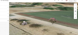
Here are pictures from the chapter 7 tutorial:
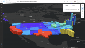
I followed every instruction on 7.2 but only these two points showed up. I’m not too sure why this happened.
I could make an application showing the population differences between the counties in Ohio. I will have to find the data and then create a web scene to better show the relationships of population between all of the counties.