Hess – Week 1

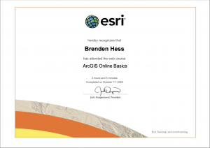
Hello, my name is Brendon Hess and I am a Sophomore majoring in Biology and Environmental Science. I am from Perrysville Ohio and I am on the Men’s Soccer team here.

I looked more closely into some of the basic functions and features of my account and I thought it was a very cool layout. I looked through the ERIS Community page a little bit and found that very interesting, its nice that there is one platform for everyone using this site to communicate through and collaborate with each other on ideas, topics, and projects.

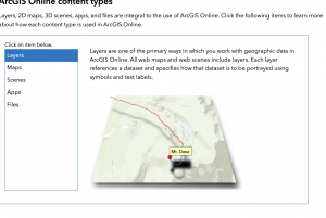
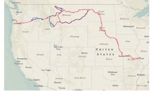
Then I read the “Get started: What is ArcGIS Online“, this was a very informative read. I think that it is cool that this Online version can be used for field work, I never thought about that when I was taking Geog 291. I also find it very cool that you can collect your own data and input it into your own system.

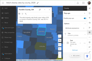
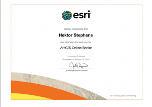
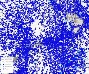
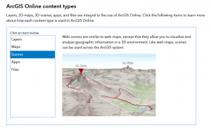
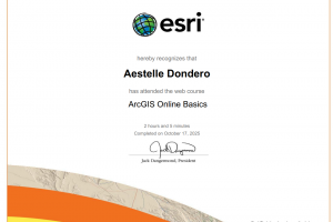
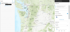
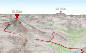
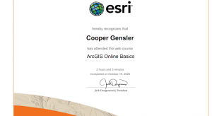
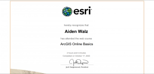
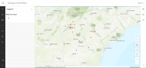
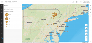
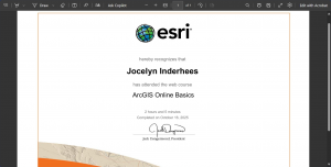
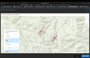
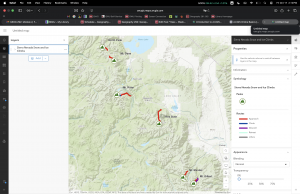
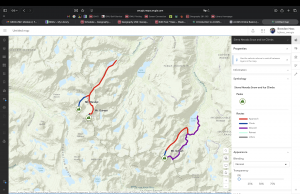
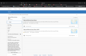
After that I went on to complete the ArcGIS Online Basics course, I got to lean about the different layers and how you can interact with them. I also learned how to keep your work within your administration, group and private as well as public. Here are some of my screenshots from the course as well as the certificate.

I already used google scholar to look into GIS Applications in GEOG 291.

Thompson – week 1

Hi! My name is Sky Thompson. I am a junior majoring in Environmental Studies. I did take 291 in the first half of this semester, so now I’m doing 292 and this is my blog for week 1!

I first went ahead and read over the syllabus and schedule and took the quiz. I also scheduled the required meetings with Dr. Krygier. 

I took a look at the different sections in ArcGIS and it just went over my basic profile stuff as well as the Esri page and training. Going through all of it helps you get a better feel of ArcGIS and all the tools you can use. Two things that I made note of when I read the “Get Started: What is ArcGIS”, were 1. You can create both 2D and 3D maps and use a bunch of different tools to do so which we worked on a bit in GEOG 291 and, 2. You can expand your work to people all throughout your community and see other people’s work as well if they choose to share it. All your work can either be saved privately or used publicly to collaborate with others. 

I completed the online training as well and I learned quite a bit about mapping through that as well. A lot of it was just basics, but it’s good to know. I learned similar things to what I learned at the beginning of Geog 291 such as what ArcGIS is used for, how to share your maps with others, how to create a 3D map, and how to look for things such as trails on a map. 

(My photos will not upload so that is why there isn’t any on here!)


An interesting map that I found on google was a map of different land coverage for the Chunati Wildlife Sanctuary. Deforestation can really negatively impact a lot of things including restoration and wildlife habitats. The hope in mapping forest cover and locations of encroachment are to help them carry out restoration in a better way.  

This is a link to the article: https://www.sciencedirect.com/science/article/pii/S026483772032531X

Stephens Week 1

Hi, my name is Hektor and I’m a senior(ish…) double majoring in art and environmental studies. I took the quiz and scheduled my appointment, and did a tutorial linked in the Getting Started pages and the Basics one as well. I already have an account from 291. In the getting started parts, I wondered right off the bat if we have access to the ArcGIS Companion app because it would be cool to be able to work on this on the go… or on location! I also thought the indoor floor view sounded interesting, and less limited than what the desktop version could do with splitting up features. Anyways, the first tutorial I did was mapping obesity rates in Alabama, which was linked in those pages. It was pretty straightforward once I got the hang of it, and similar to desktop GIS, just differently arranged. I did finish the tutorial in Alabama, I just had this one screenshot but the finished product is (should be) shared with everyone.

And here’s my certificate from the Basics Tutorial.

Then I looked for a couple maps. This first one is a whole infographic about runoff.

https://www.esri.com/about/newsroom/arcnews/with-gis-communities-see-how-land-use-changes-may-affect-local-water-quality

The second one I’m linking because its an interactive map!

INTERACTIVE SMOKEFREE MAPS

Baer Week 1

Hi! My name is Samuel Baer. I am a junior from Mt. Gilead Ohio studying environmental science and geography.

I took the quiz and I have made my appointments for weeks 2 and 3.

Poking around the account was interesting. I wish My ERSI was a little more accessible but it’s fine. Also I think it was funny to see some of the community posts. Some of them were interesting, and some of them were a little strange.

The starting page was fine. I felt like the training was better at explaining everything, but if I was trying to refresh myself this article would be fine. It is a really good spot to quickly trouble shoot any issues.

The training wasn’t as meticulous as I was expecting. I liked that we were doing the practice maps with mountains,  just because I like that kind of stuff. I also thought the 3D imaging was cool. To be honest I would do that to plan a hiking or backpacking trip.

One of the two applications I found was  of Indian Ocean Ostracod sites. Having these sites mapped out allows them to overlay them with other environmental factors like wind and temperature.

And finally I found two courses:
  • Field Data Collection and management Using ArcGIS
  • Take Your Web Maps Offline with ArcGIS Field Maps

I liked these because they both felt like extremely practical applications for GIS. They seem like they would be really useful longterm.


Patel-Week 1 (292)

Hello, I’m Dylan Patel and I’m a Jr currently majoring in Environmental Studies. I’m from Anaheim Hills near Disneyland.

This week I not only completed a quiz for the syllabus but also explored my account information and more on ARCGIS online. I discovered how to find my profile information, my settings, my ESRI, training, community & forums, ArcGIS blog, and how to seek help.

Within the info on Get Started with ARCGIS online in ESRI I found ArcGIS Online bundles map/3D scene creation, apps, analysis tools, and Python notebooks. I found the information to be very helpful when it came to navigating each I enjoyed how it broke everything down into there own categories.

Two courses that interest me are ArcGIS Online: Essential Workflows and Going Places with spatial Awarenes

ARCGIS ONLINE SOURCES THAT INTEREST ME

For me I really liked the website Gensler found and decided to write about it. This map shows the distribution of 9 banded Armadillos in the US. I always thought that Armadillo were in australia only but to my suprise they exsist in the Americas as well which also supprised me. Everyday you learn something new.

https://www.mdpi.com/1424-2818/17/2/138


Dondero – Week 1

Hi, my name is Aestelle and I am a junior majoring in astrophysics, and I also took GIS 291 earlier this semester.

After receiving the wordpress and ArcGIS emails, I logged into my respective accounts for both services and then completed the quiz and emailed Dr. Krygier. After this, I did the ArcGIS Online Basics training, which explained what ArcGIS Online is and the various functionalities it offers, along with things like the various sharing levels available and when to use each, as well as where to find layers to add to your map.

One use I found for ArcGISOnline was for mapping rail network history: https://journals.sagepub.com/doi/abs/10.7227/tjth.25.1.5, however I couldn’t figure out how to access the article to find any maps.

Another ArcGIS Online application I found was a feature layer showing the locations of the heritage barns in Washington state, which I felt was a cool use of the software.

https://owugis.maps.arcgis.com/apps/mapviewer/index.html?layers=39e31e3c81f34a49a21344100bb46096 

Gensler – Week 1

Hi, my name is Cooper Gensler and I am a sophomore and I majoring in environmental science and geography.

This week I completed the syllabus quiz and I have my account still have my account from GEOG 291.

After reading “Get Started: What is ArcGIS Online,” and I learned all about the main uses and benefits of using ArcGis Online. I enjoyed learning about this application and how it differs from the desktop version of ArcGis. 

I then completed the ARCGis Online Basics. This was a great introduction and tutorial into ARCGis Online and learning the difference in base map and layer maps and the main uses for those. 

I looked on google and found the distribution of nine-banded armadillos in the US. While I knew they were prevalent within the southern United States,  I had no idea that they were sometimes found within Ohio and Indiana which I found pretty interesting.

https://www.mdpi.com/1424-2818/17/2/138  

Walz – Week 1

Hi my name is Aiden, I am a junior pursuing a bachelors in biochemistry with a minor in environmental science. This was week 1 of Geog. 291 where I completed:

The syllabus quiz and scheduled an appointment with Professor Krygier.

Spent a few minutes just looking at where stuff was on my ArcGIS online account and then I read the section; Get Started: What Is ArcGIS Online. This section talked about how ArcGIS Online is a cloud based mapping and analysis site designed to create, analyze, share and manage geographical data. It can look at 2D and 3D visualization and work with other ArcGIS products.

I then did the ArcGIS Online Basics course. This course delved deeper into what ArcGIS online is. It really focused on the collaboration and sharing aspect of ArcGIS online. It then also talked about how these maps are set up; with base maps layers, uploading/downloading data, operational layers, and analyzing tools.

I then used google to look at an application online and found a map titled “Georgia’s Serial Killers” which went over the locations of where these serial killers in Georgia were caught. Though the map didn’t have a very good legend delving deeper into how/who was caught.

Another application was looking at some pizza chain uploading all of their locations onto ArcGIS online. They also seemed to have a bunch of other posts about using GIS and pizza, and I don’t quite have an opinion on that.