Week 1
Chapter 1
-
- First GIS developed in 1960s by Roger Tomlinson
- Advantages of Web GIS:
- Global reach
- Lots of users
- Low cost per user
- Cross-platform capabilities
- Easy to use/maintain
- Web GIS Applications
- Mapping and visualization
- Data management
- Field mobility
- Monitoring
- Analytics
- Design and planning
- Decision support
- Etc.
- Web GIS can be used in everyday contexts all the way up to governmental contexts
- Arc GIS Online- software-as-a-service (SaaS) offering of Web GIS hosted on AWS and Microsoft Azure
-
-
- No hardware infrastructure to maintain
-
- Arc GIS Enterprise– Web GIS product that organization can acquire and deploy
-
-
- Four basic software components
- Portal for ArcGIS
- ArcGIS Server
- ArcGIS Data Store
- ArcGIS Web Adapter
- Four basic software components
- Web GIS has evolved
- From closed websites to open geospatial web services
- From One-way to two-way information flow
- Portal technology
- Cloud GIS
- More Mobile Web GIS users
- From 2D to 3D maps (and VR)
- From static data source to real time and spatiotemporal big data
- All content items have metadata
- Types of content items:
- Data
- CSV, shapefiles, GPS Exchange Format (GPX), JavaScript Object Notation, photos, imagery, geodatabases
- Layers
- Feature layers, tiled layers, vector tiles, map image layers, etc.
- Tools
- Perform analytical functions like geocoding, routing, creating PDF files, summarizing data, finding hotspots, and analyzing proximity
- Web maps and web scenes
- Map (2D) or scene (3D) comprises one or multiple layers and allow for sophisticated layer configuration
- Apps
- Mapcentric programs that can be used on mobile devices, in web browsers, or on desktops
- Data
- Basic components of Web GIS app:
- Basemaps
- Operational layers
- Tools
-
- Hosted– web service is based on ArcGIS-managed data
- Nonhosted- web service connects directly to user-managed data
- Feature layers posted to ArcGIS Online are always hosted
- Attachments are an emergingly popular data source
- Attachment Viewer is an instant app template that allows you to quickly build an app that presents spatial data with an intuitive feature-by-feature viewing experience
- Other apps allow staff to take pictures in the field and attach them to GIS
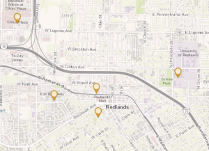
One application of the ideas from this chapter could be to label restaurants I’ve visited in my hometown and displaying how I rate them. I would do this in Berea, Ohio and again limit myself to places I have eaten at.
Chapter 2
- Web layers are building blocks of web apps
- Most common types of feature layers:
- Hosted feature layers
- Hosted Web Feature Service Layers
- Hosted tile layers
- Hosted vector tile layers
- Hosted Web Map Tile Service layers
- Hosted scene layers
- Hosted image layers
- Hosted map image layers
- Ways to publish hosted feature layers:
- Create feature layer from own data
- Create feature layer from existing template
- Create empty feature layer and define your own fields interactively
- Smart mapping enables users to visually analyze, create, and share professional-quality maps easily and quickly with minimal cartographic or software skills
- Examples of smart mapping
- Heat map
- Color and size
- Compare A to B
- Relationship
- Dot density
- Predominant
- Type and size
- Continuous timeline
- Vector field
- Pop-up windows show geographic information and deliver geographic insight
- Arcade– portable, lightweight, and secure expression language written for use in ArcGIS to style, label, and add values to layer pop-ups
- ArcGIS Living Atlas has lots of data for usage
- Good web layers, maps, and apps are fast, easy, and fun
- ArcGIS StoryMaps provides a set of web-based story-authoring tools that can combine interactive maps, multimedia content—text, photos, video, audio, and intuitive user experiences—to tell stories about the world
- Sidecar– special immersive block with a side-by-side reading experience
- slideshow block- uses horizontal scrolling to emphasize your media
- map tour block– take a curated set of places and guide your audience through them one point at a time
- swipe block– interactive experience that allows readers to compare two maps or images
- timeline block– illustrate a series of chronological events in three layout options: waterfall, single side, and condensed
- I had issues around halfway through the tutorial that I couldn’t seem to figure out
I could use this to do a spatial pattern tracking map of natural factors in my hometown. I would do it there because there are lots of ways that nature is being incorporated in the city layout.